
Iceland

Posted
on
in
Travel
• 3023 words
• 15 minute read
Tags:
Iceland, Abroad
Iceland is one of those mysterious corners of the globe to the average American such as myself, which is why I decided to visit with my mother following my graduation. We left on the final day of August on a direct flight from Seattle. Iceland is on Greenwich Mean Time, meaning an eight hour time difference that did not bode well with my inability to sleep on planes. After we landed at around ten in the morning on the first of September, we picked up our rental car and headed to Reykjavík. Thankfully, Iceland drives on the right side of the road, removing driving as one of the unpredictable variables that comes with travelling abroad. The biggest difference there was how narrow the roads were and kilometers per hour being the standard speed limit format. I would look down at the speedometer, see 100, and freak out for a second.
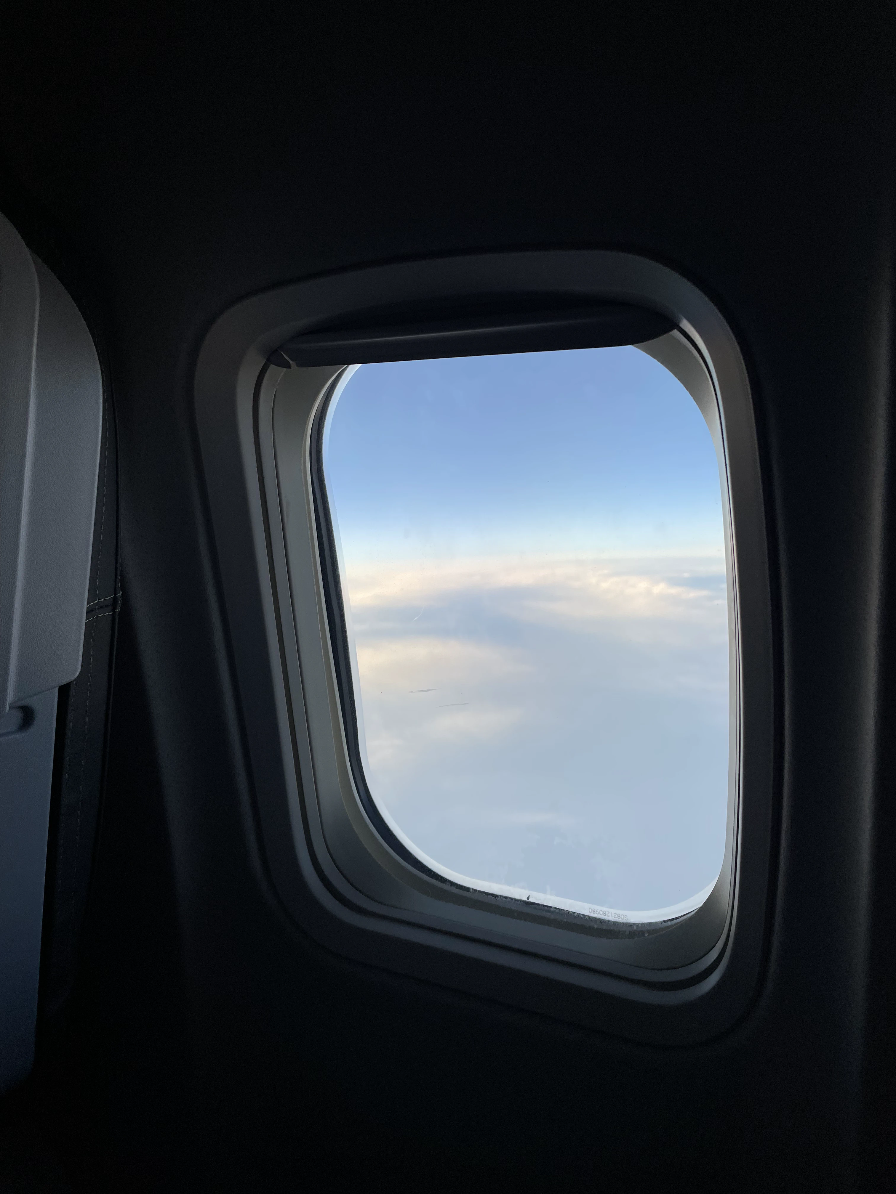
Seattle to Reykjavík
Shot on the iPhone 12. Credit: Keenan Schott
Reykjavík
On our first day in Reykjavík, we explored the city, visited the Harpa Concert Hall and Conference Center, and went on a food tour. The highlight of the tour was at Messinn, a seafood restaurant. This is an Icelandic cod with curry sauce, rucola salad, and potatoes. The other dish here was Plokkfiskur, a hearty fish and potato mash. Nearly every restaurant we visited only offered Icelandic beer, which I found interesting because while American soda brands, like Coca-Cola, are a universal language, Coors Light is not. The typical offerings were some variants of Gull, Víking, and Boli - all were pretty good!
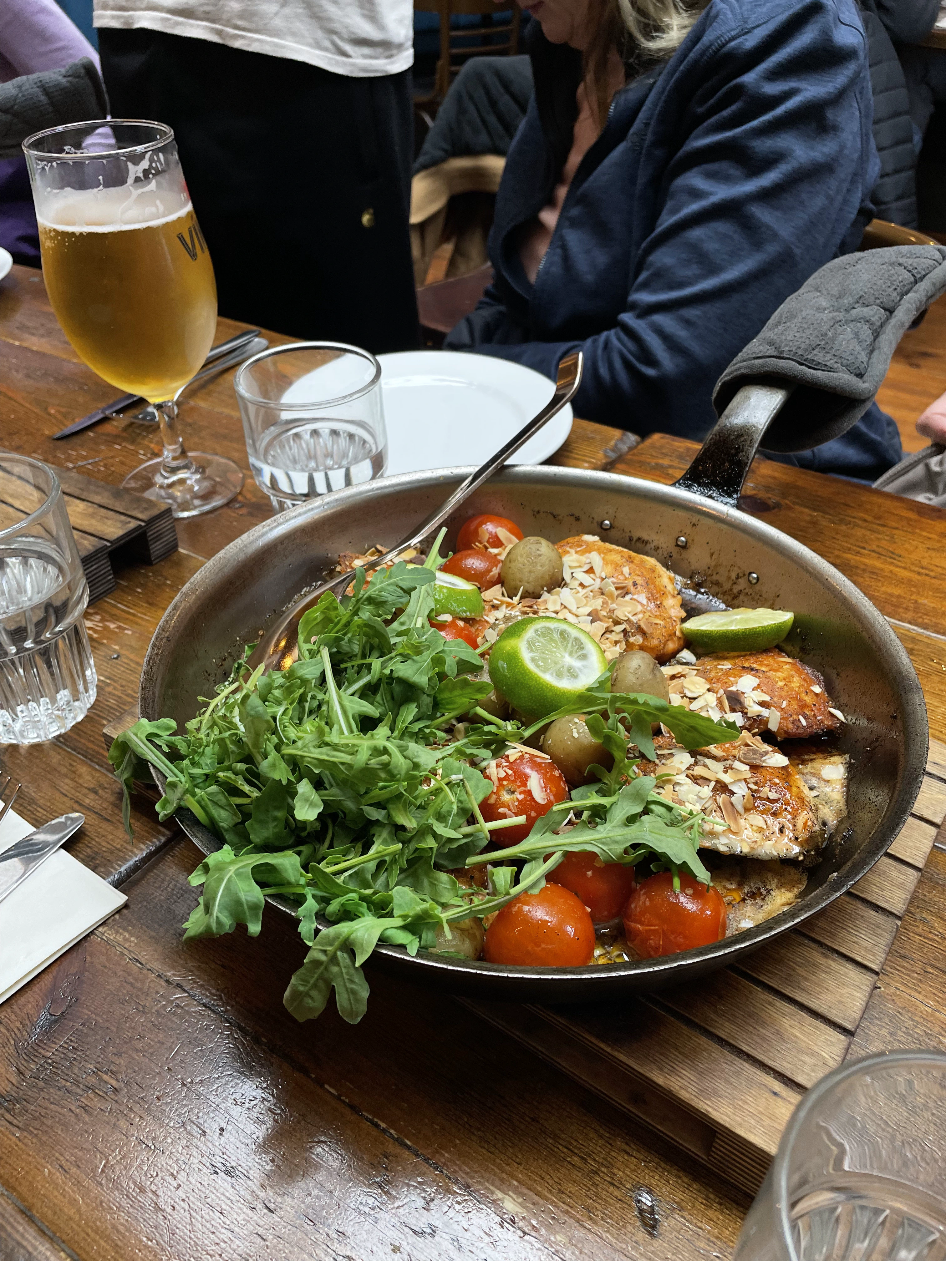
Scran
Shot on the iPhone 12. Credit: Keenan Schott
At another restaurant, Íslenski Barinn, we had the opportunity to try fermented shark. Although the smell was putrid, the taste was pretty neutral - I can see how, if driven by necessity, those who lived hundreds of years ago could live off this. We also had Brennivín, or burning wine. As the name implies, it burned as it went down the hatch. Another highlight of the food tour was trying Iceland’s unofficial national dish, the hotdog, which had ketchup, mustard, remoulade sauce, deep fried onion, and raw onion. It was good, but a little overwhelming. Sometimes, plain old ketchup and mustard will do the trick.
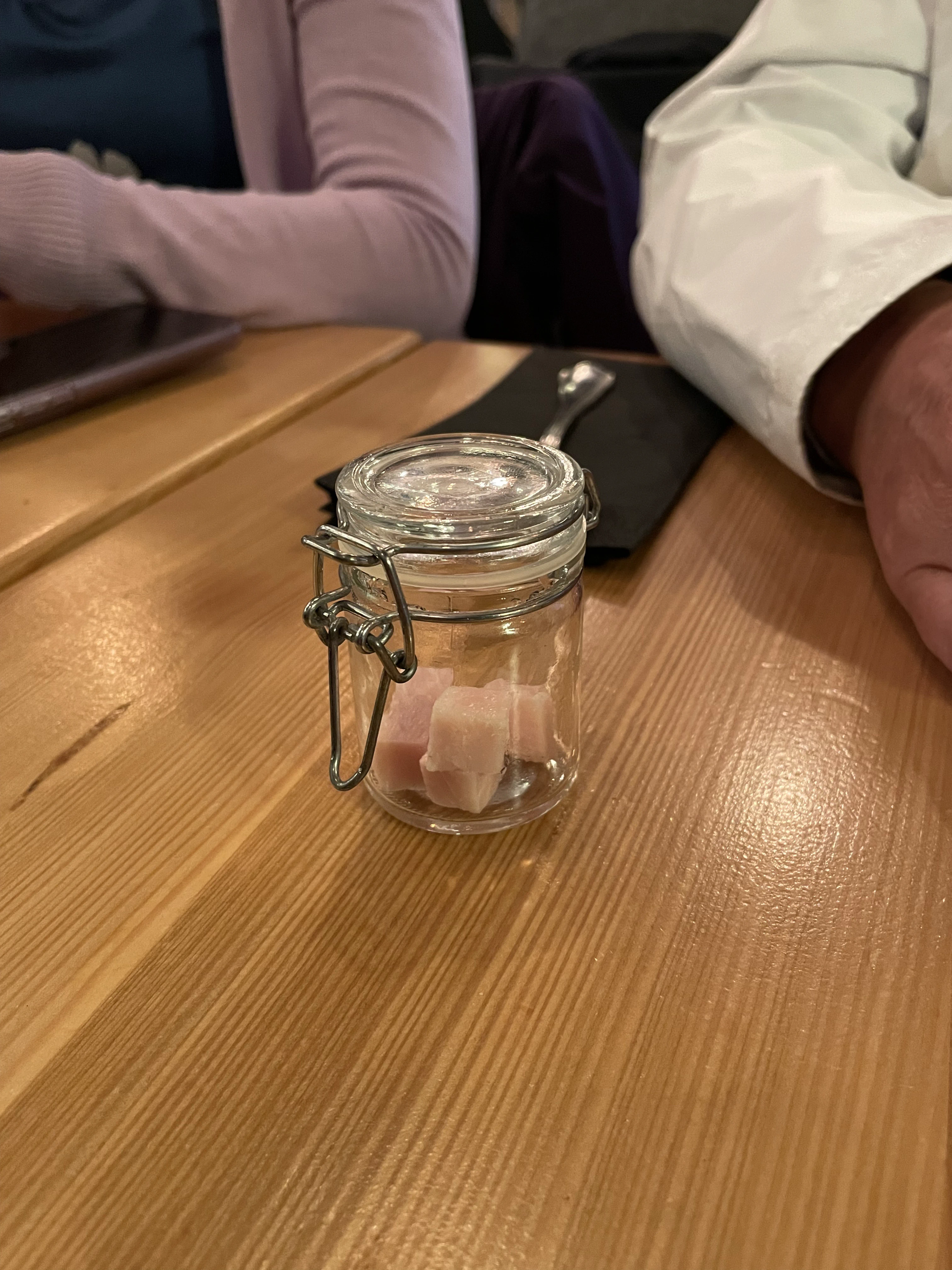
Fermented Shark
Shot on the iPhone 12. Credit: Keenan Schott
Following our tour, we were dropped in front of Hallgrímskirkja, the largest church in Iceland and among the tallest structures in the country. Its designed to resemble the trap rocks, mountains, and glaciers of Iceland’s landscape. As we’ll see later, the design does a pretty good job.
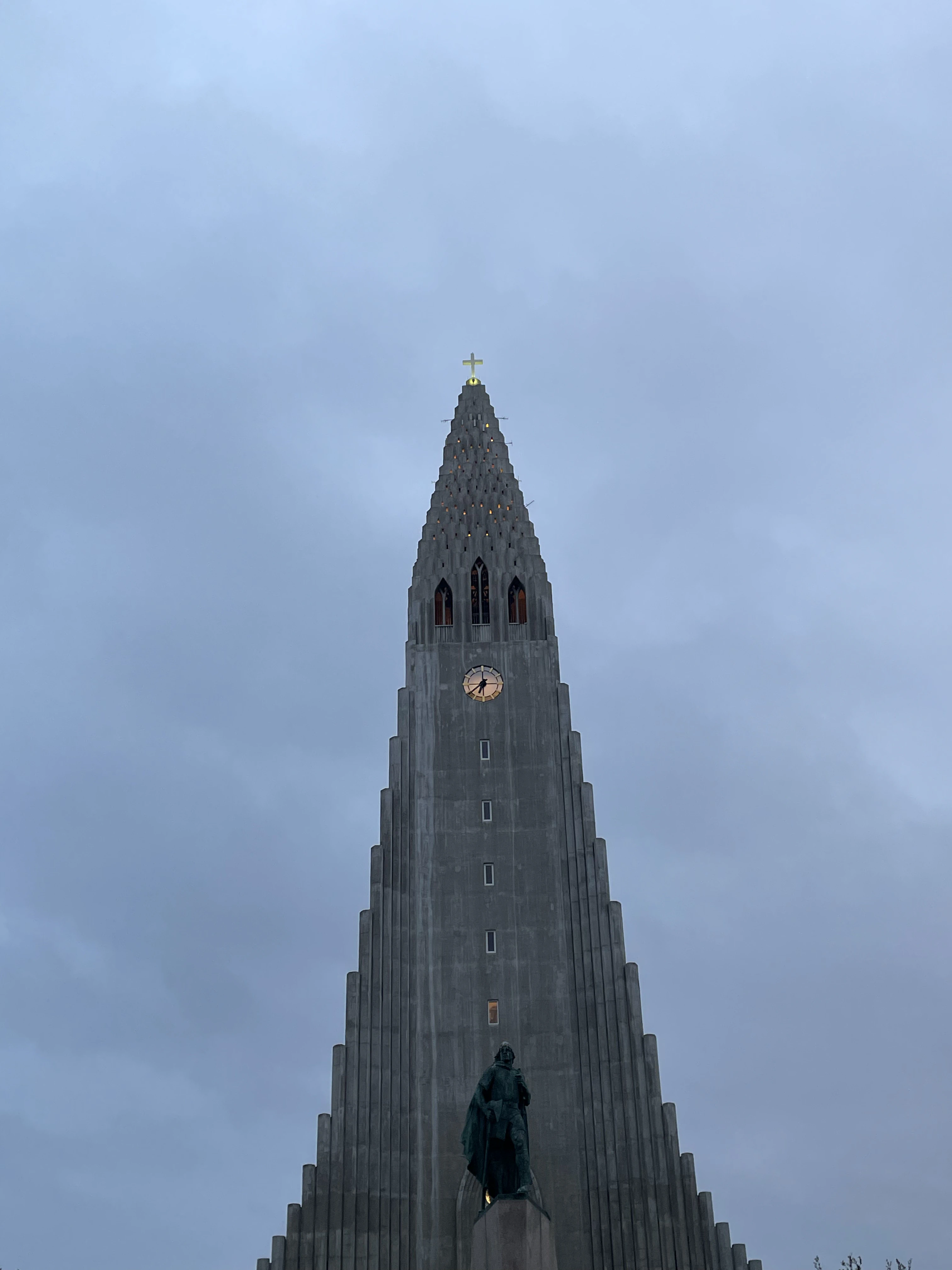
Hallgrímskirkja
Shot on the iPhone 12. Credit: Keenan Schott
In front of Hallgrímskirkja sits the statue of Norse explorer Leif Erikson, commissioned by the United States. It was a gift to Iceland for the 1,000th anniversary of the Alþingi, Iceland’s parliament, in 1930. If anything, us Americans can respect democracy.
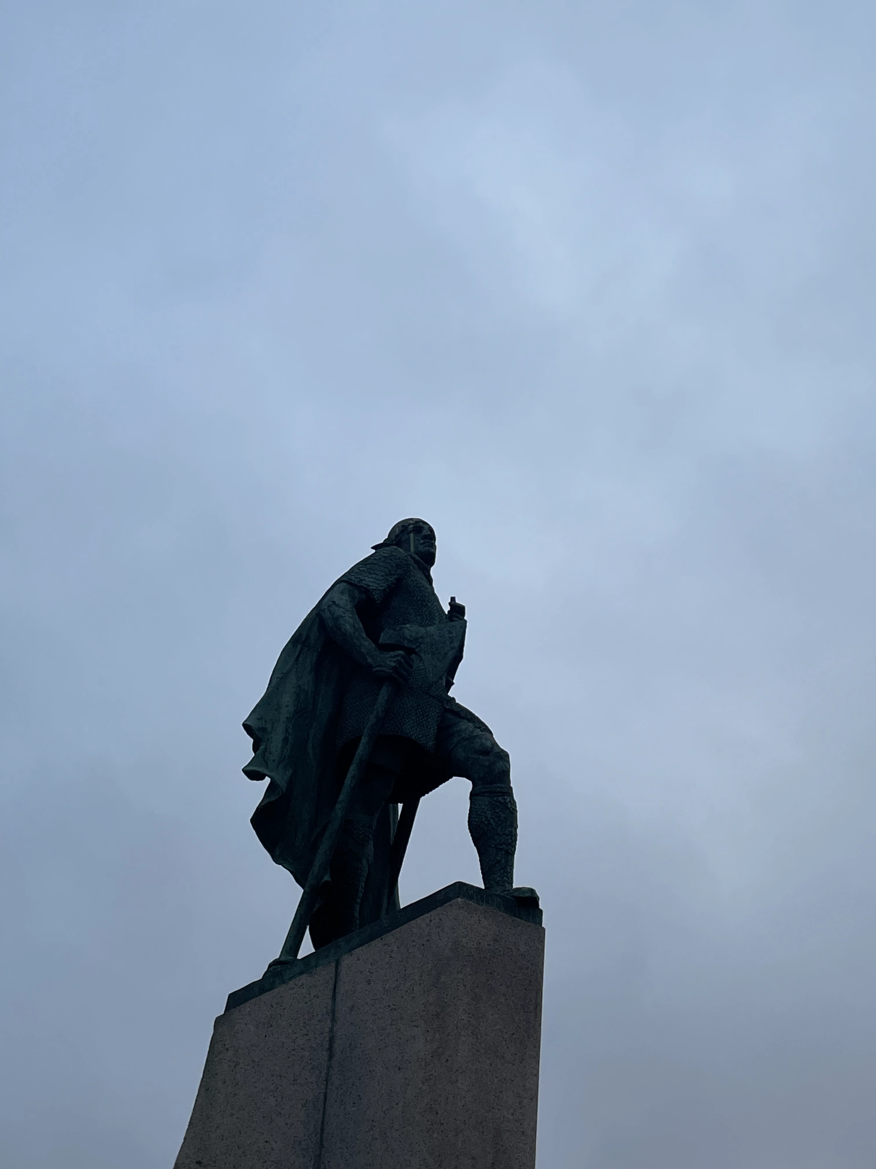
Leif Erikson
Shot on the iPhone 12. Credit: Keenan Schott
Snæfellsnes
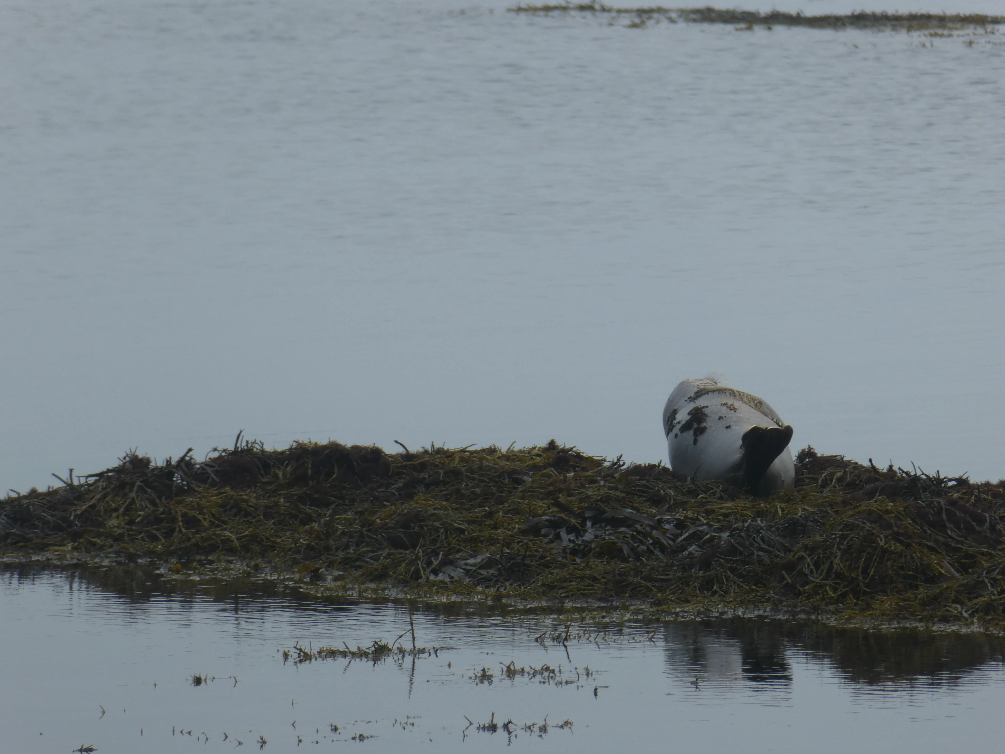
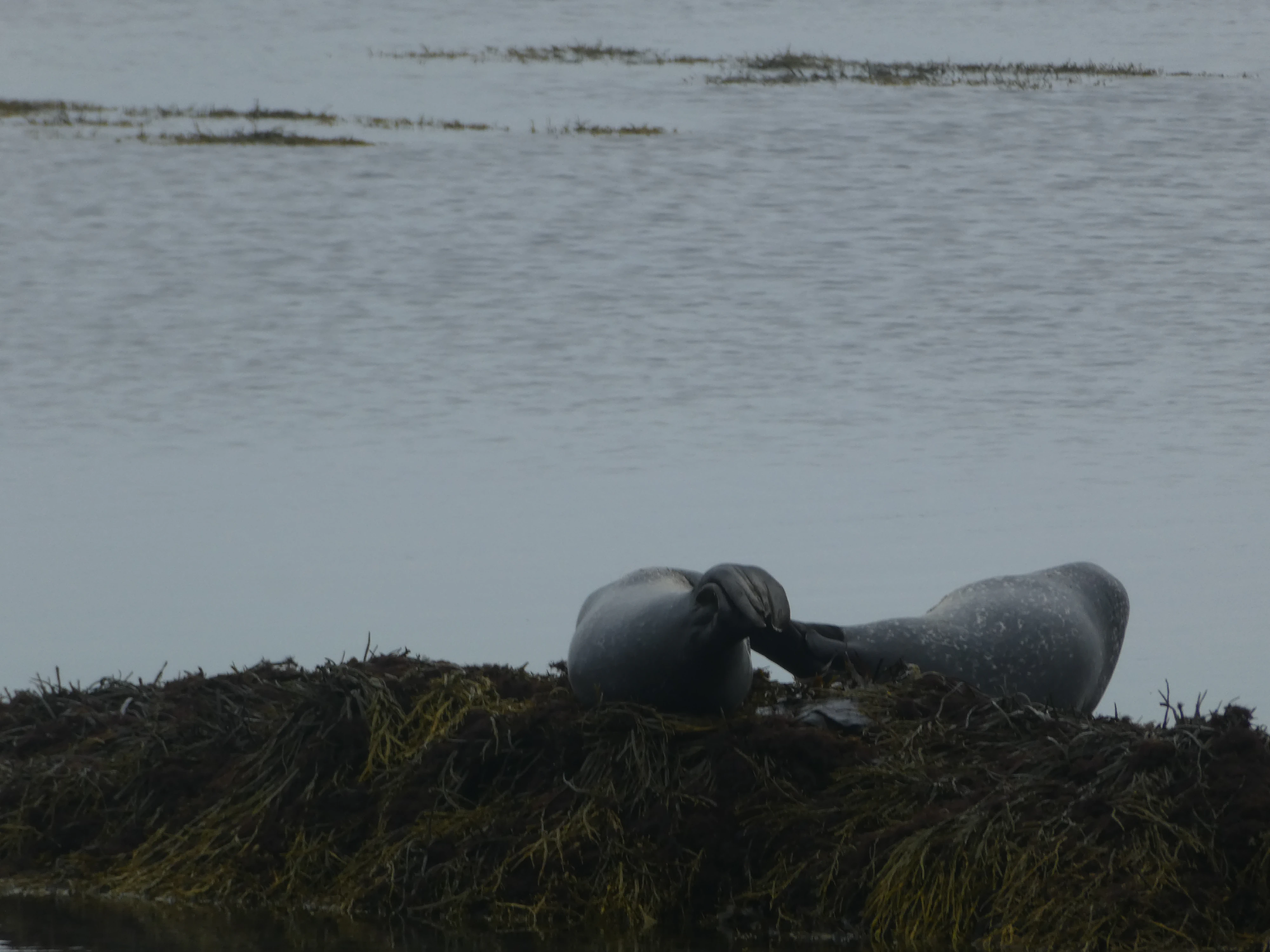
Next, we headed north to Snæfellsnes, a large peninsula in western Iceland. We stopped at Ytri Tunga, a beach by a farm of the same name. Unlike many of the beaches in Iceland, Ytri Tunga has golden sand rather than black. The big draw here was the seals, as it’s said to be one of the most reliable sites in Iceland to see them.
Cheesin'
Shot on the Panasonic Lumix DMC-ZS60. Credit: Keenan Schott

Loungin’ Around
Shot on the Panasonic Lumix DMC-ZS60. Credit: Keenan Schott
Stretchin'
Shot on the Panasonic Lumix DMC-ZS60. Credit: Keenan Schott
Messin’ Around
Shot on the Panasonic Lumix DMC-ZS60. Credit: Keenan Schott
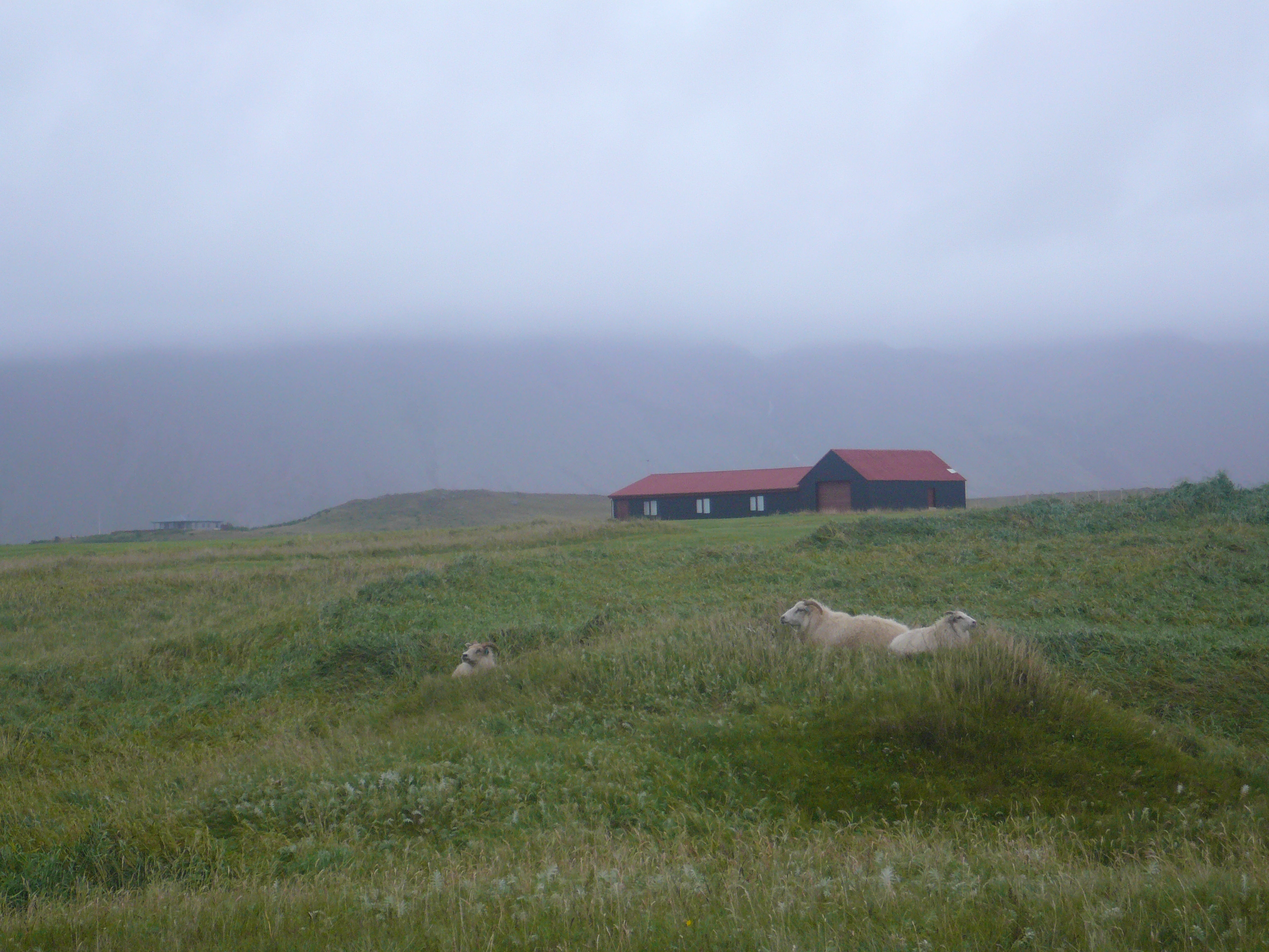
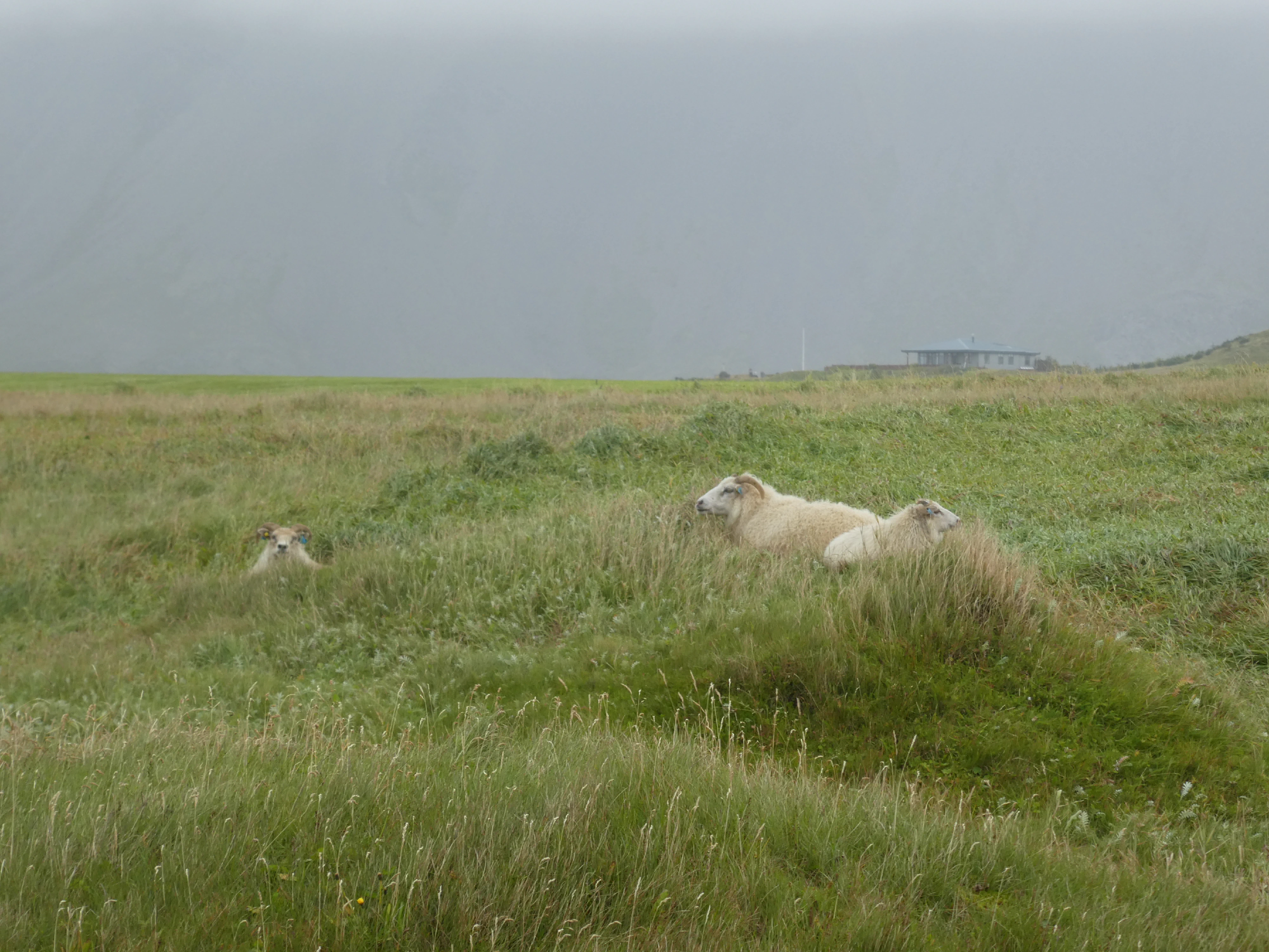
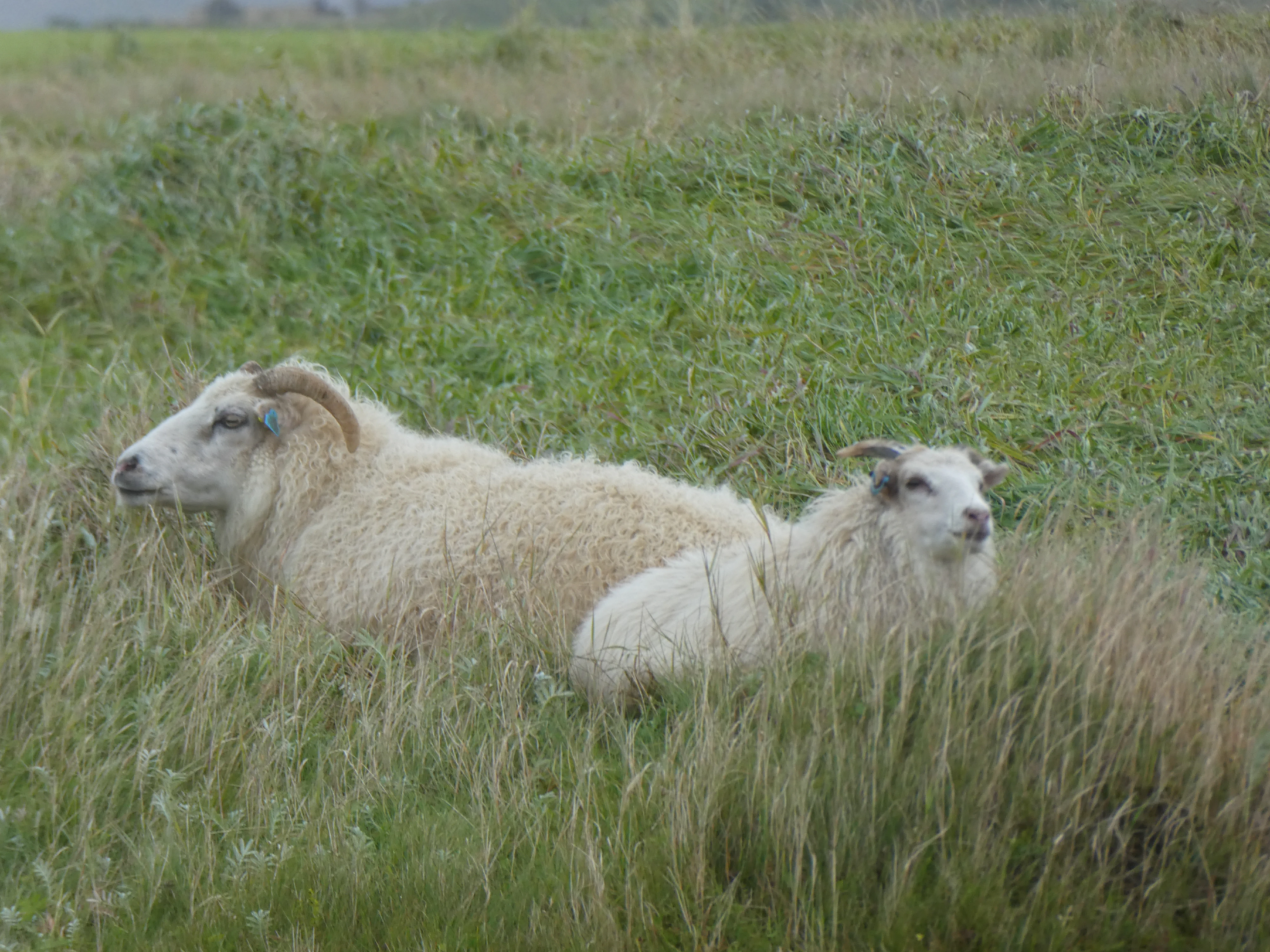
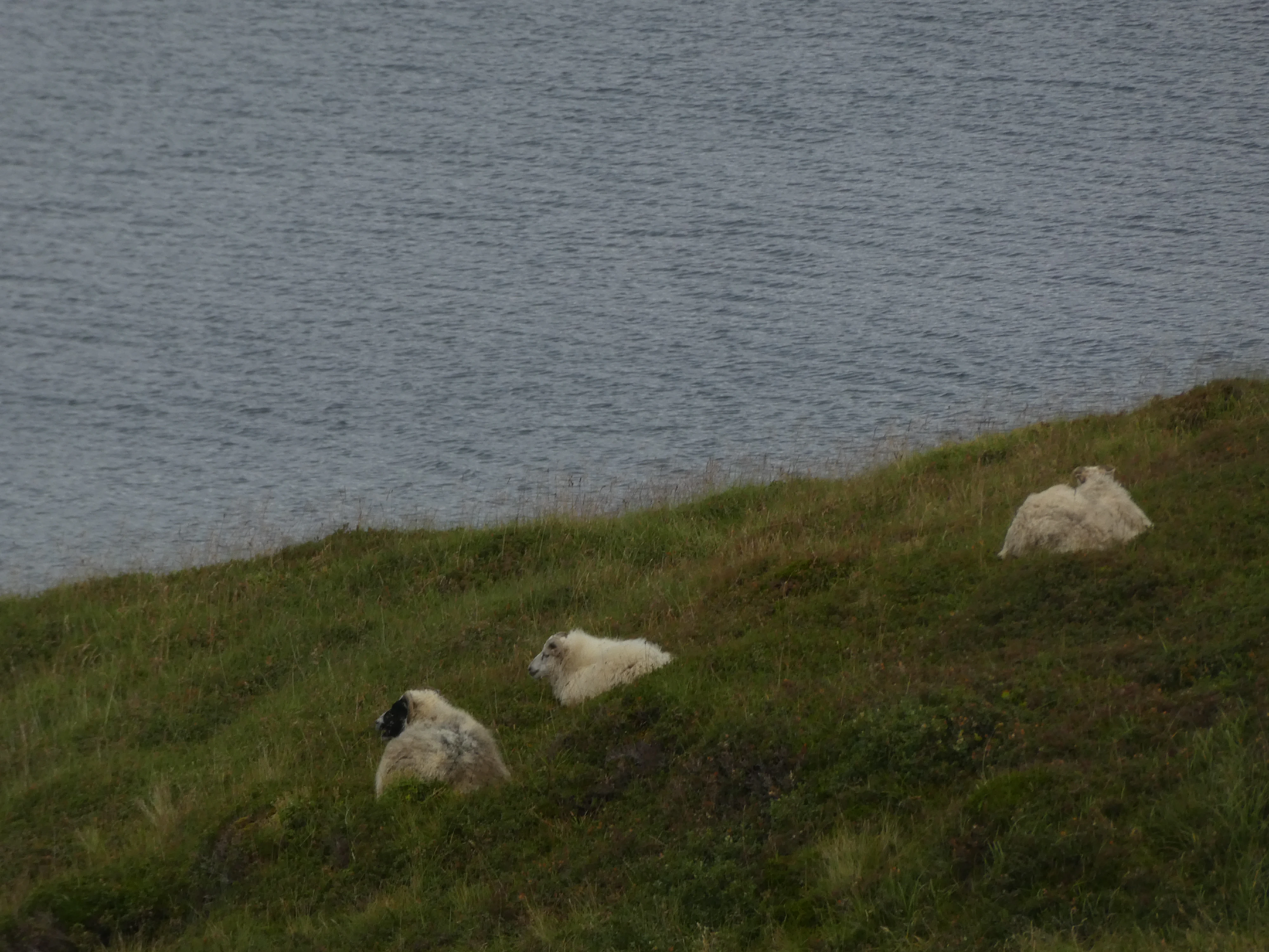
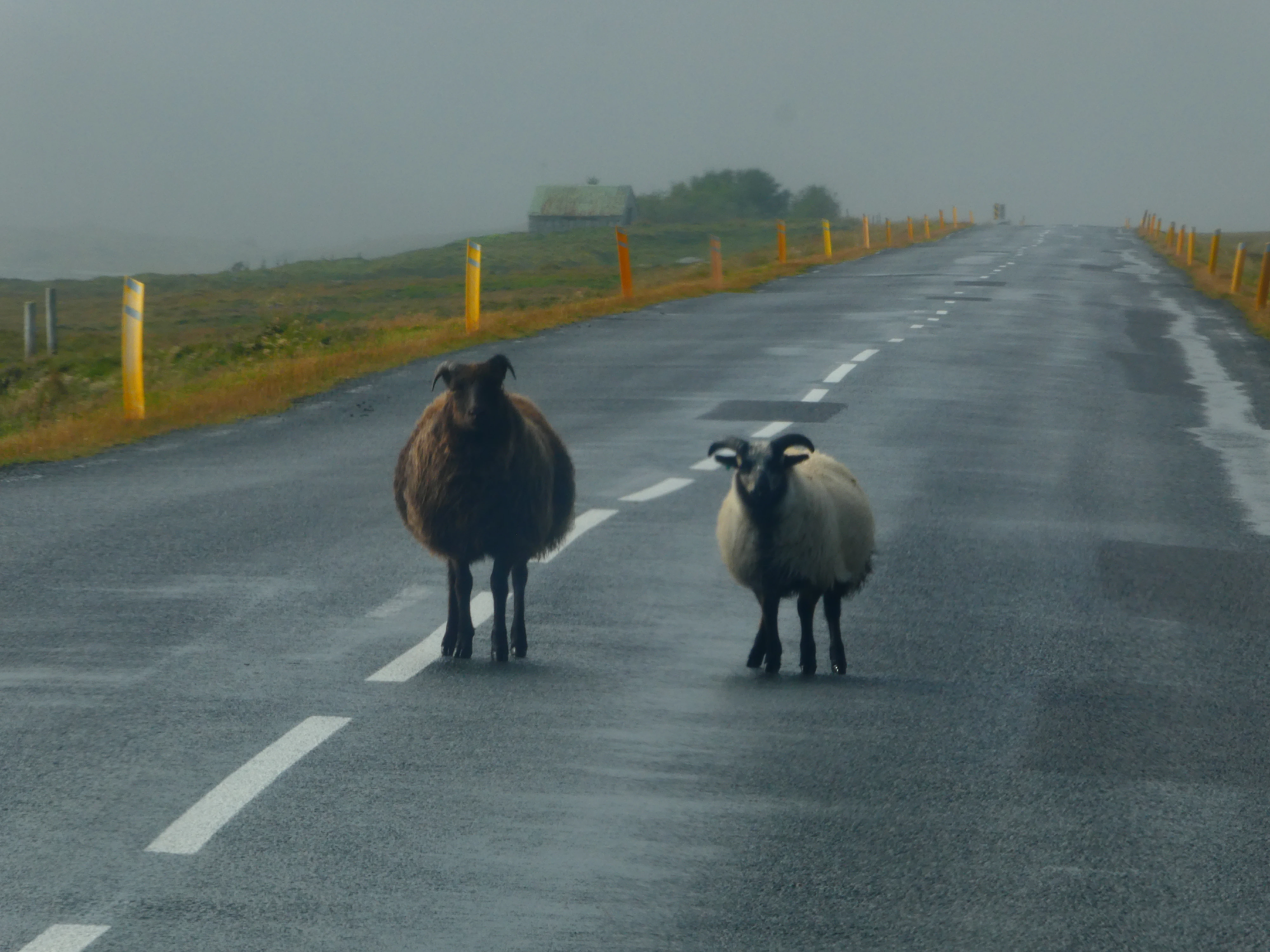
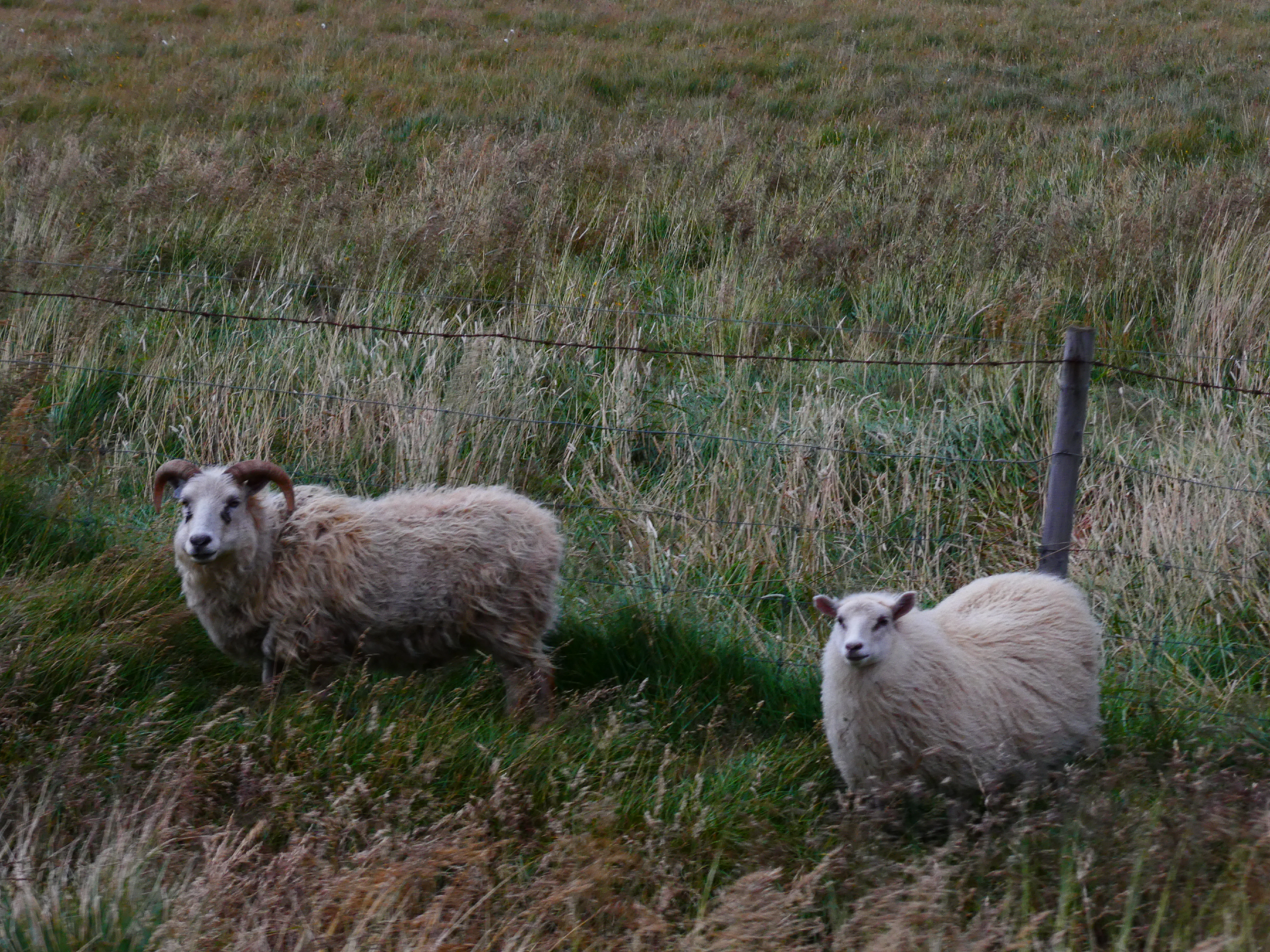
The sheep in Iceland are abundant; not a day passed without seeing at least hundreds of sheep. Introduced to Iceland by the Vikings in the late ninth or early tenth century, their numbers peeked in 1978 when there were approximately 891,000 sheep, or about four sheep for every inhabitant of Iceland. It is illegal to import sheep to Iceland, as their genetic purity leaves them vulnerable to disease.
Hangin’ Out
Shot on the Panasonic Lumix DMC-FX07. Credit: Keenan Schott
Alerted
Shot on the Panasonic Lumix DMC-ZS60. Credit: Keenan Schott
A Closer Look
Shot on the Panasonic Lumix DMC-ZS60. Credit: Keenan Schott
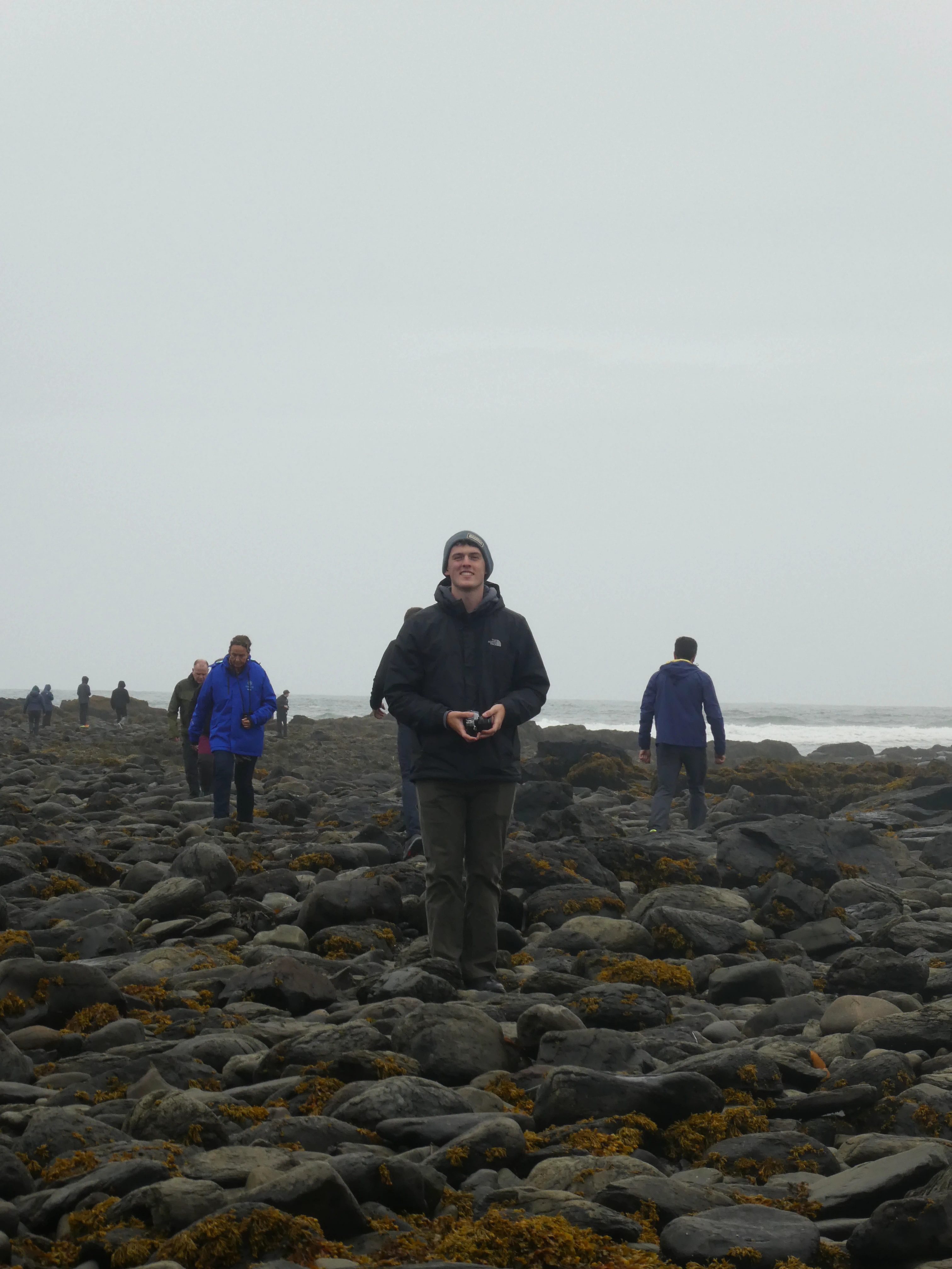
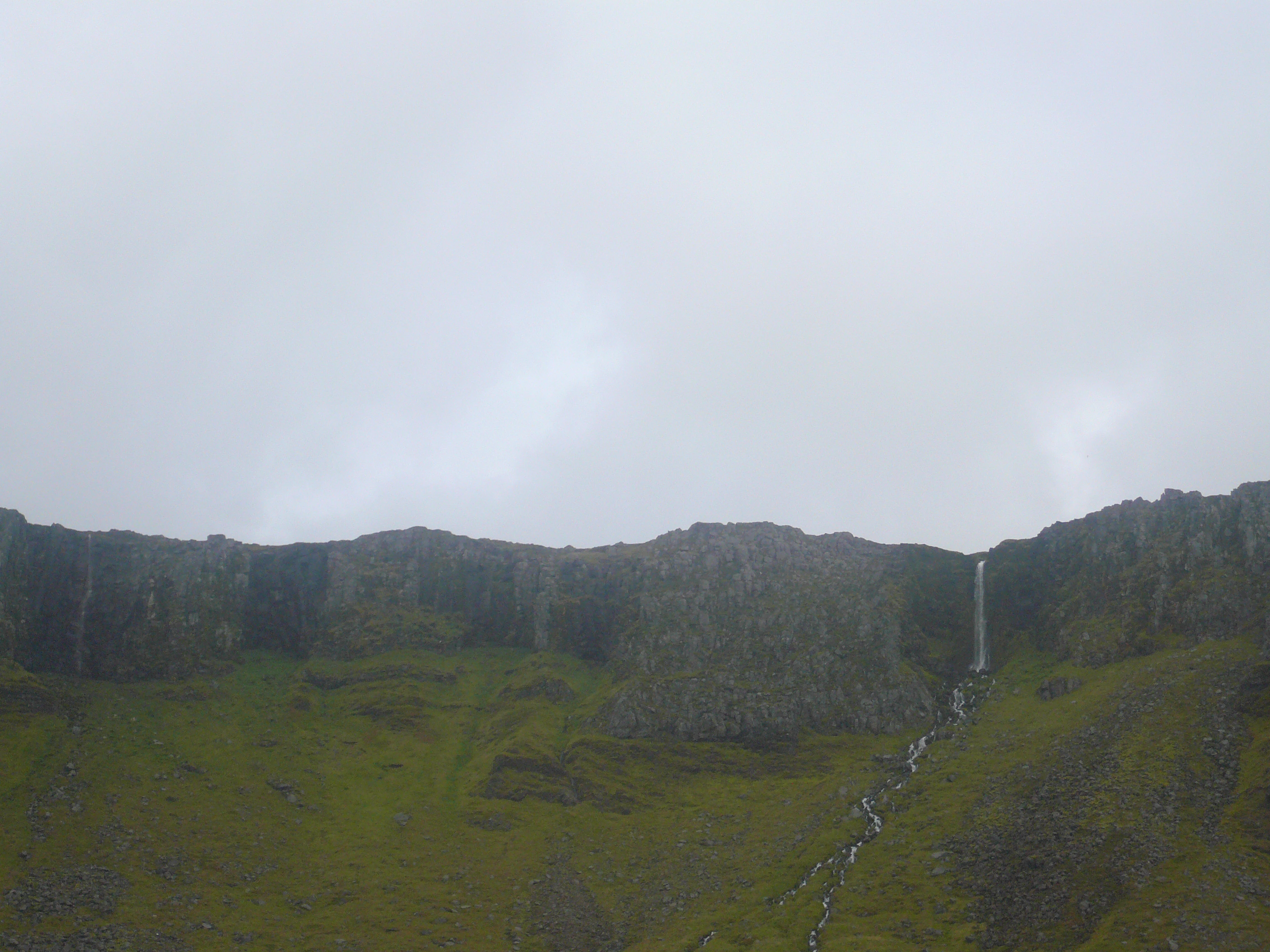
Despite Iceland’s many attractions, there was a fundamental lack of boring terrain in between points of interest. Oftentimes, driving from one point to another was more entertaining than the eventual destination.
Roadside Attractions
Shot on the Panasonic Lumix DMC-FX07. Credit: Keenan Schott
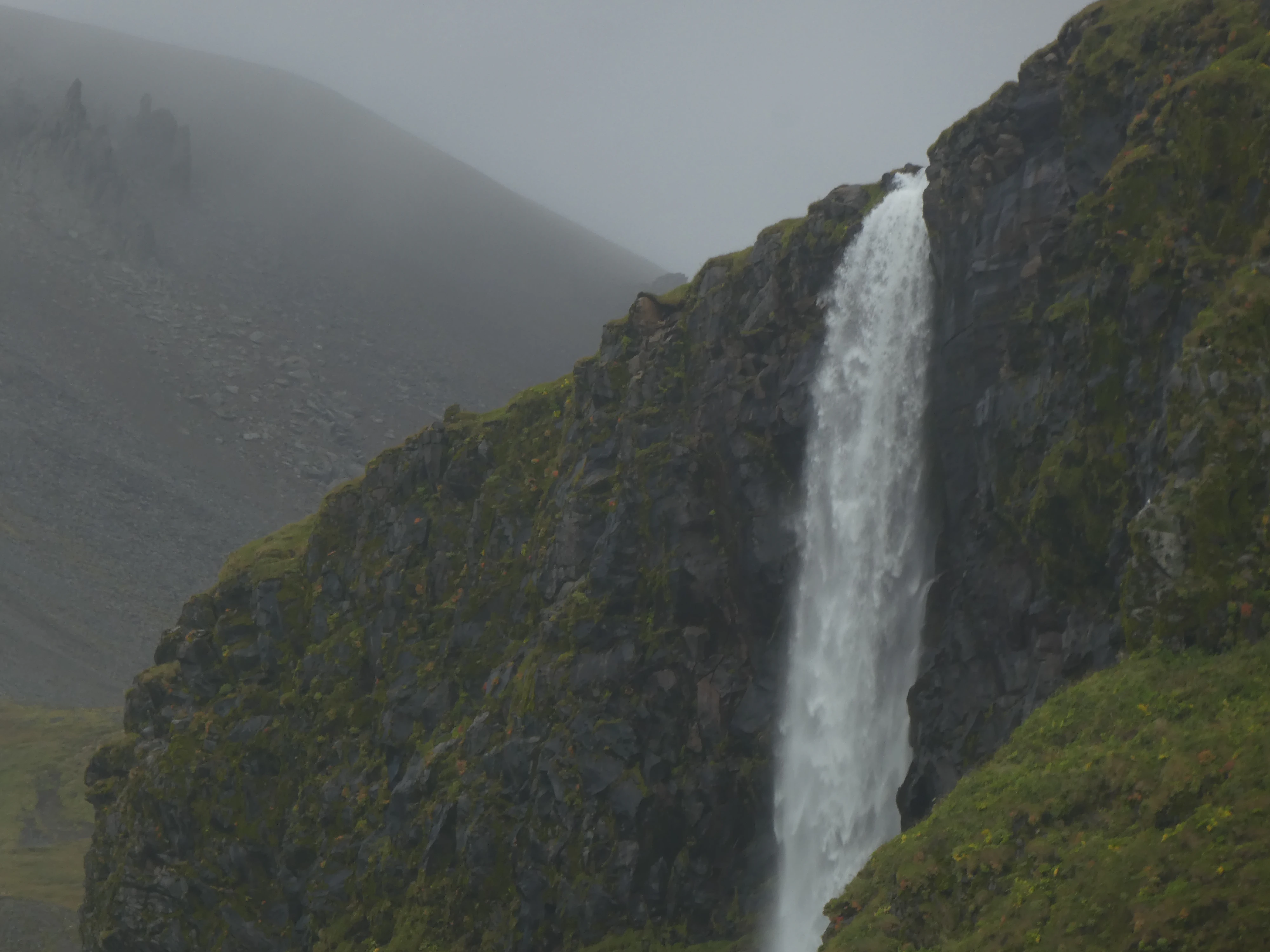
A Roadside Waterfall
Shot on the Panasonic Lumix DMC-ZS60. Credit: Keenan Schott
As a result, I was able to capture my favorite photos of the trip. I feel as if these perfectly encapsulate the natural beauty of the remote island nation.
Iceland
Shot on the Panasonic Lumix DMC-ZS60. Credit: Keenan Schott

A Gathering on the Hill
Shot on the Panasonic Lumix DMC-ZS60. Credit: Keenan Schott
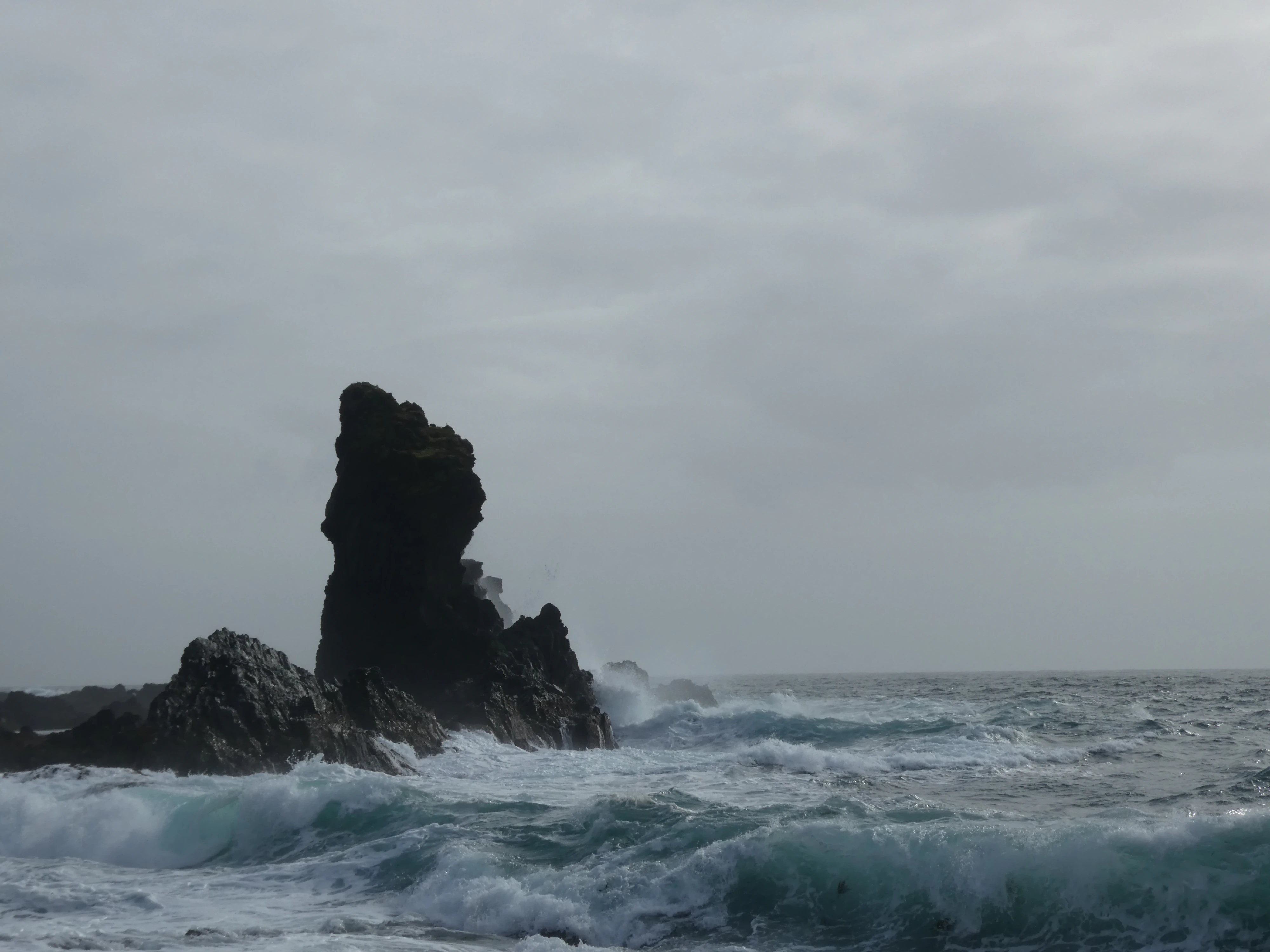
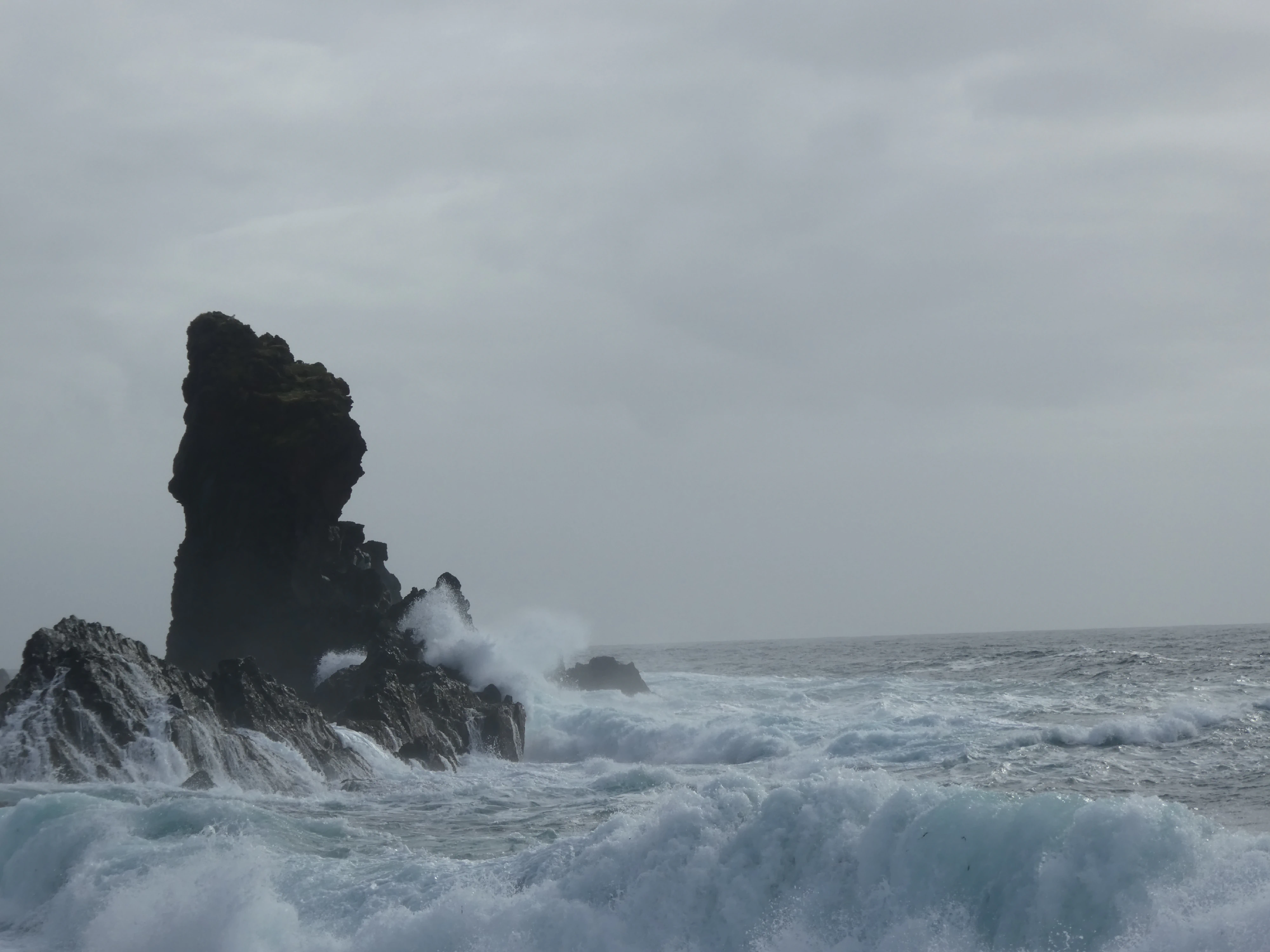
Djúpalónssandur is a black sand beach at the foot of Snæfellsjökull, the 700,000-year-old glacier-capped stratovolcano where the protagonists of Journey to the Center of the Earth began their journey. I tried my hand at the lifting stones that were used by fishermen to test their strength and walked away humbled and with dust all over my pants.
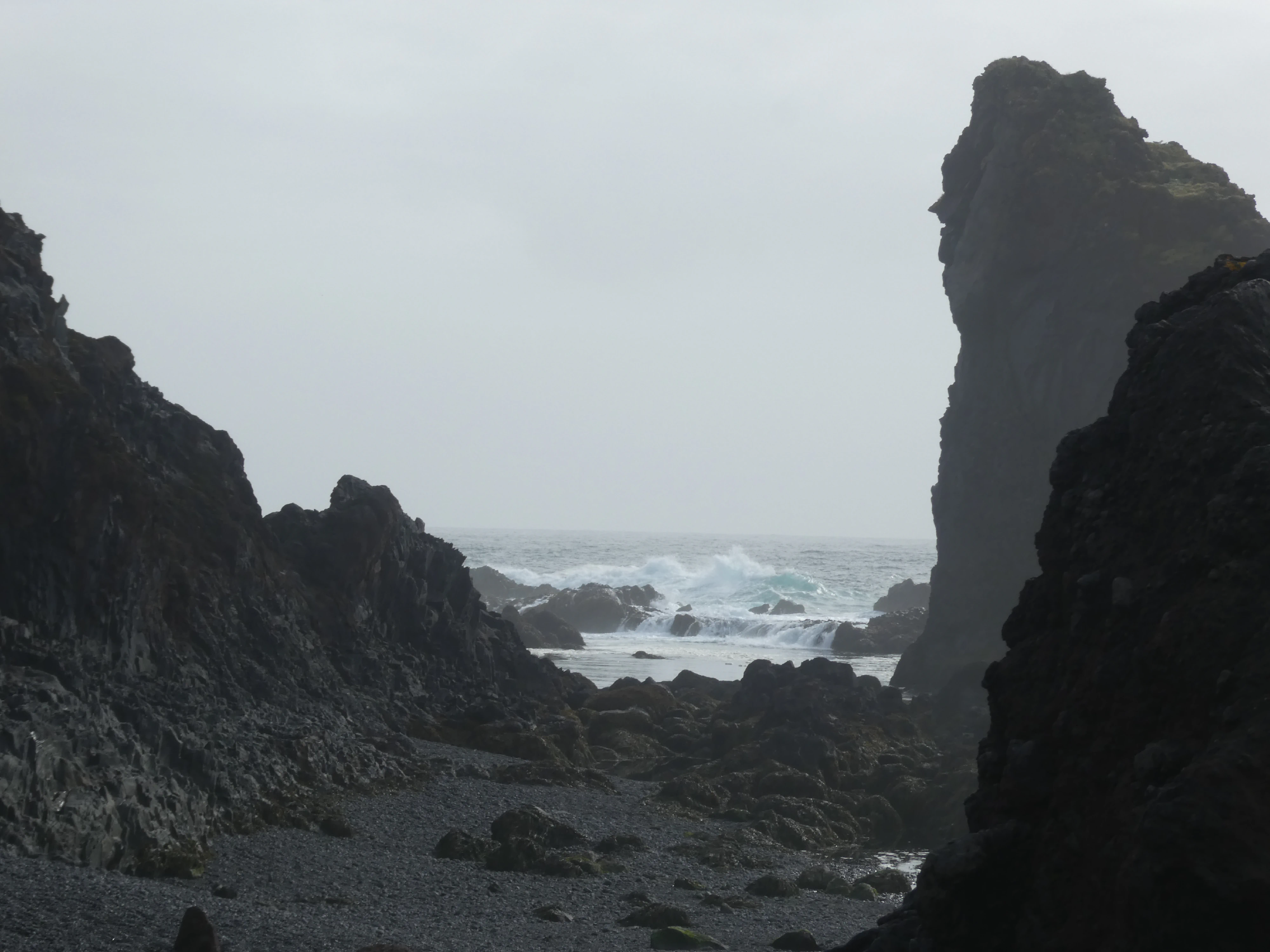
Djúpalónssandur
Shot on the Panasonic Lumix DMC-ZS60. Credit: Keenan Schott
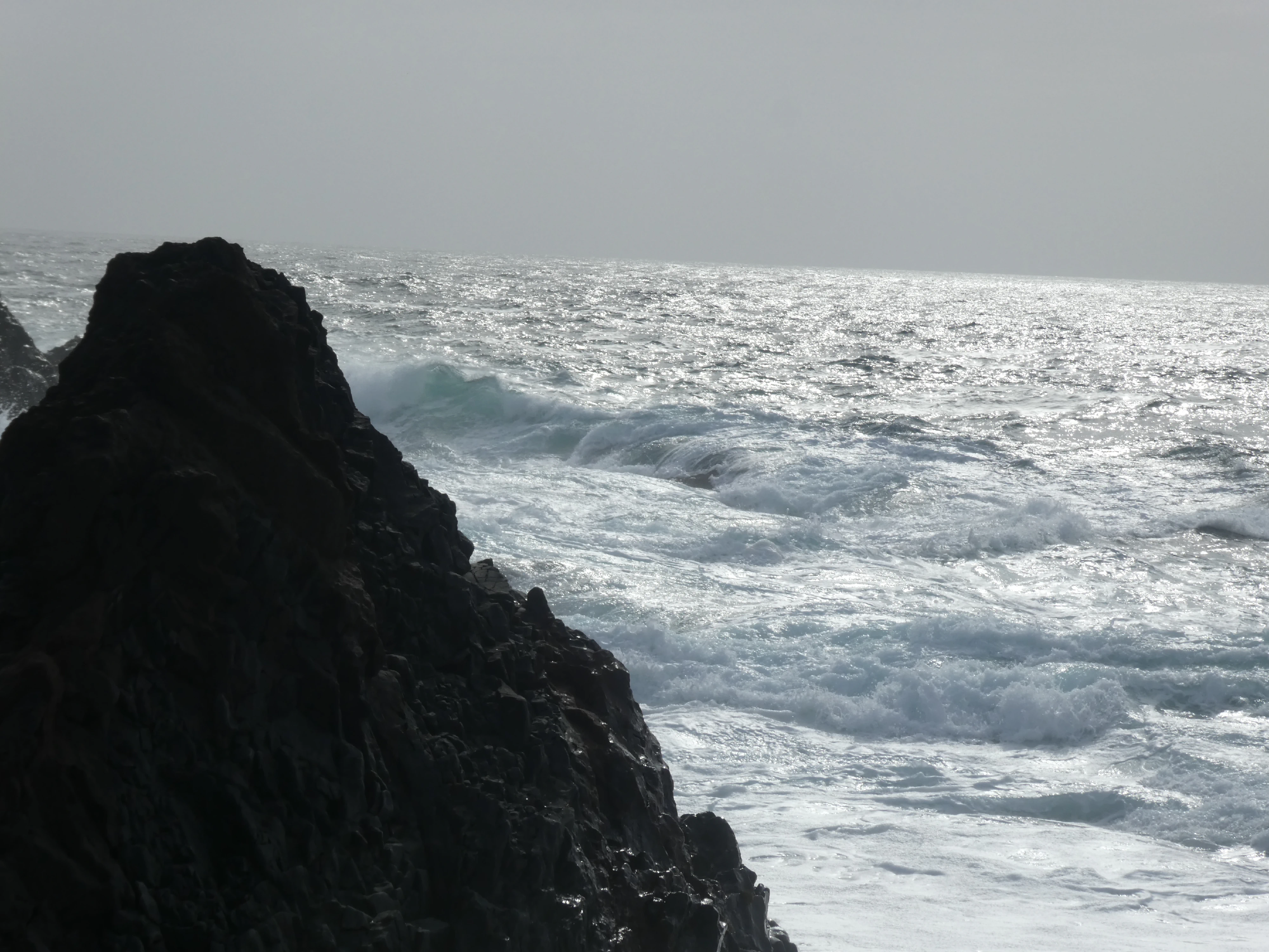
The North Atlantic
Shot on the Panasonic Lumix DMC-ZS60. Credit: Keenan Schott
Standing Tall
Shot on the Panasonic Lumix DMC-ZS60. Credit: Keenan Schott
Beaten and Battered
Shot on the Panasonic Lumix DMC-ZS60. Credit: Keenan Schott
The Beach
Shot on the iPhone 12. Credit: Keenan Schott
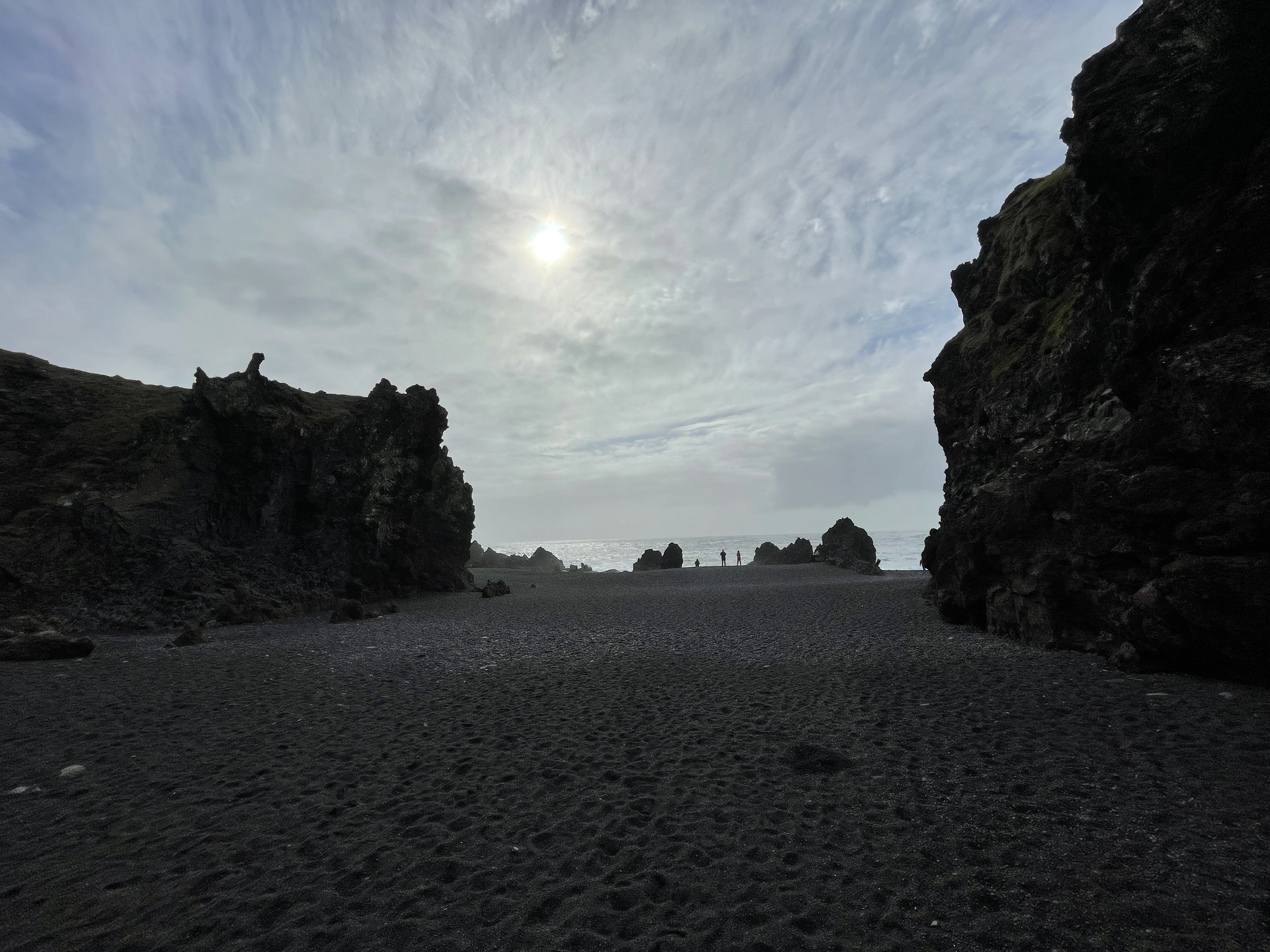
After a seemingly long drive on a rough, unpaved road, Skardsvík Beach offered a view of Iceland’s geology and the force of the north Atlantic.
The Overlook
Shot on the iPhone 12. Credit: Keenan Schott

Gimme Shelter
Shot on the Panasonic Lumix DMC-ZS60. Credit: Keenan Schott
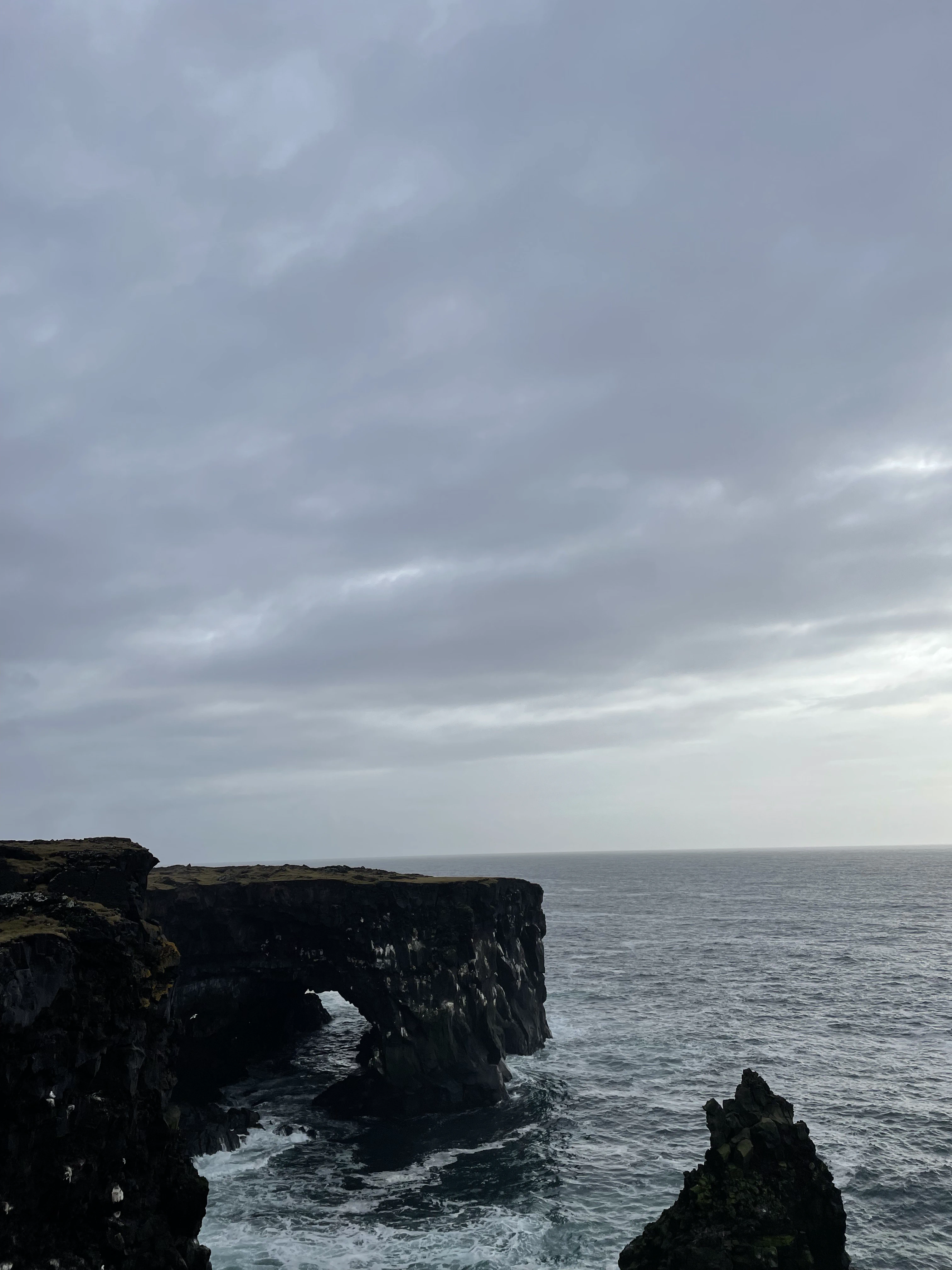
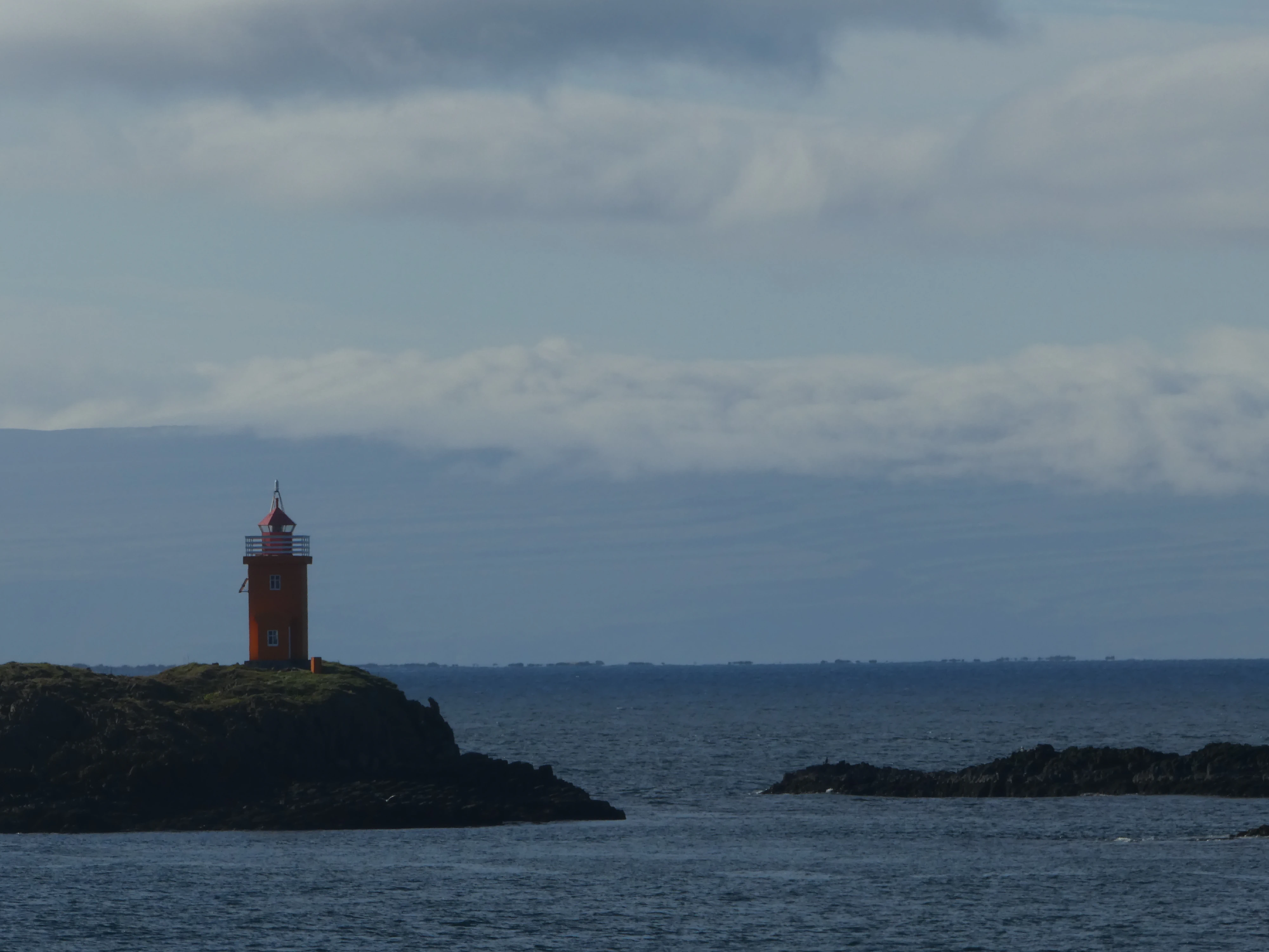
When visiting the Öndverðarnes cape, or the westernmost point of the Snæfellsnes peninsula, we captured an incognito observer in the water. The area had a small orange lighthouse, Öndverðarnesviti, built in 1973, with a couple of parking spaces next to it. Since 1945, Öndverðarnes has been deserted, and we saw the ruins of fishing huts, fish storage huts, and farms.
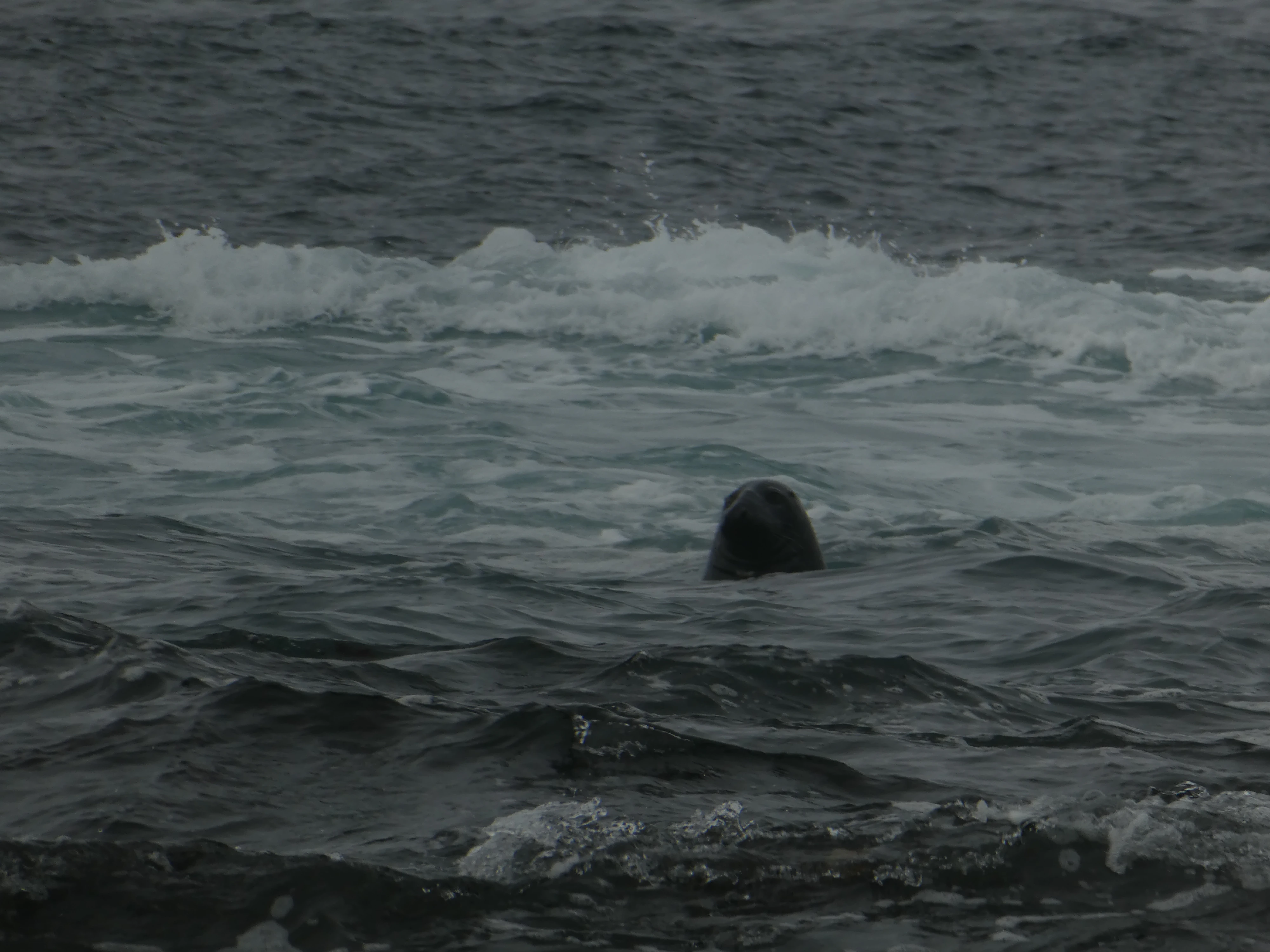
A Watchful Eye
Shot on the Panasonic Lumix DMC-ZS60. Credit: Keenan Schott
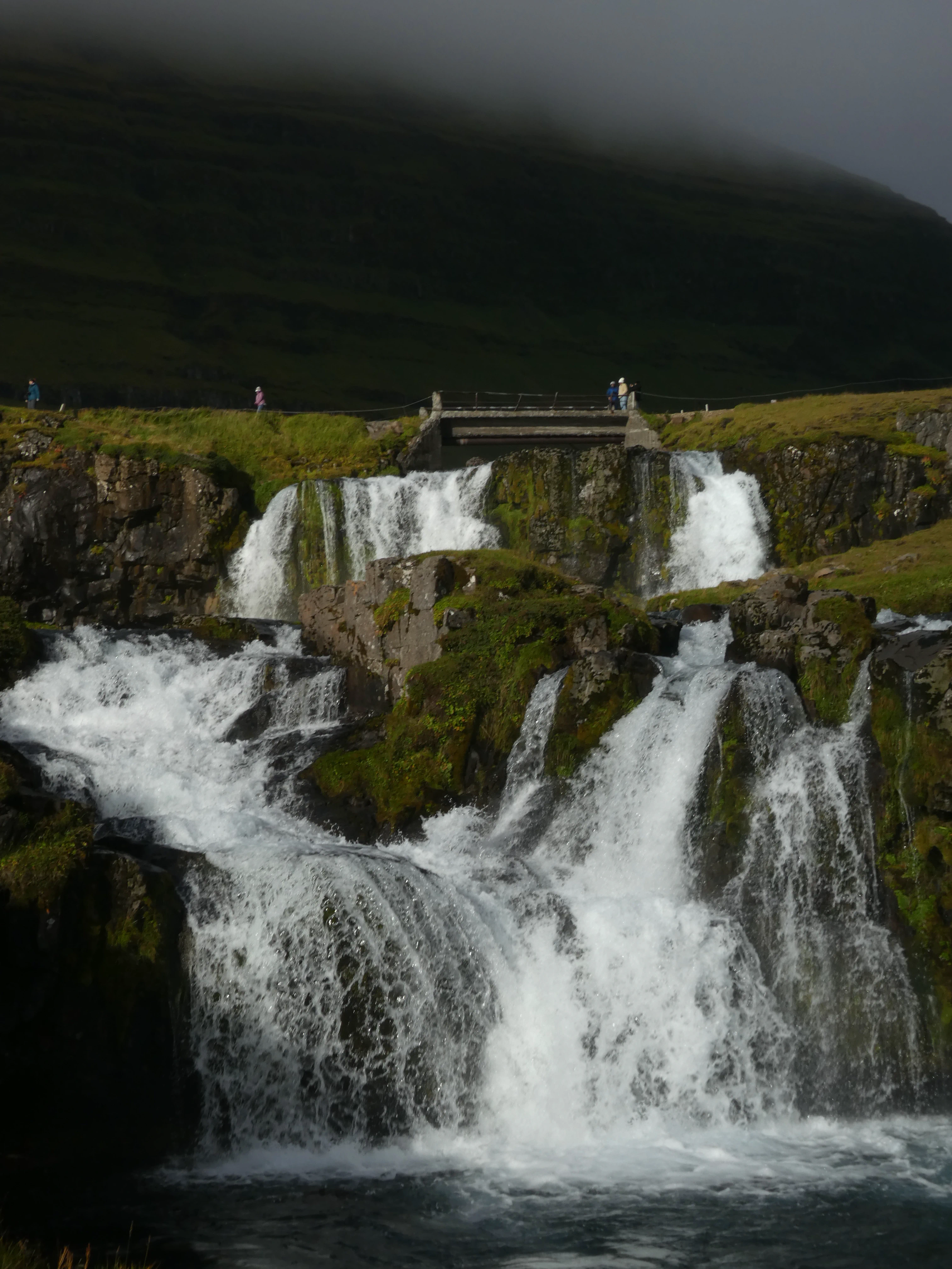
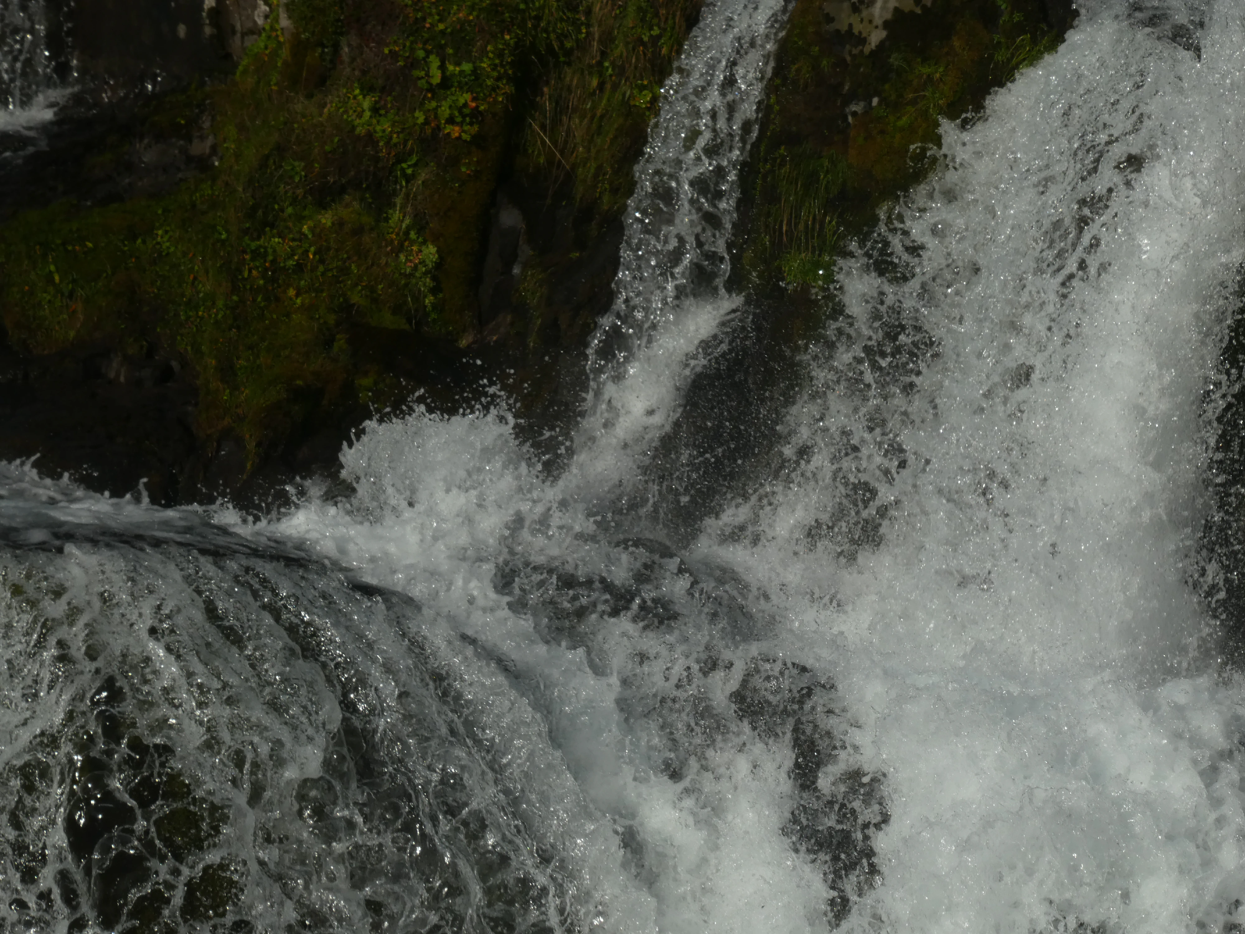
Kirkjufellsfoss, named after the adjacent steeple-shaped mountain, is one of Iceland’s most photographed locations. This was what I now consider our first official waterfall of the trip - it was quite awesome.
Kirkjufellsfoss
Shot on the Panasonic Lumix DMC-ZS60. Credit: Keenan Schott
In Motion
Shot on the Panasonic Lumix DMC-ZS60. Credit: Keenan Schott
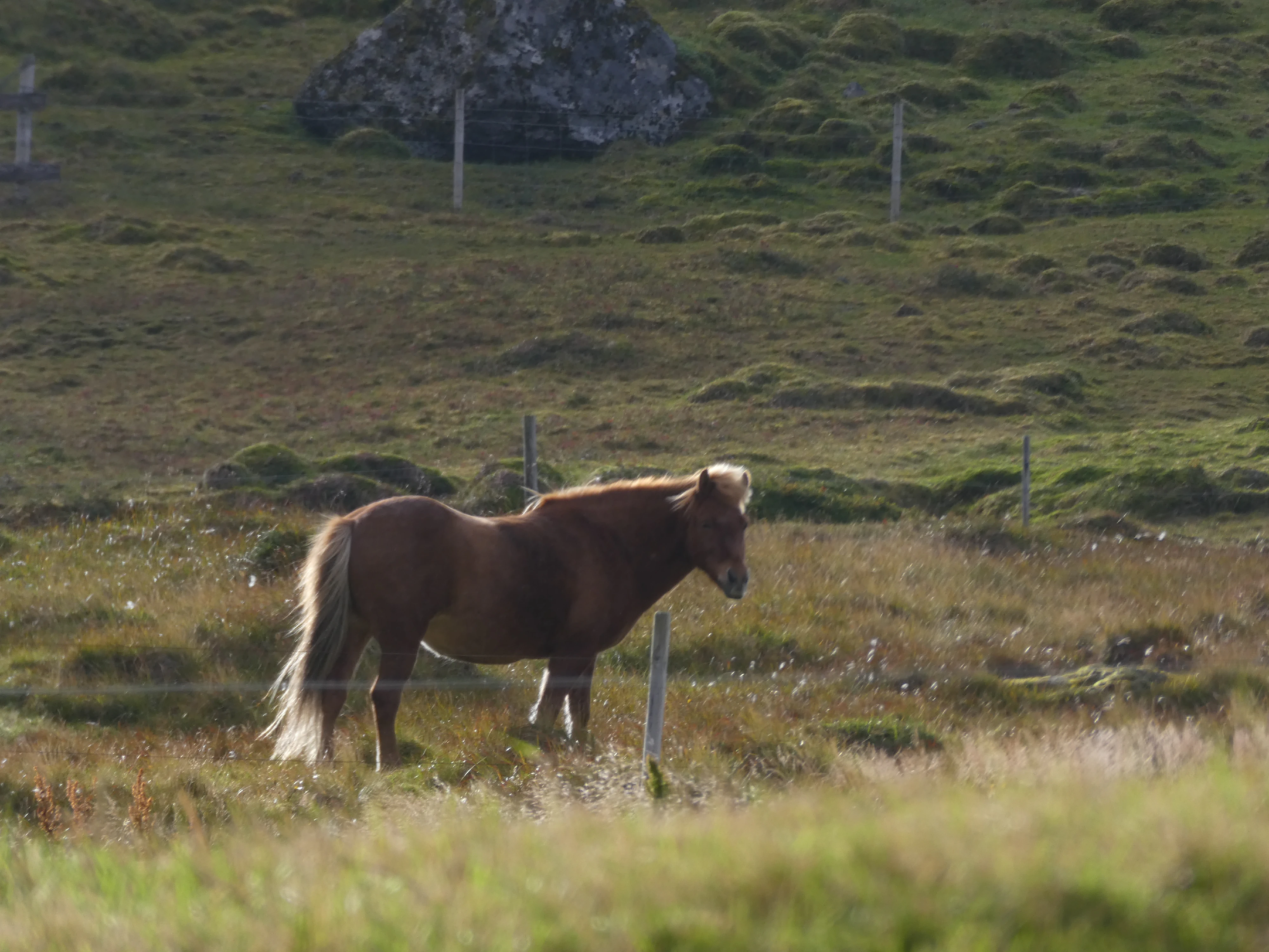
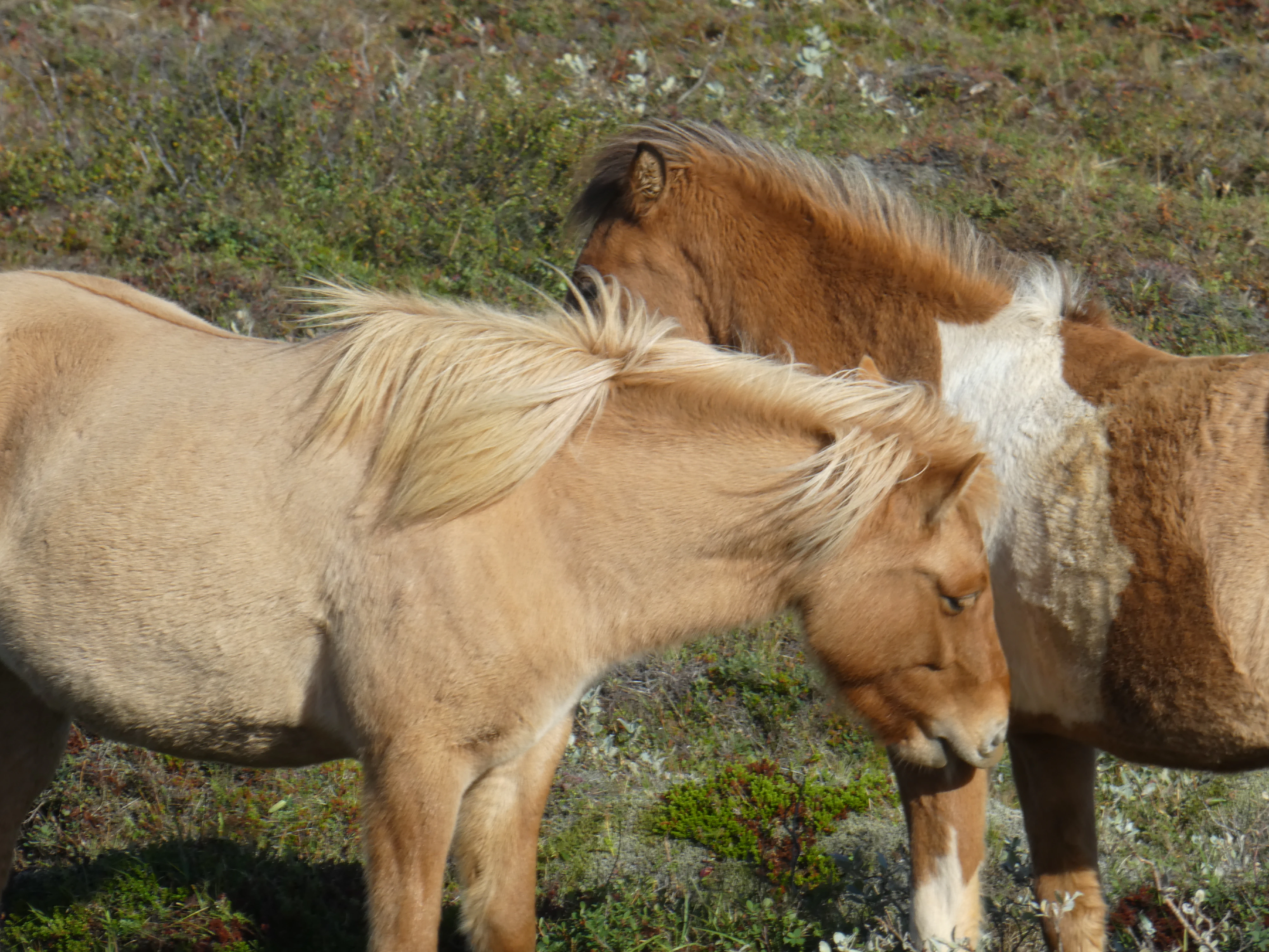
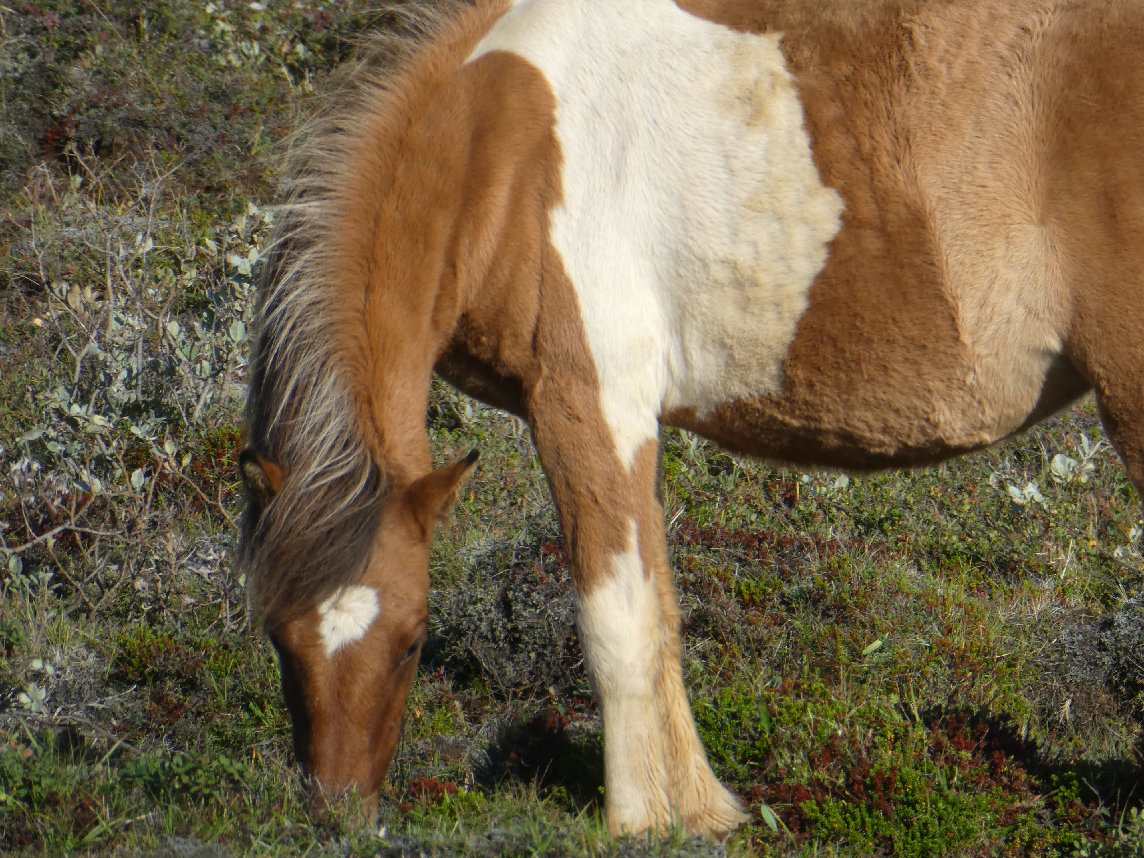
My mother was particularly excited about Iceland’s horses. Icelandic horses are known for being able to do the tölt, or ambling gait. In 982, parliament passed laws prohibiting the importation of horses into Iceland. Today, the breed has now been bred pure for more than 1,000 years.
An Icelandic Horse
Shot on the Panasonic Lumix DMC-ZS60. Credit: Keenan Schott
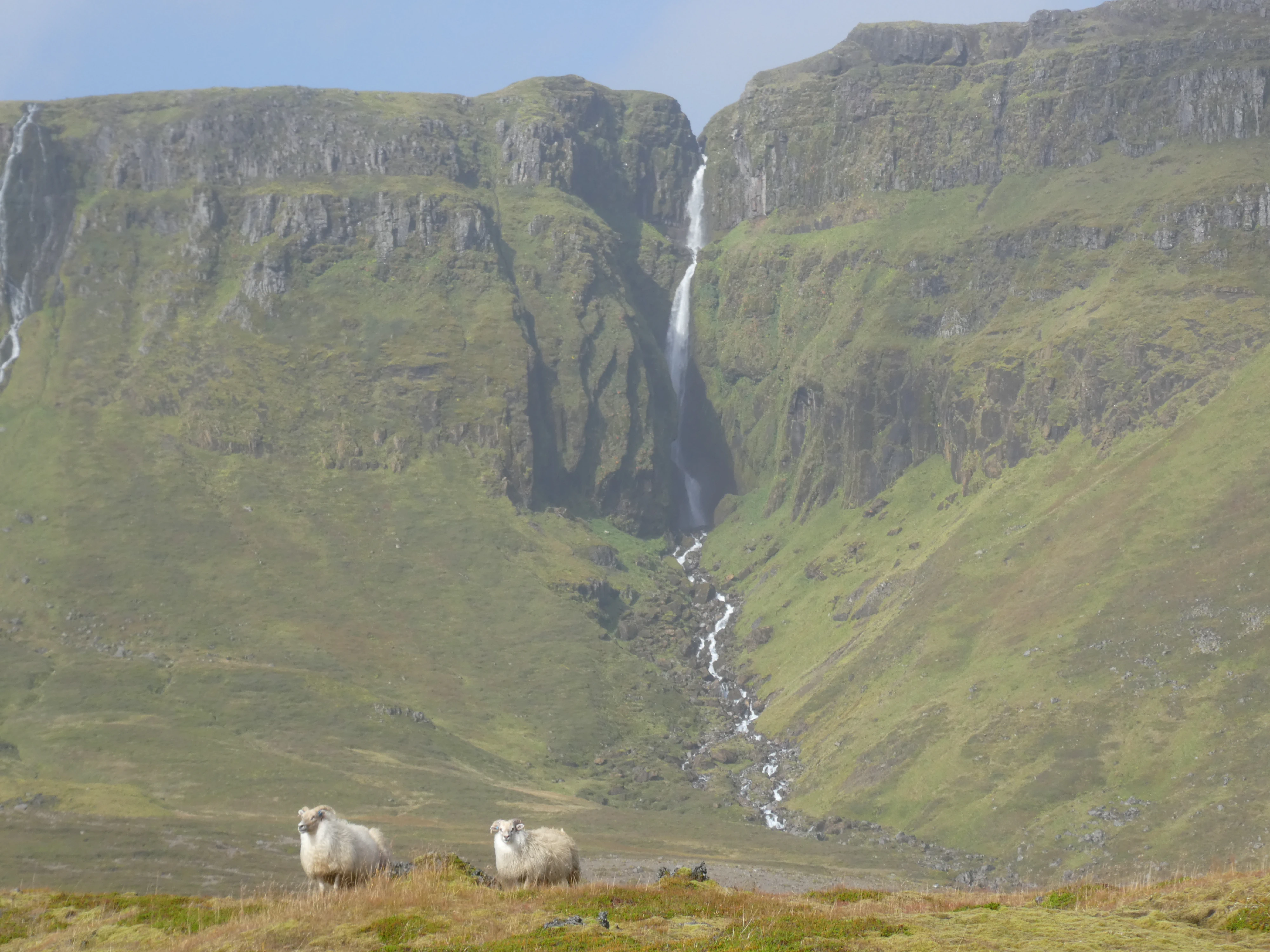
Our last stop on Snæfellsnes was Selvallafoss, or the “Sheep’s Waterfall”, and, naturally, it had sheep. If you can spot it, there’s a trail that allows hikers to walk behind the water. It made for some great photos.
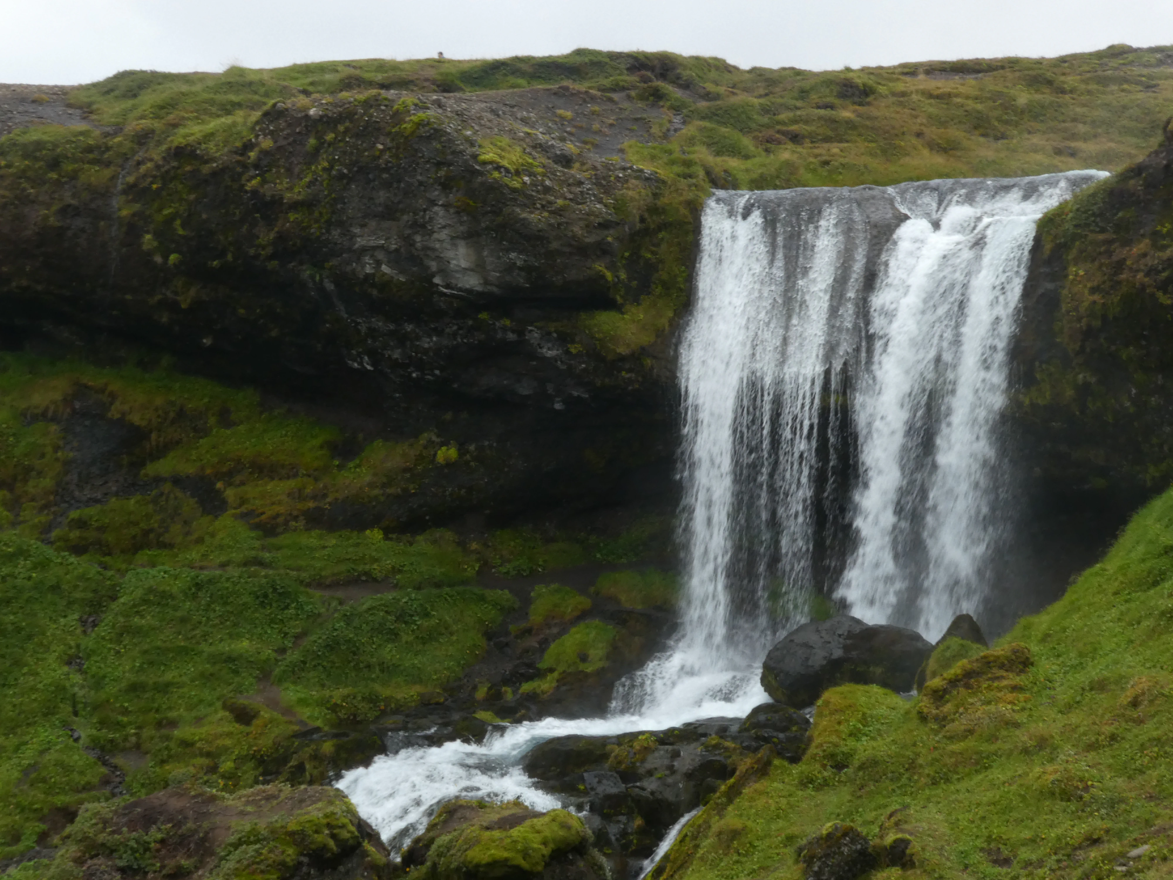
Selvallafoss
Shot on the Panasonic Lumix DMC-ZS60. Credit: Keenan Schott
The Sheep
Shot on the Panasonic Lumix DMC-ZS60. Credit: Keenan Schott
In preparation for our exploration of Iceland’s Westfjords, we headed to Stykkishólmur, a larger town situated on the northern part of Snæfellsnes. The ferry, Baldur, crosses the Breiðafjörður fjord and is named after a son of the god Odin and the goddess Frigg. His death is said to be a harbinger of Ragnarök. Thankfully, we didn’t sink. Recently, my brother accepted his return offer with KPMG - I excitedly took a photo of Stykkishólmur’s local office.
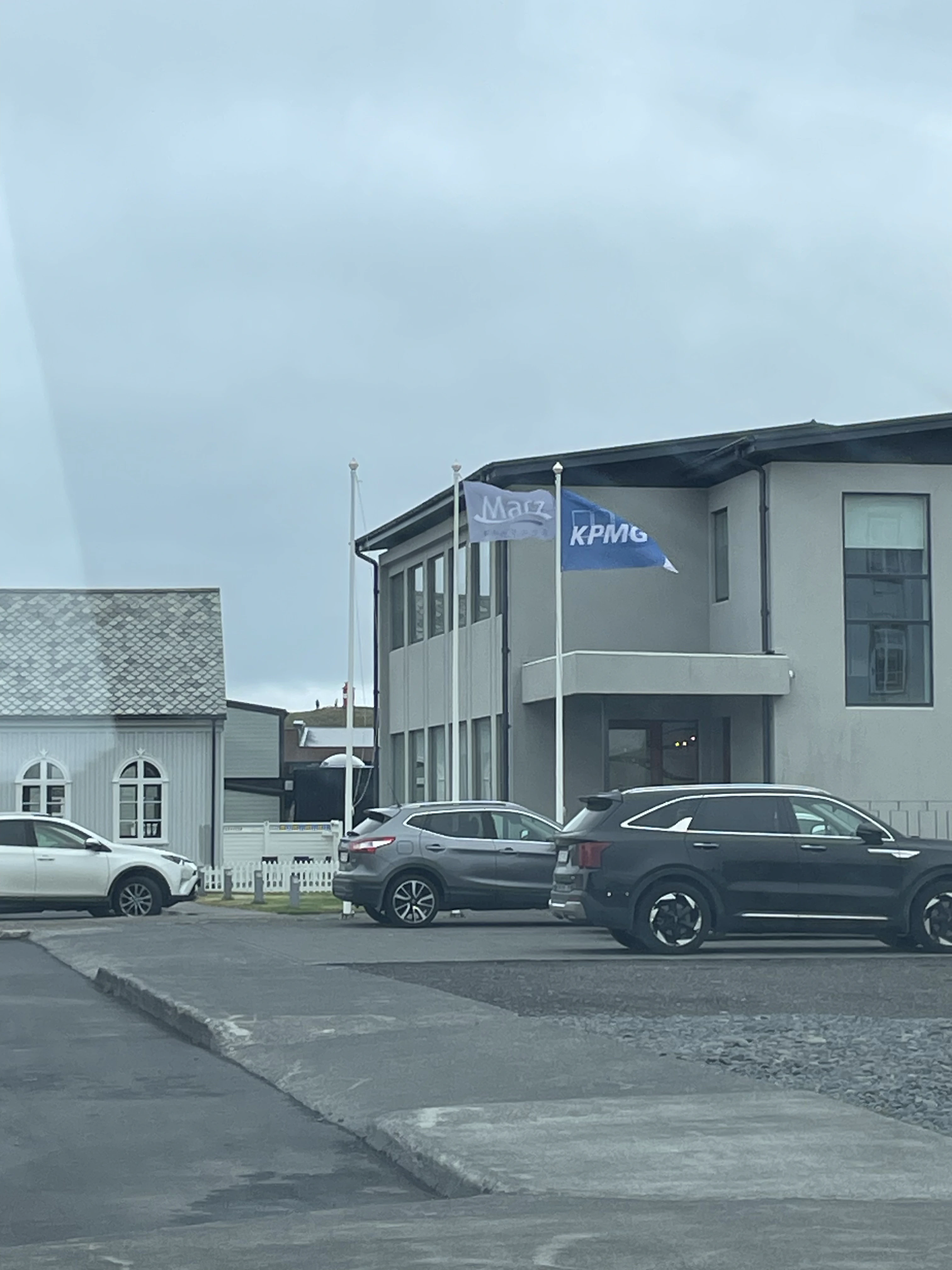
KPMG
Shot on the iPhone 12. Credit: Keenan Schott
The View from the Lighthouse
Shot on the Panasonic Lumix DMC-FX07. Credit: Keenan Schott
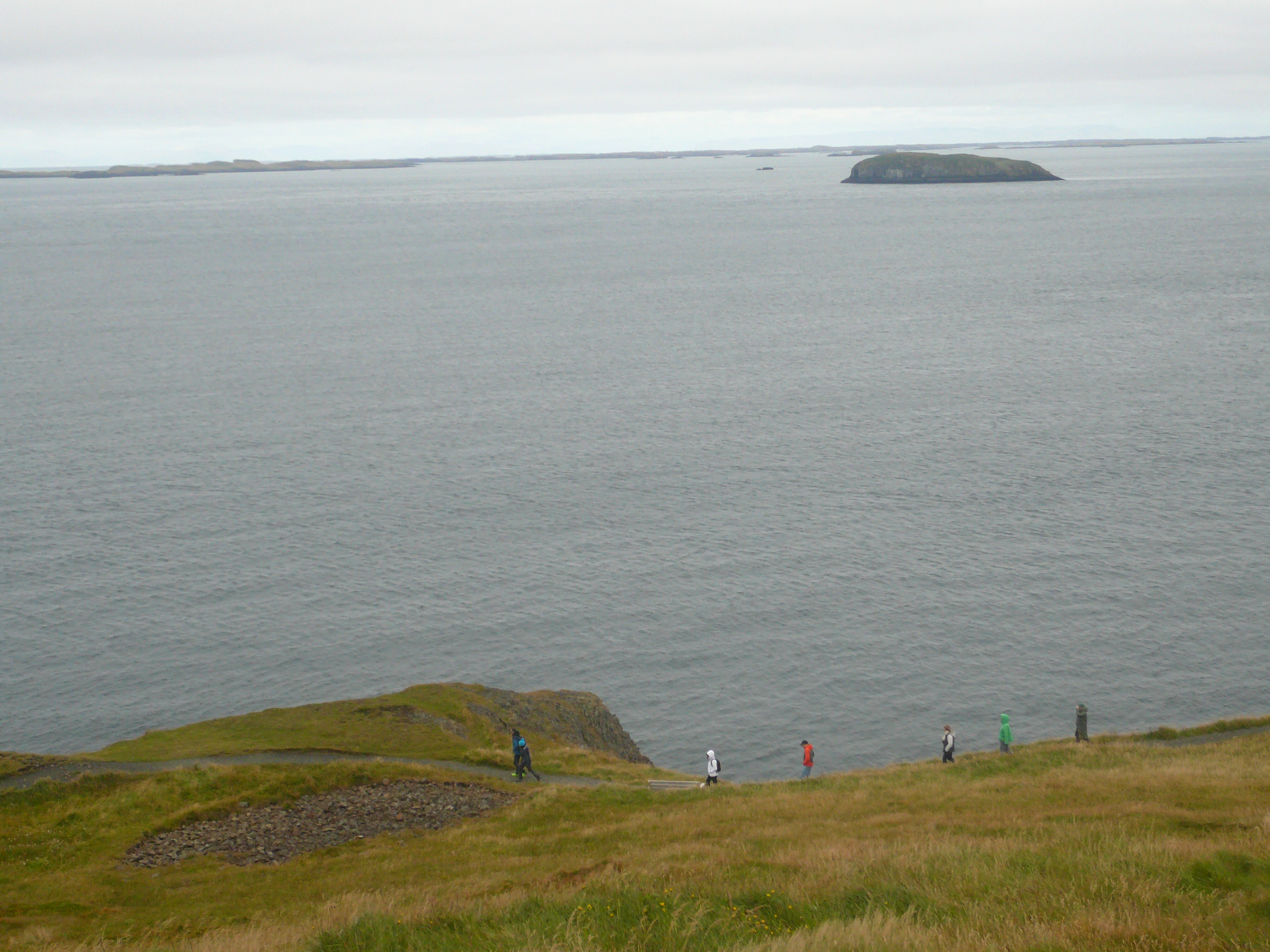
On the ferry, we passed by Flatey, an island whose name means “flat island” in Icelandic. The island was indeed flat. In 1172, the no-longer existing monastery stood on the highest point of the island.
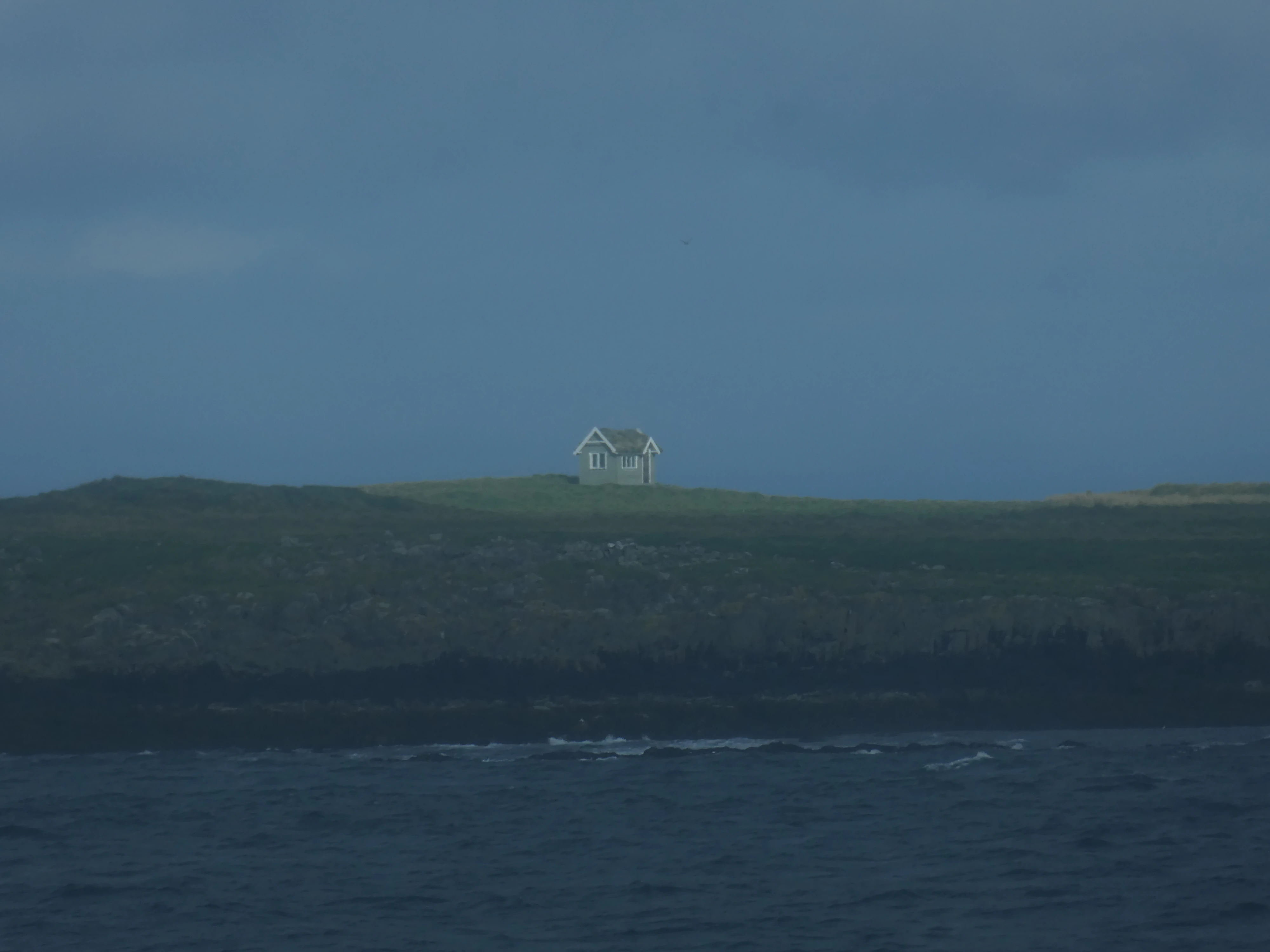
The World’s Most Remote She-Shed?
Shot on the Panasonic Lumix DMC-ZS60. Credit: Keenan Schott
A Lighthouse
Shot on the Panasonic Lumix DMC-ZS60. Credit: Keenan Schott
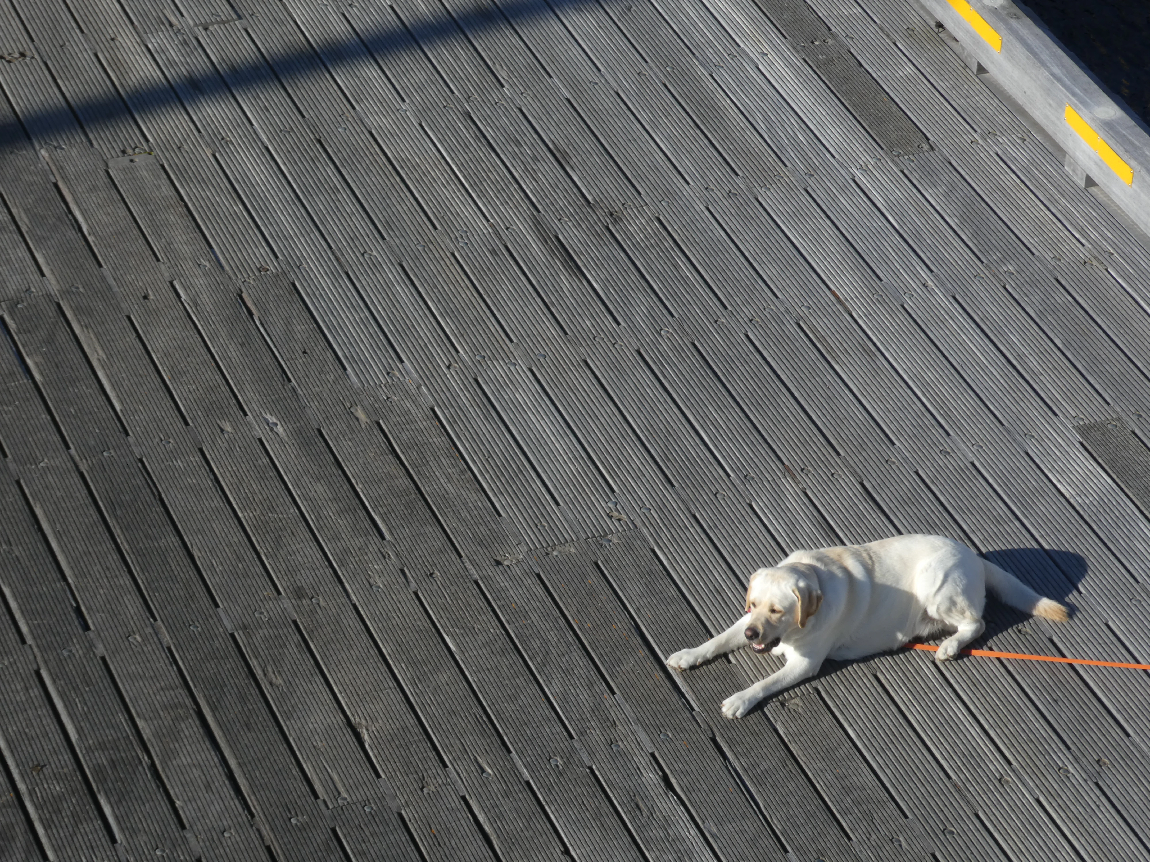
An Icelandic Longshoreman
Shot on the Panasonic Lumix DMC-ZS60. Credit: Keenan Schott
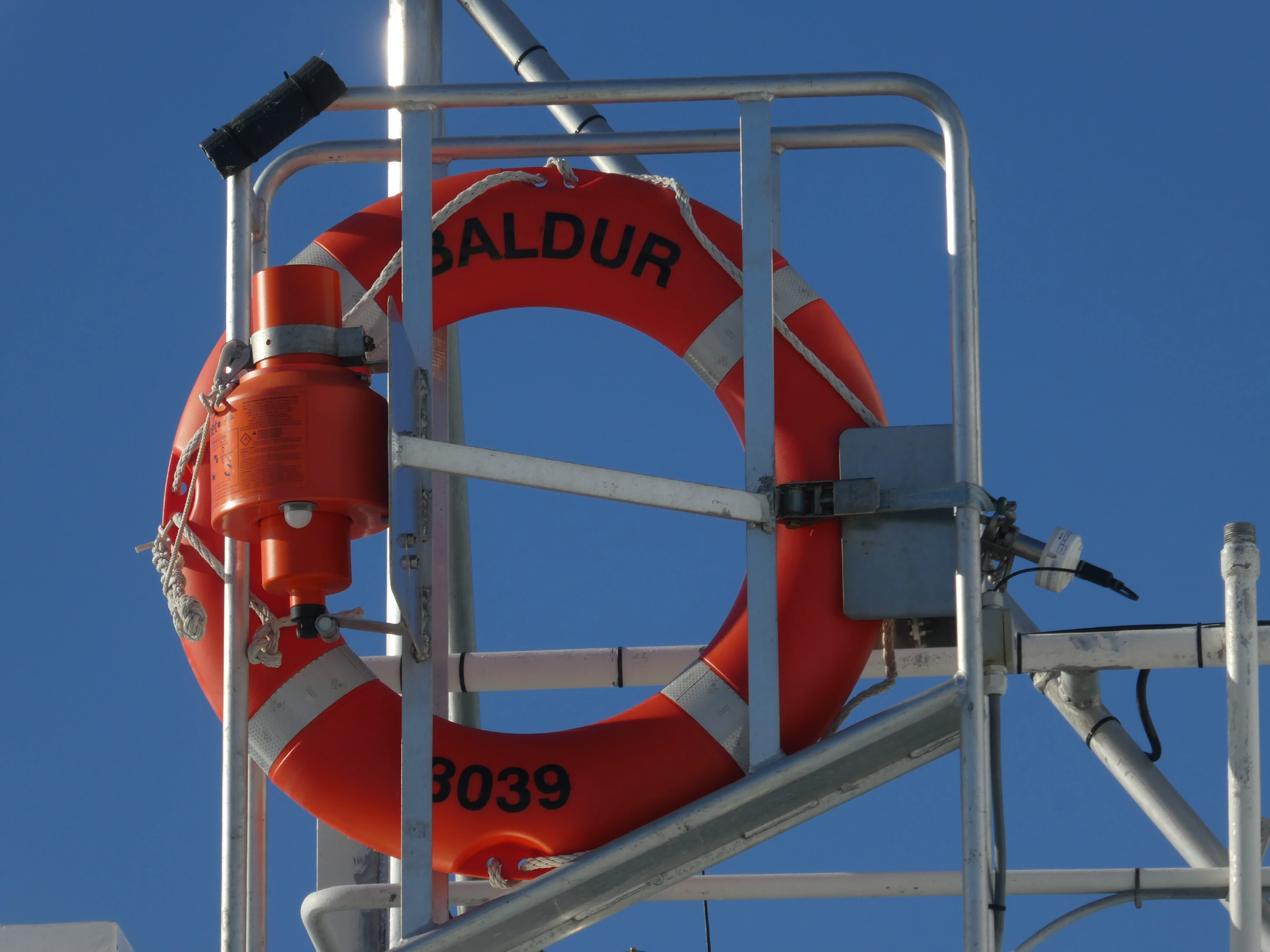
Baldur
Shot on the Panasonic Lumix DMC-ZS60. Credit: Keenan Schott
The Westfjords
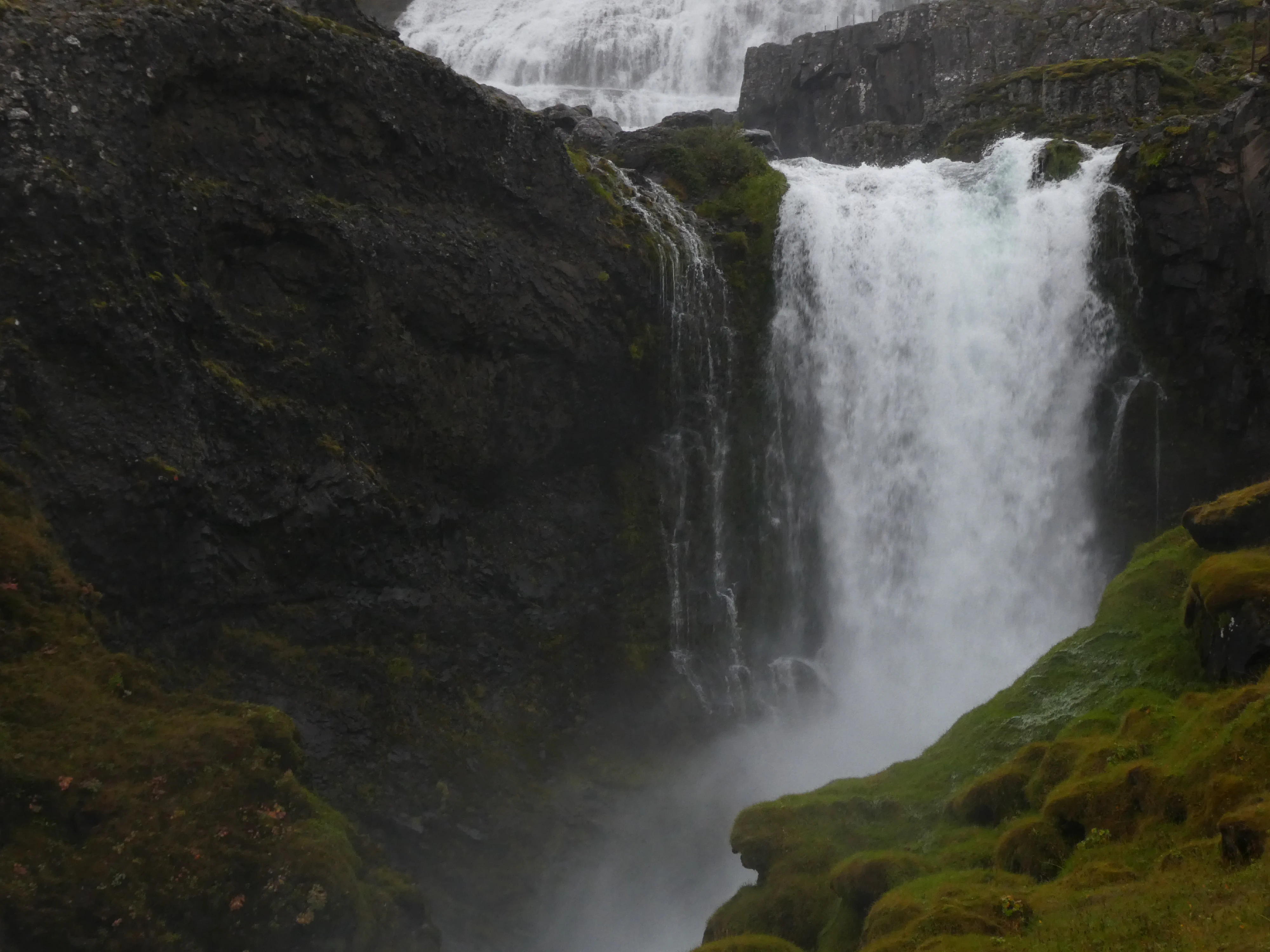
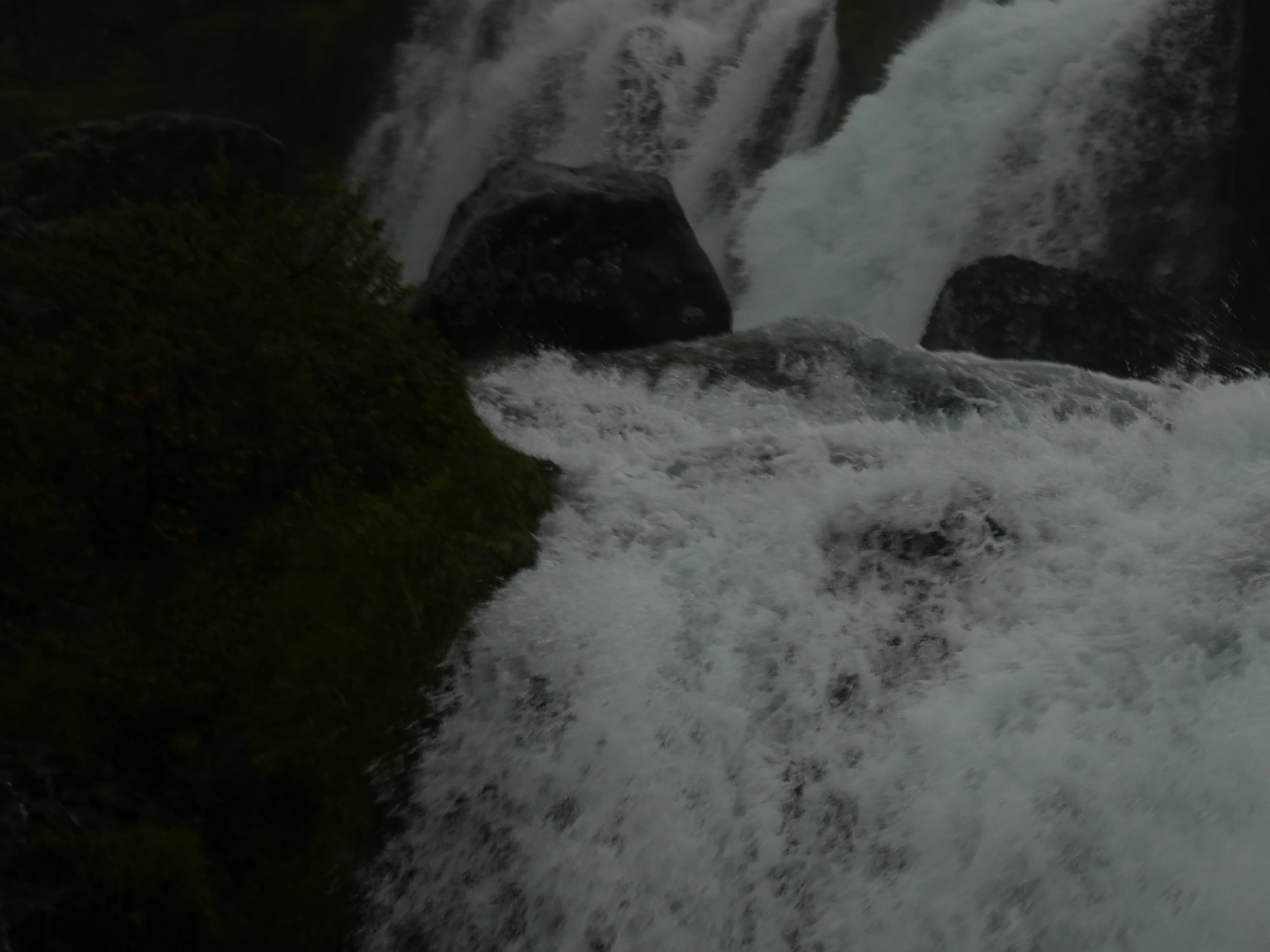
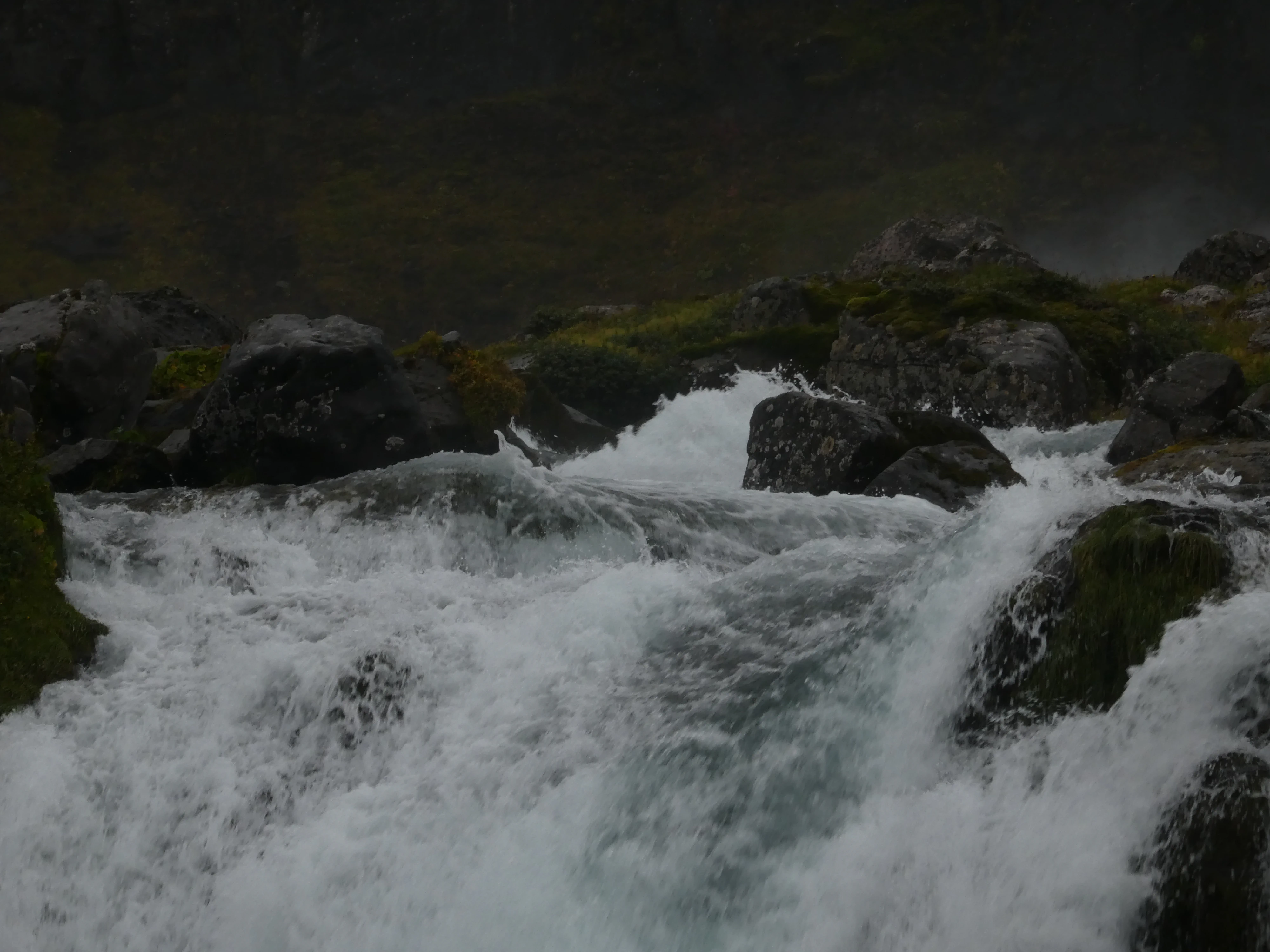
Our first stop in the Westfjords was Dynjandi, the largest waterfall in the region. Below it are five other waterfalls: Háifoss, Úðafoss, Göngufoss, Hundafoss and Bæjarfoss. It required a slippery, uphill hike - I was proud of my mother for making the trek.
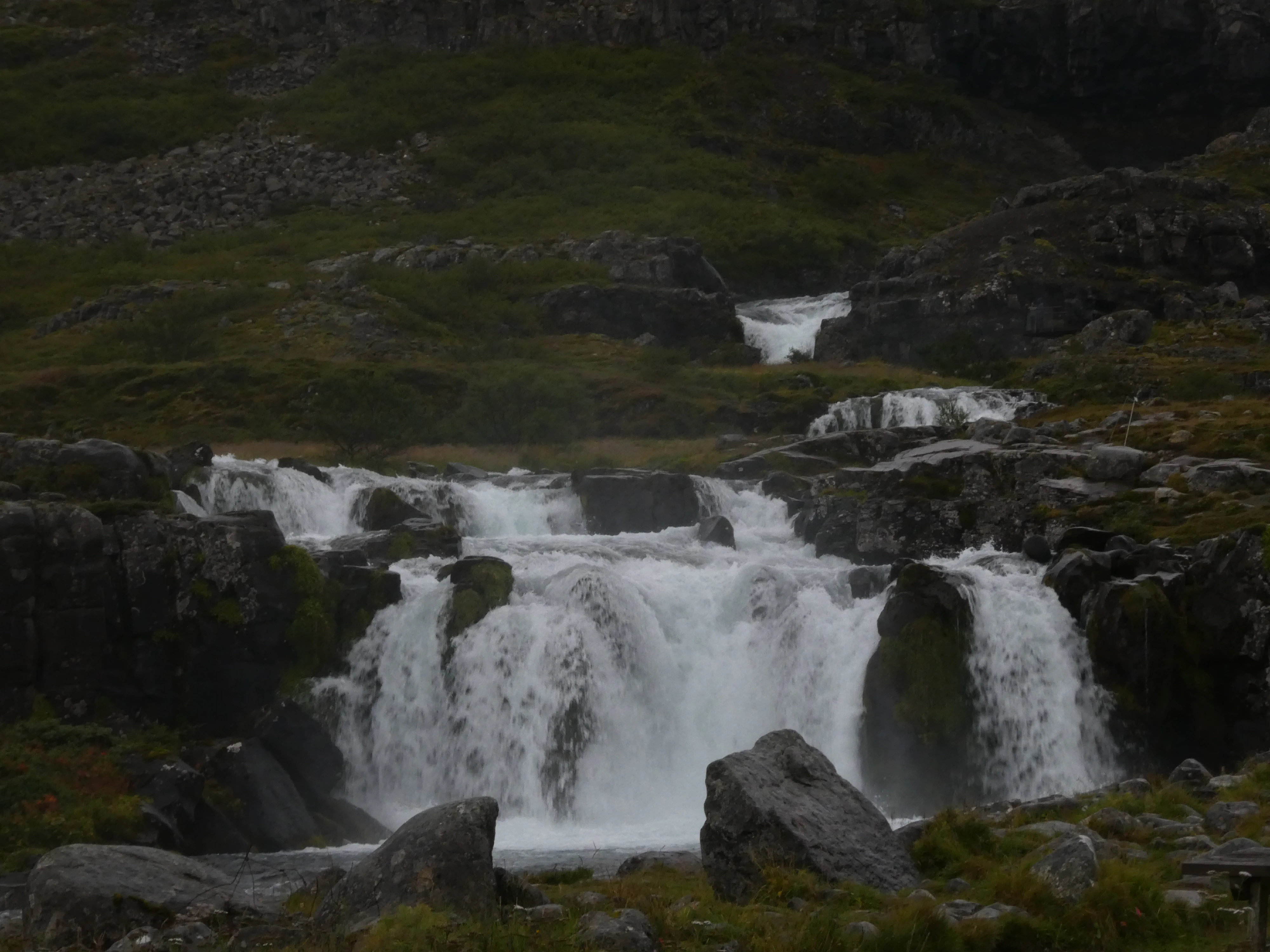
Cascading Down
Shot on the Panasonic Lumix DMC-ZS60. Credit: Keenan Schott
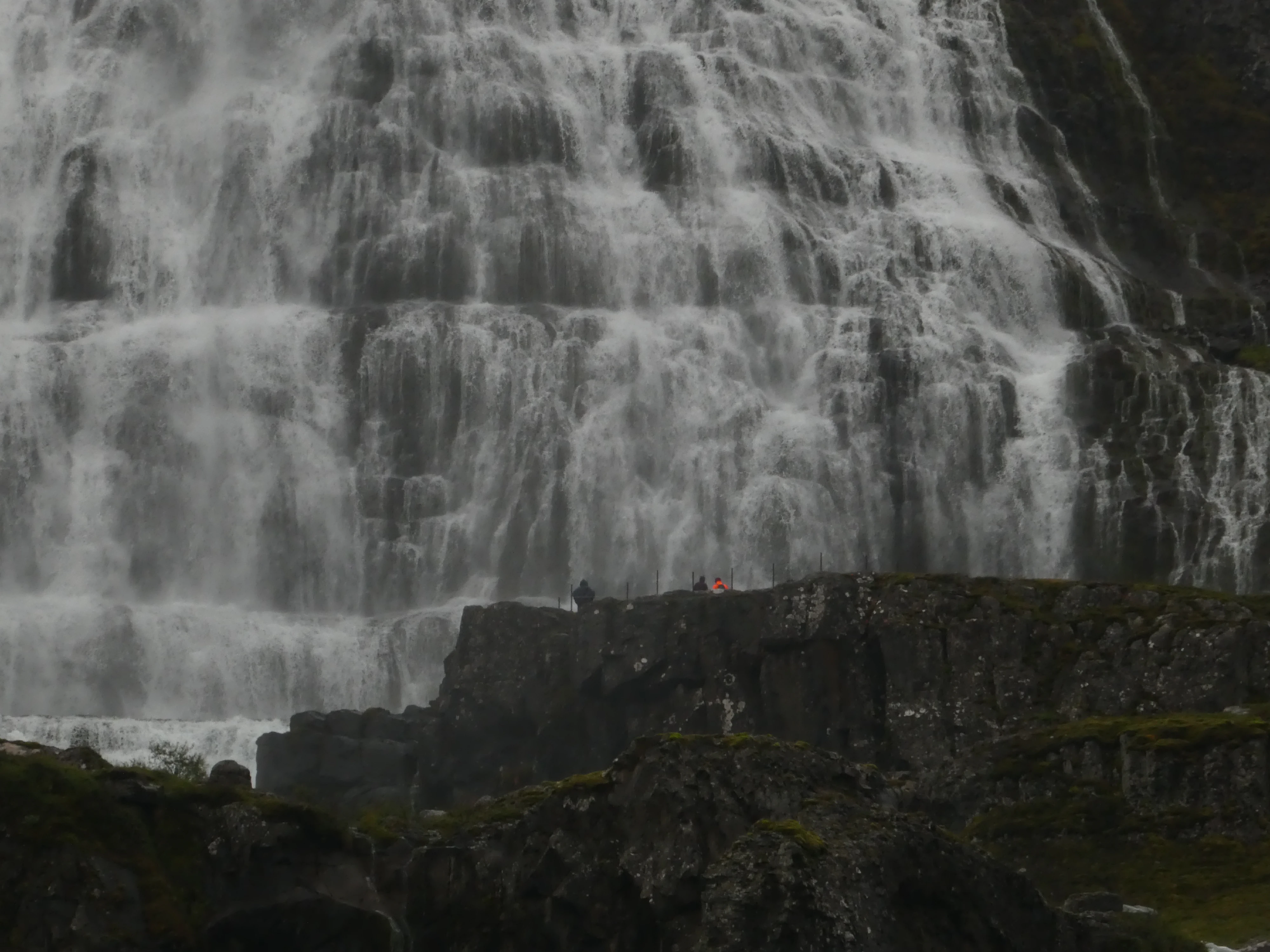
Ants
Shot on the Panasonic Lumix DMC-ZS60. Credit: Keenan Schott
Rushing
Shot on the Panasonic Lumix DMC-ZS60. Credit: Keenan Schott
An Intersection
Shot on the Panasonic Lumix DMC-ZS60. Credit: Keenan Schott
Movement
Shot on the Panasonic Lumix DMC-ZS60. Credit: Keenan Schott

Dynjandi
Shot on the Panasonic Lumix DMC-ZS60. Credit: Keenan Schott
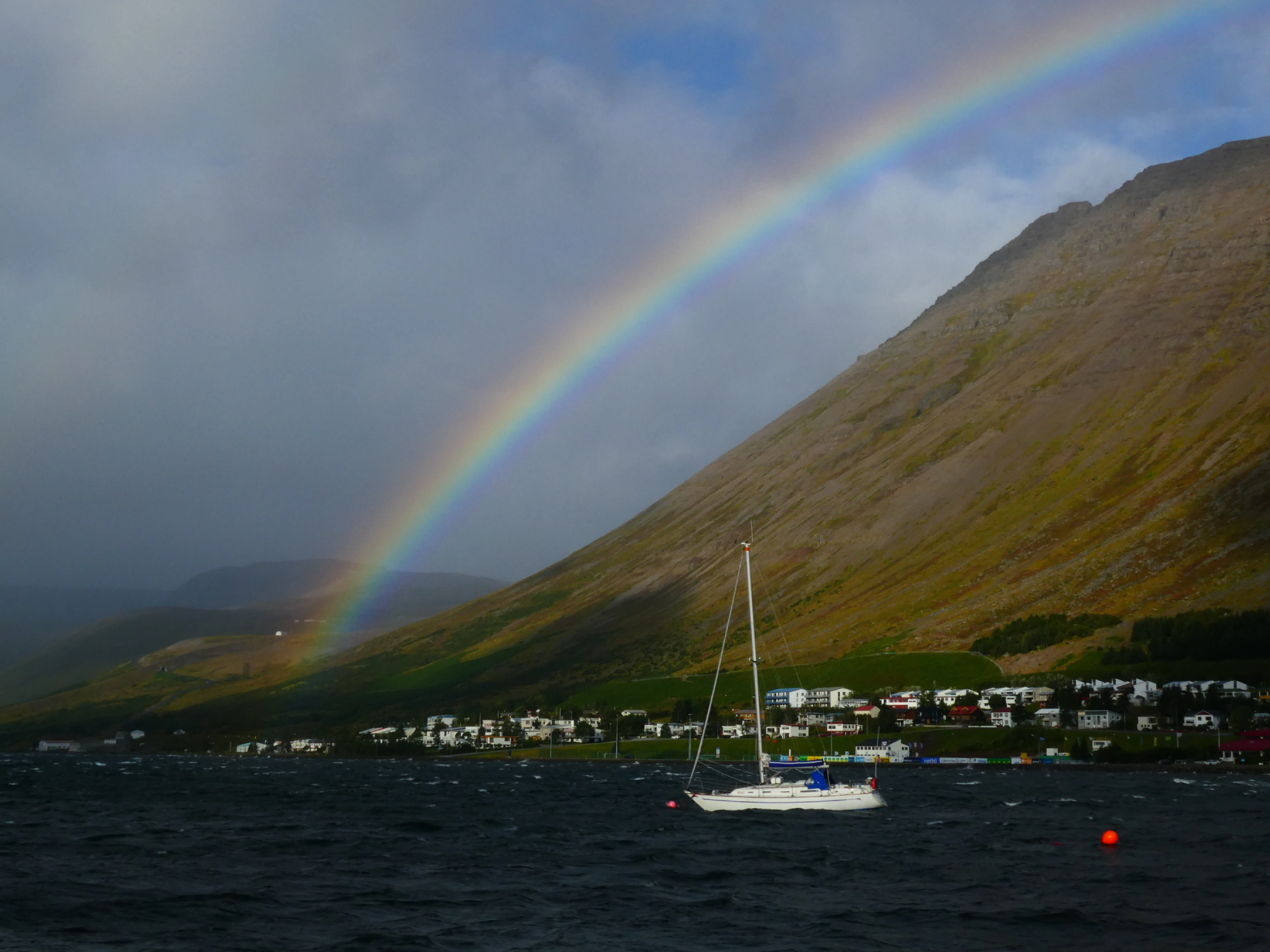
Ísafjörður, meaning “ice fjord”, is the Westfjord’s largest settlement. Despite its size, the town had a surprisingly urban atmosphere. We were present during a particularly gusty day - an unlucky local must have forgot to tie everything down correctly and the police had to get involved. Ísafjörður was my favorite town in Iceland. I was simultaneously impressed with its remoteness and development, and it sticks out as a highlight.
The Harbor
Shot on the Panasonic Lumix DMC-ZS60. Credit: Keenan Schott

Police Work
Shot on the Panasonic Lumix DMC-ZS60. Credit: Keenan Schott
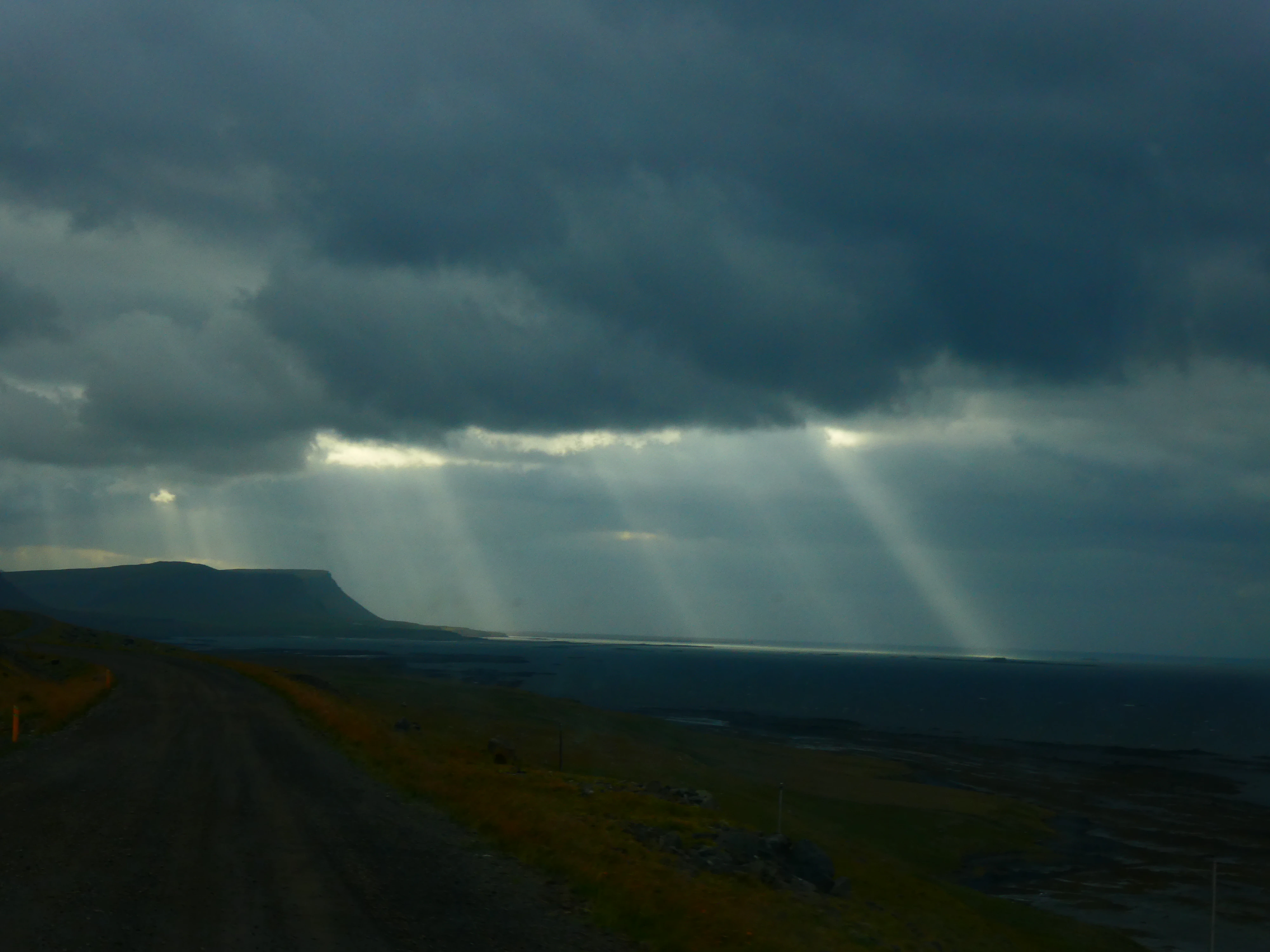
Our wanderings around the Westfjords was without a doubt some of the most impressive natural beauty I have ever seen. Despite a brief blockade on the road, we encountered no obstacles. Weaving in and out of the fjords, passing over bridges and mountains, and traversing desolate landscapes; definitely not a boring drive.
The Blockade
Shot on the Panasonic Lumix DMC-ZS60. Credit: Keenan Schott
From the Car
Shot on the Panasonic Lumix DMC-ZS60. Credit: Keenan Schott
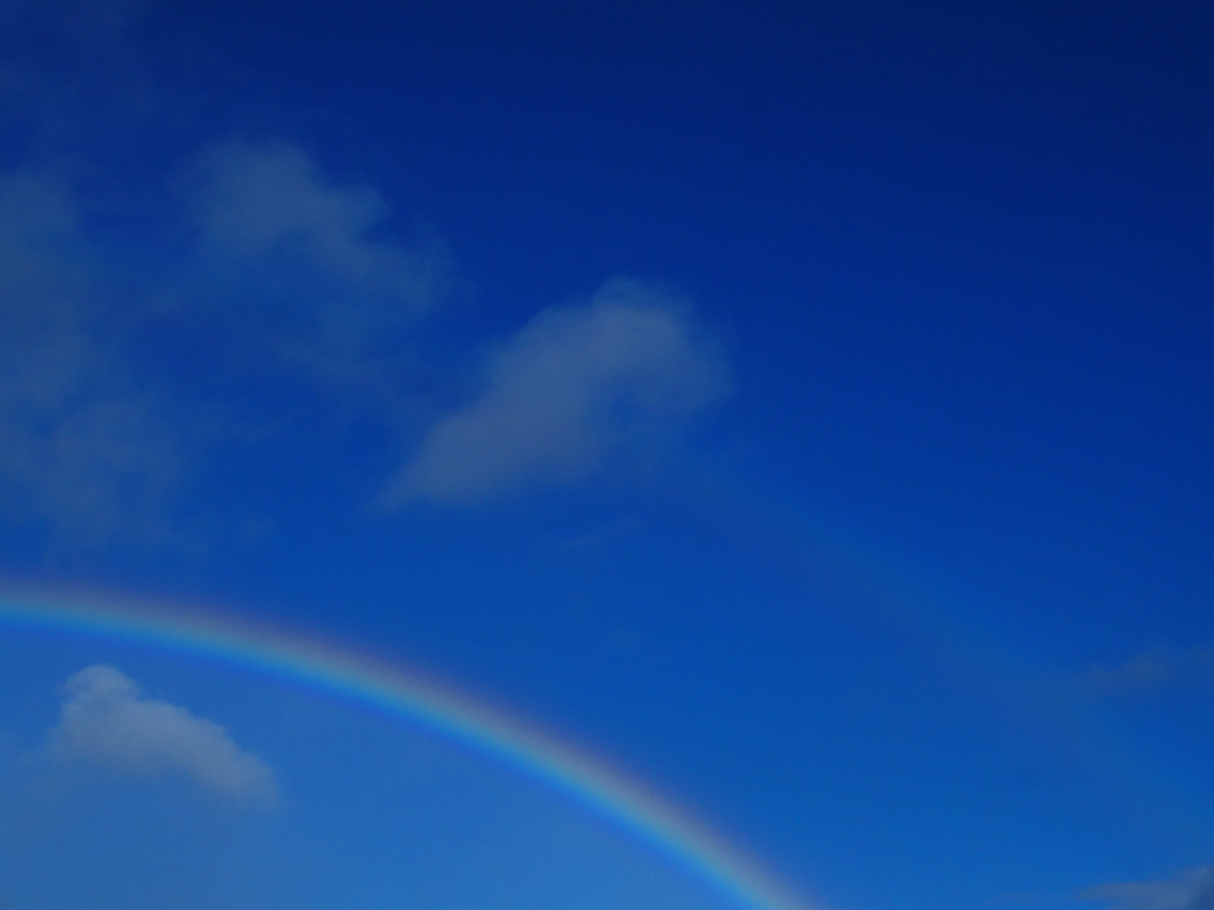
A Rainbow on a Clear Day
Shot on the Panasonic Lumix DMC-ZS60. Credit: Keenan Schott
A Slight Breeze
Shot on the Panasonic Lumix DMC-ZS60. Credit: Keenan Schott
Peeking Through
Shot on the Panasonic Lumix DMC-ZS60. Credit: Keenan Schott
The Golden Circle
After our adventures in the Westfjords, we rejoined tourist society and hit the Golden Circle, which is a tourist route in southern Iceland, covering about 190 miles in a loop from Reykjavík into the southern uplands of Iceland and back. Named after its vibrant blue color, Brúarfoss, called Iceland’s bluest waterfall, was first on our list and one of the few waterfalls that required an out-and-back hike. Even on an older, fuzzier digital camera, the blue still stands out.
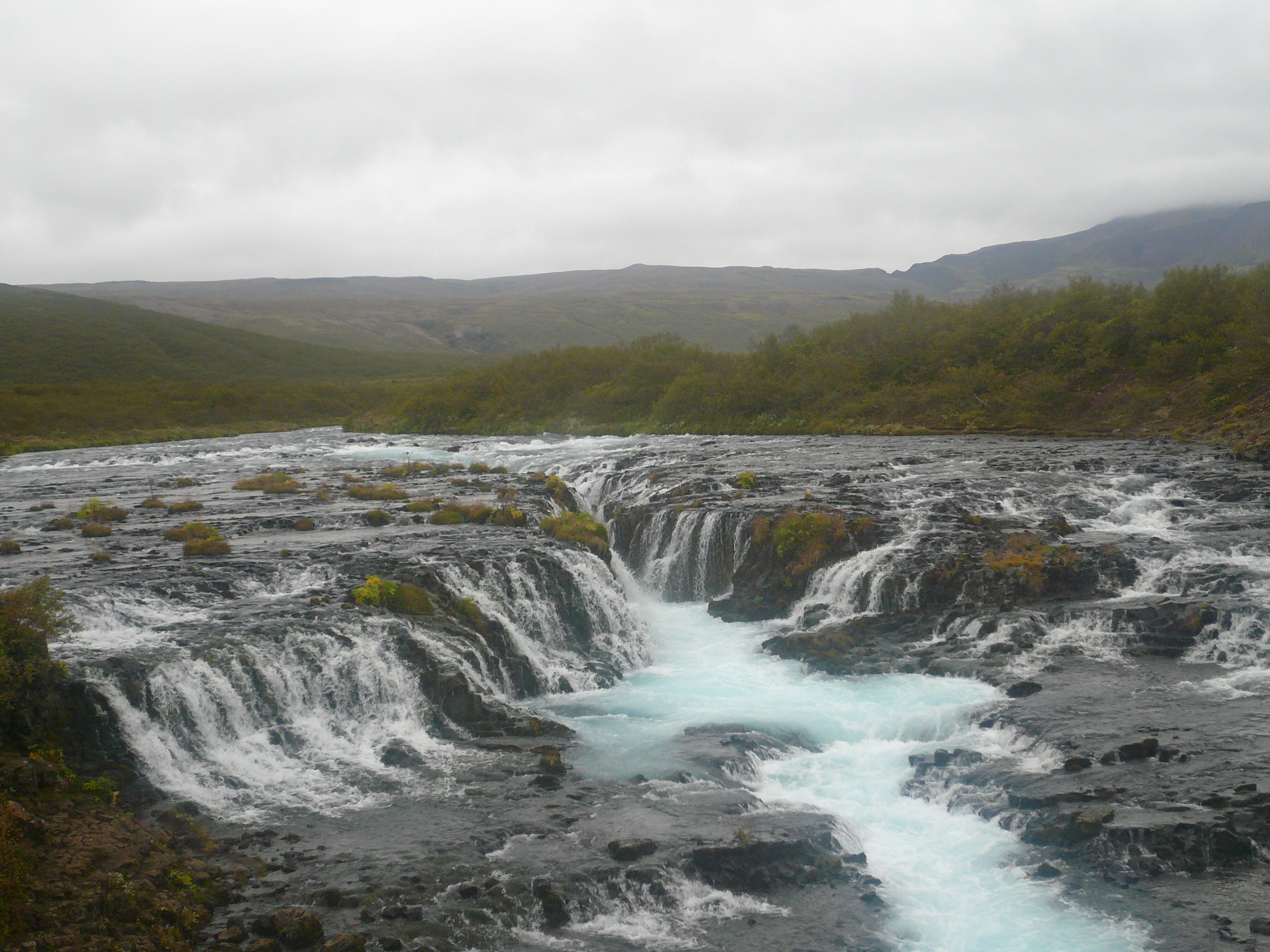
Brúarfoss
Shot on the Panasonic Lumix DMC-FX07. Credit: Keenan Schott
Next, we stopped for a beer at the Faxi waterfall. The falls are full of salmon, making it a popular fishing spot.
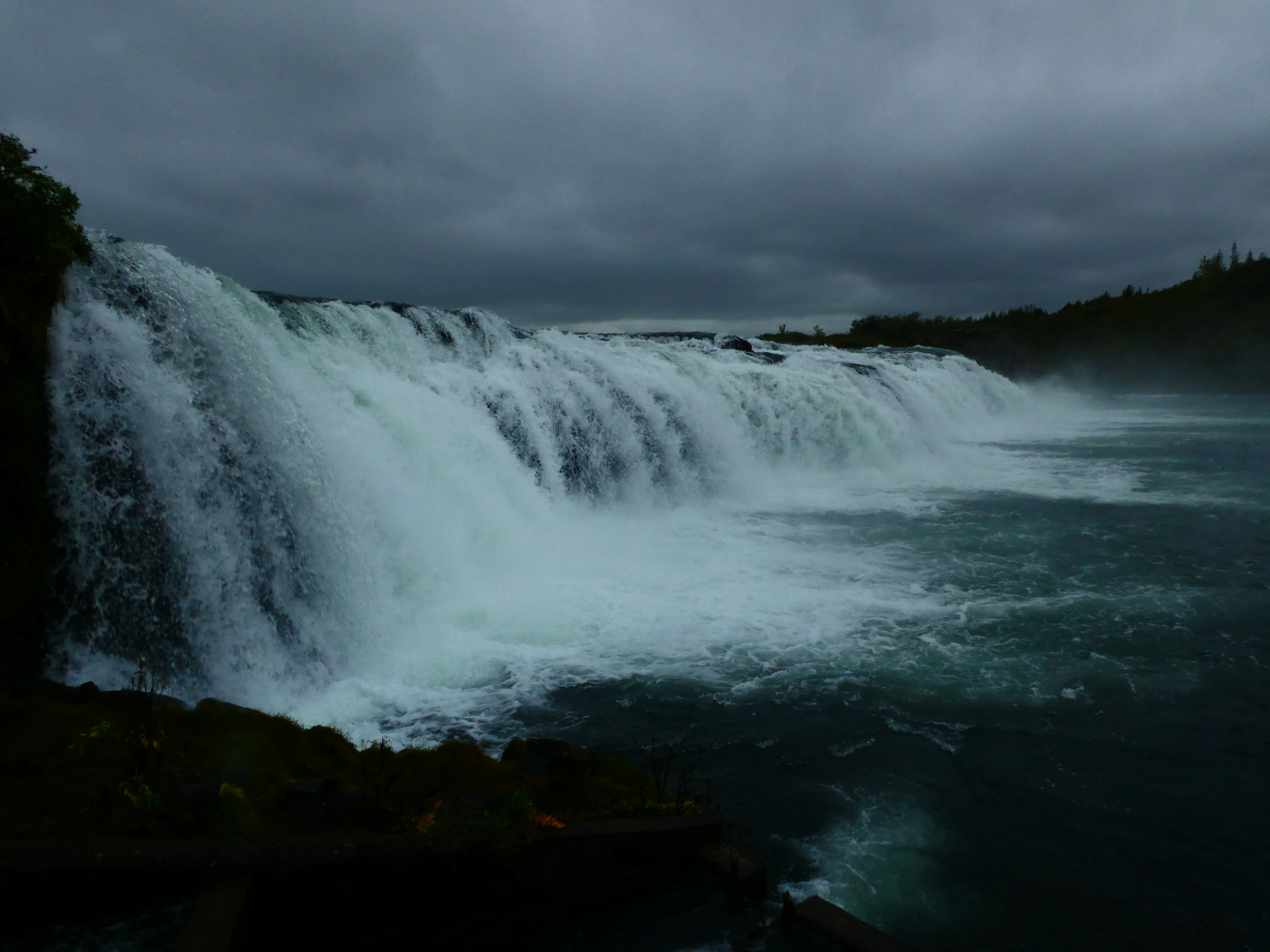
The Faxi Waterfall
Shot on the Panasonic Lumix DMC-ZS60. Credit: Keenan Schott
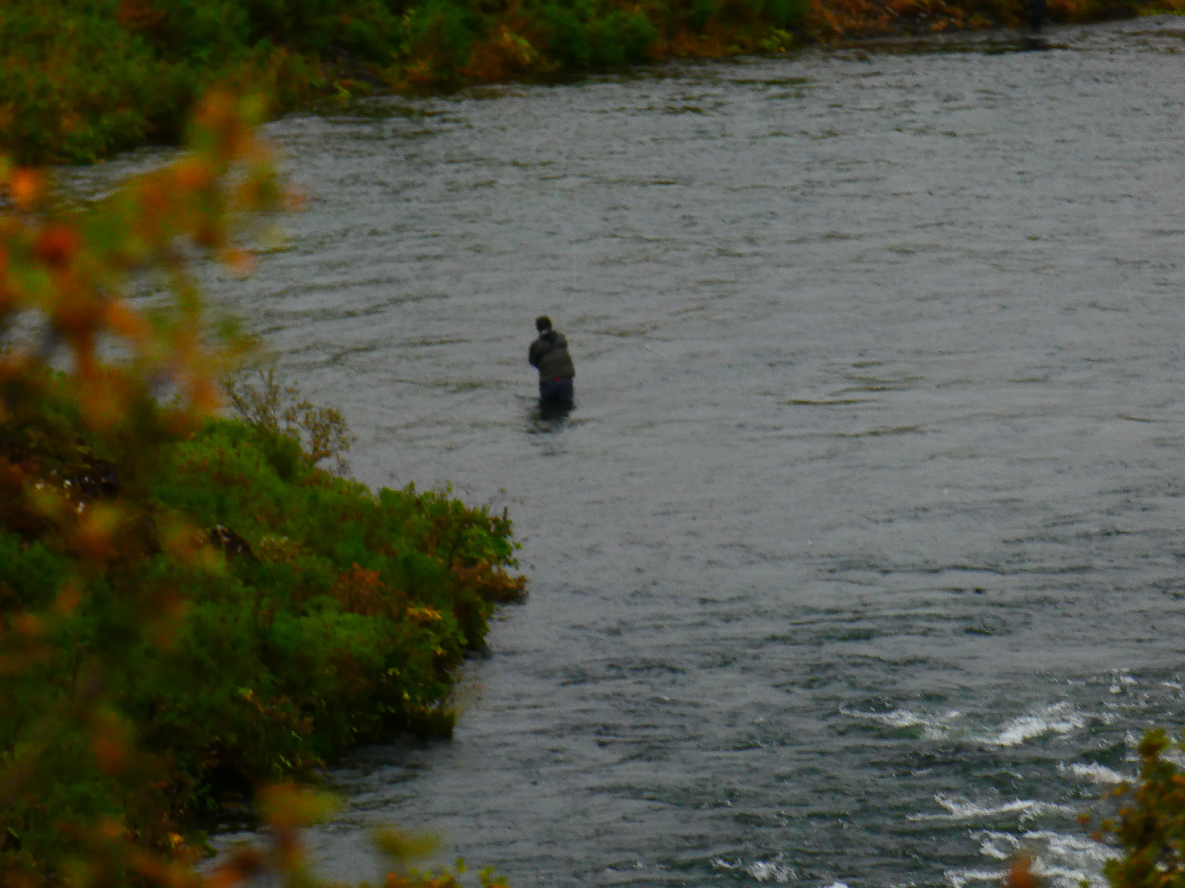
A Fisherman
Shot on the Panasonic Lumix DMC-ZS60. Credit: Keenan Schott
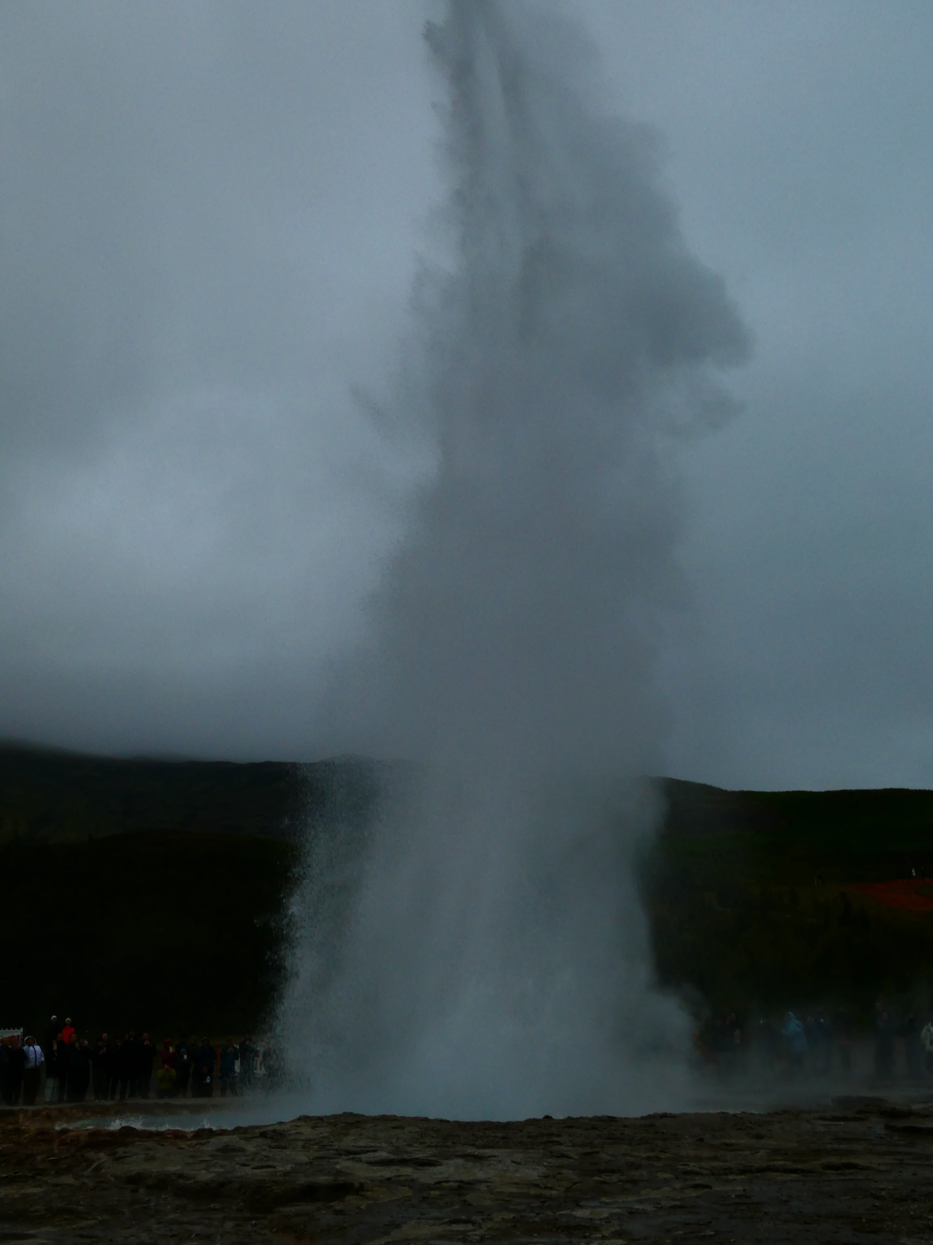
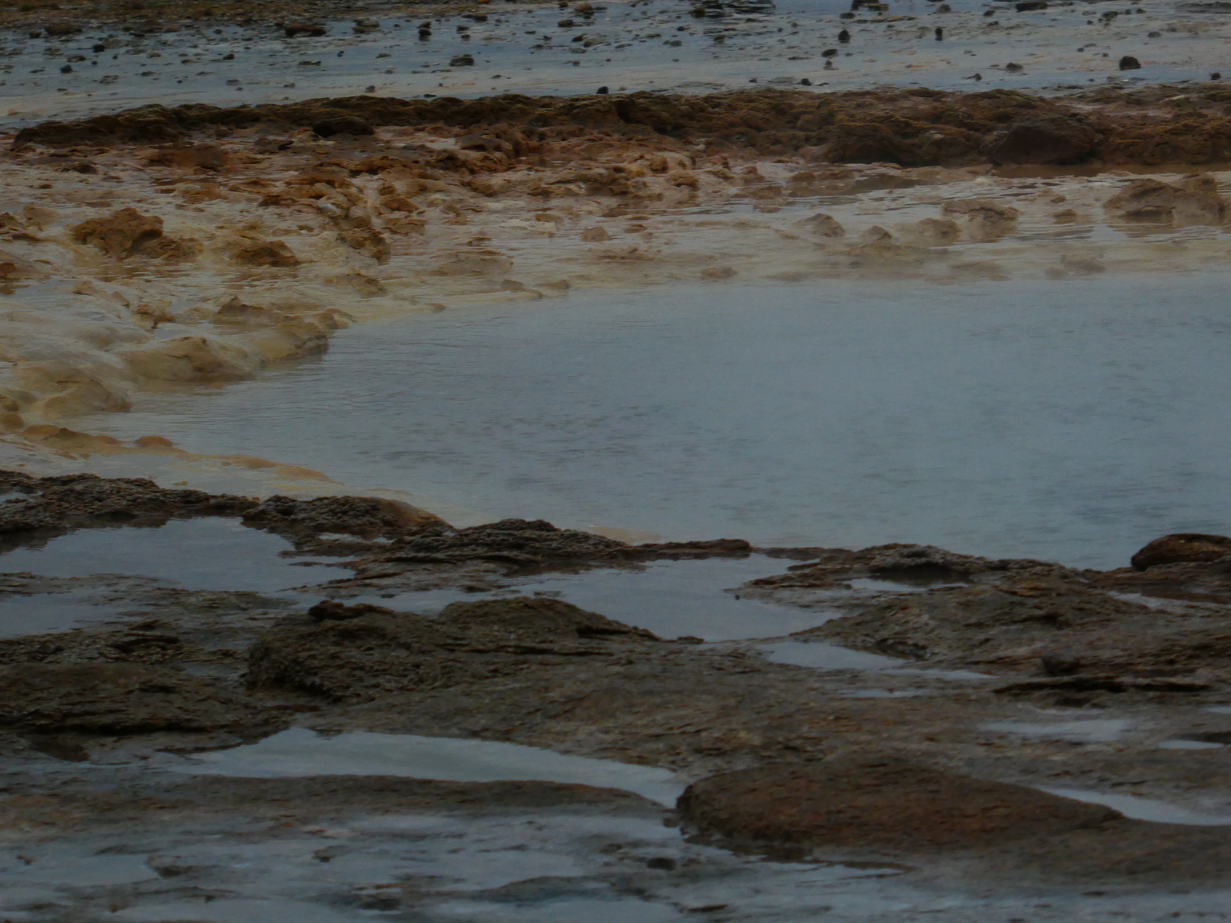
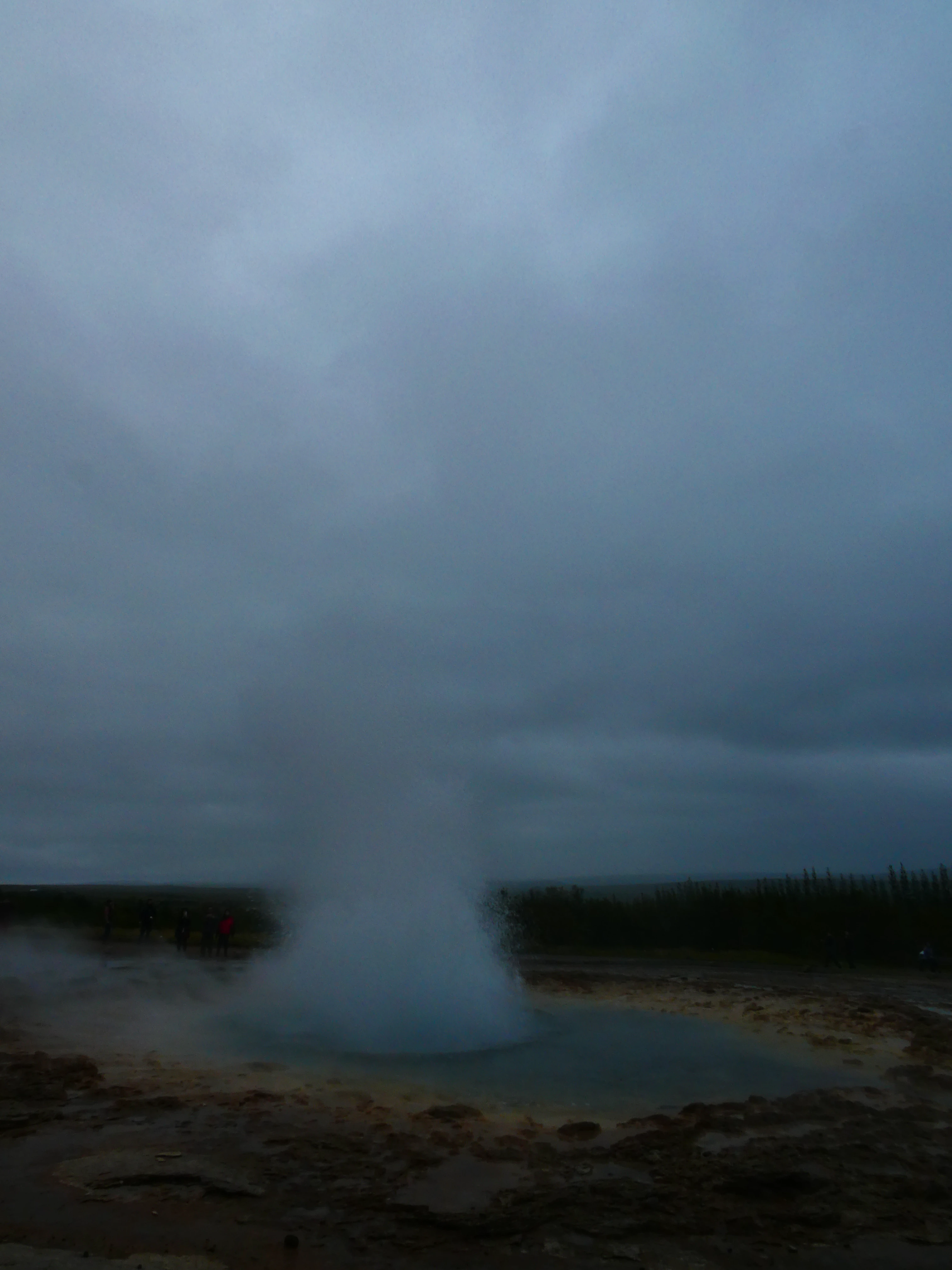
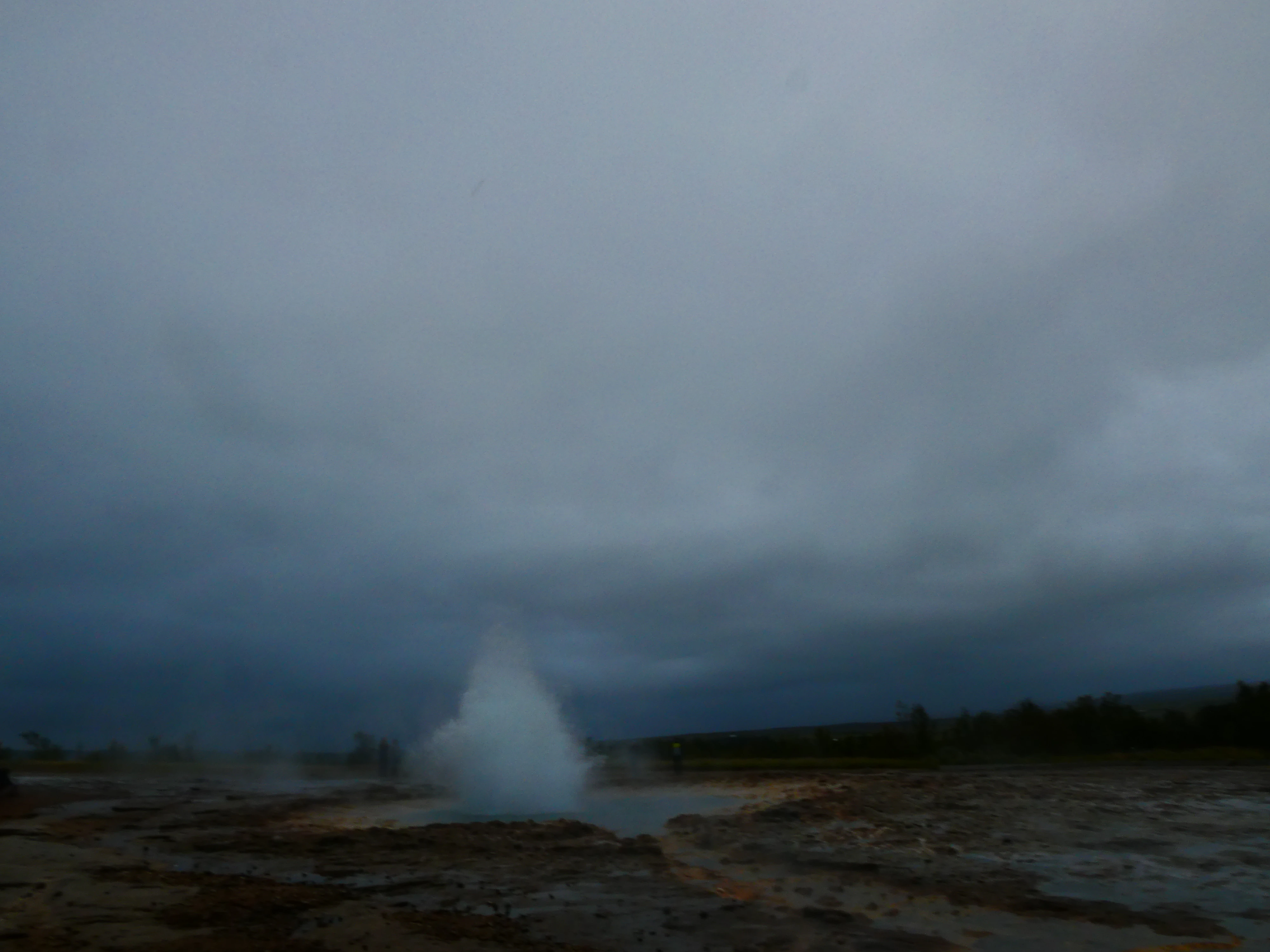
Geysir, a geyser along the Golden Circle, is the OG - the English word geyser derives from Geysir. Eruptions can reach up to 200 feet in the air, and although the sites were spectacular, these stops felt like Disneyland compared to the Westfjords or Snæfellsnes.
Geysir
Shot on the Panasonic Lumix DMC-ZS60. Credit: Keenan Schott
Lying in Wait
Shot on the Panasonic Lumix DMC-ZS60. Credit: Keenan Schott
The Eruption
Shot on the Panasonic Lumix DMC-ZS60. Credit: Keenan Schott
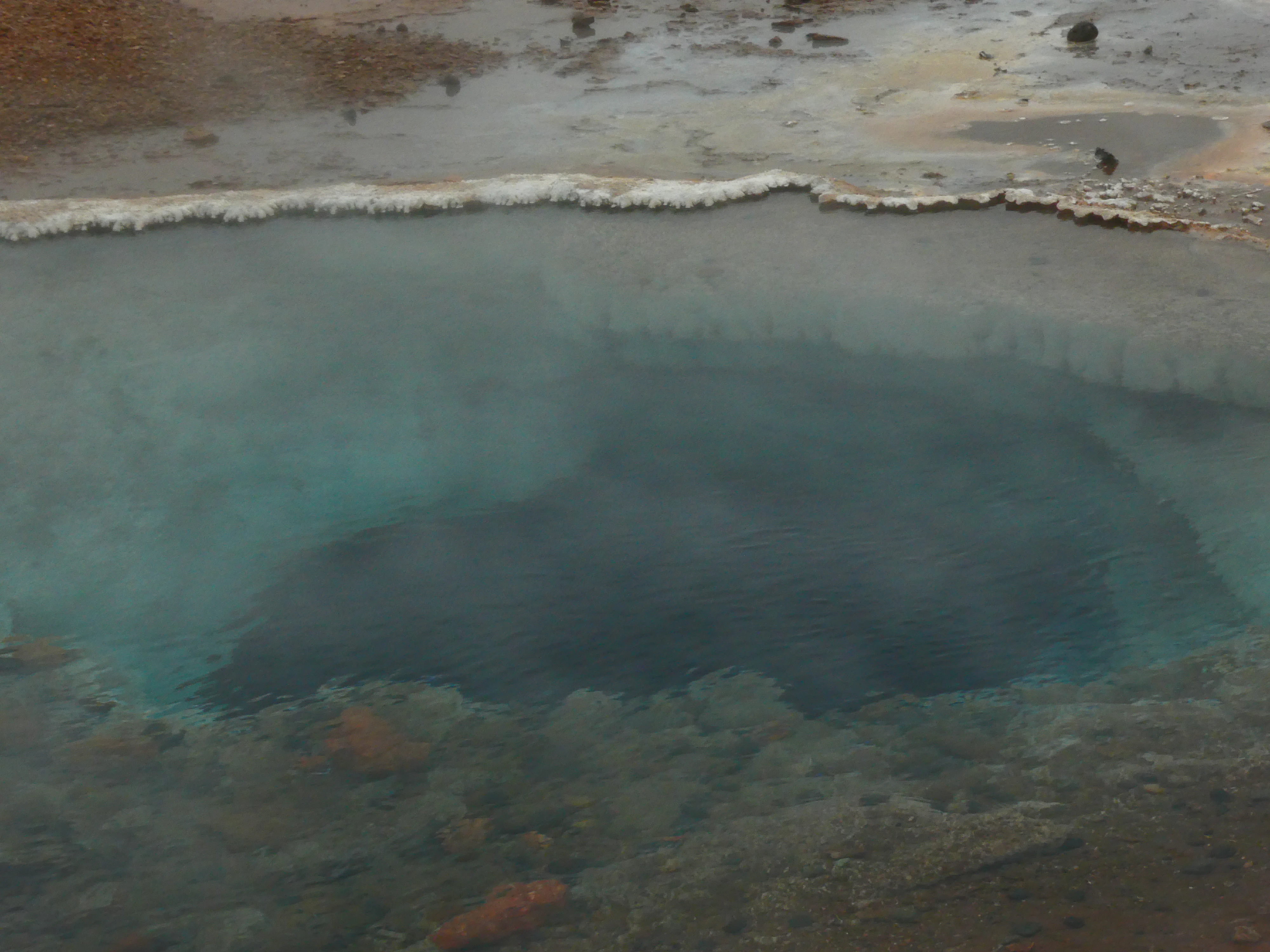
Vibrant Colors
Shot on the Panasonic Lumix DMC-ZS60. Credit: Keenan Schott
The Precipice
Shot on the Panasonic Lumix DMC-ZS60. Credit: Keenan Schott
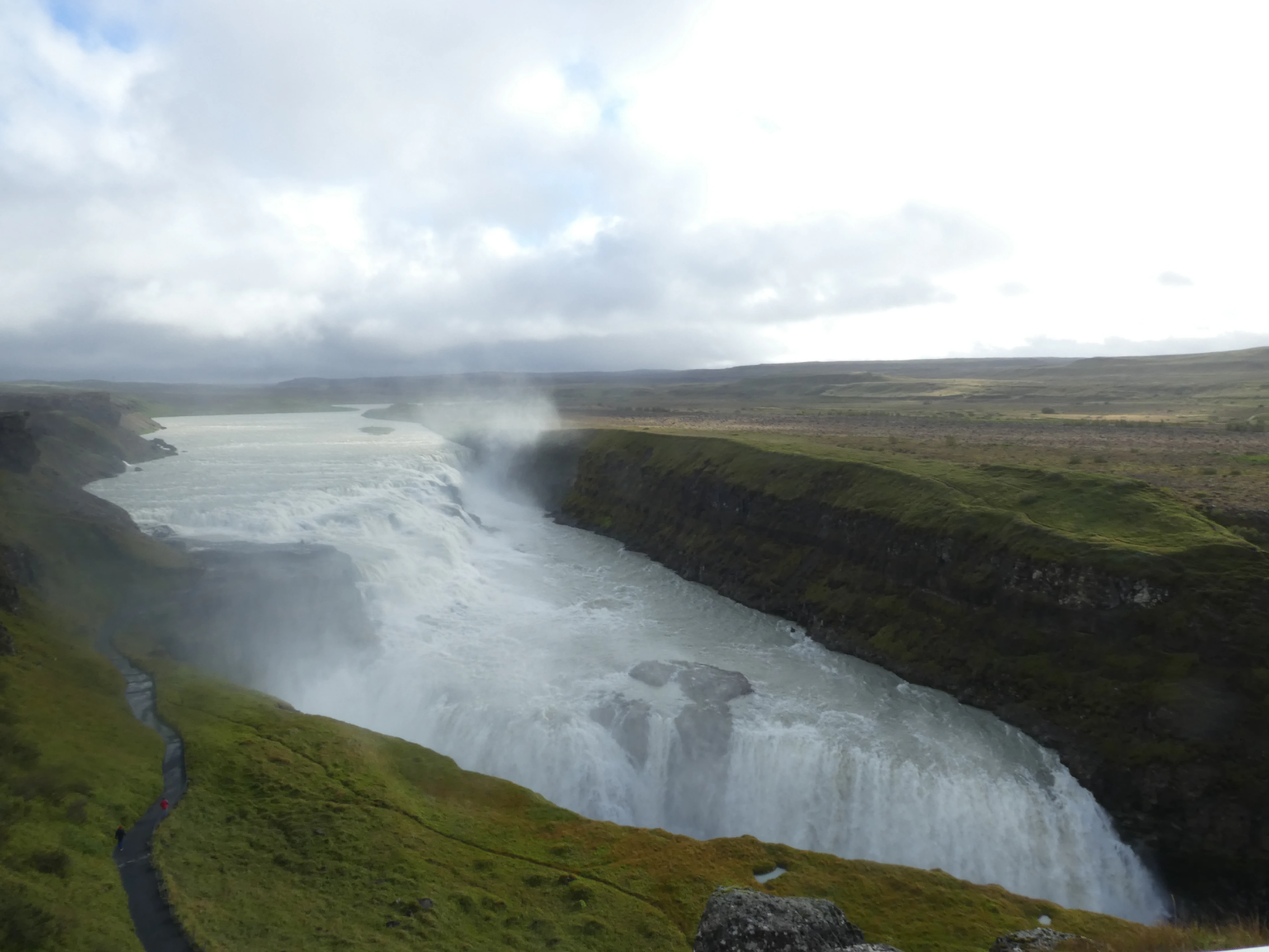
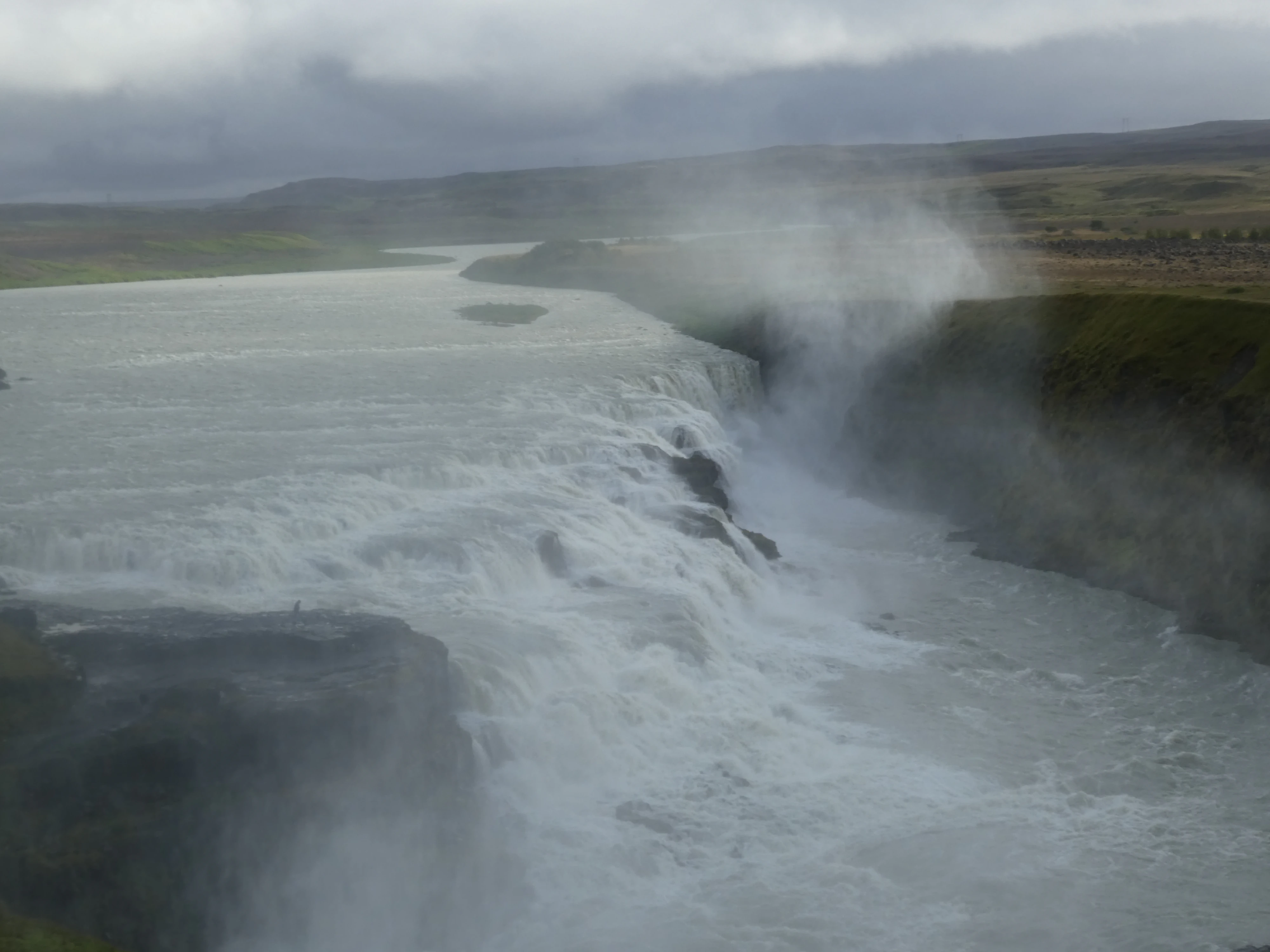
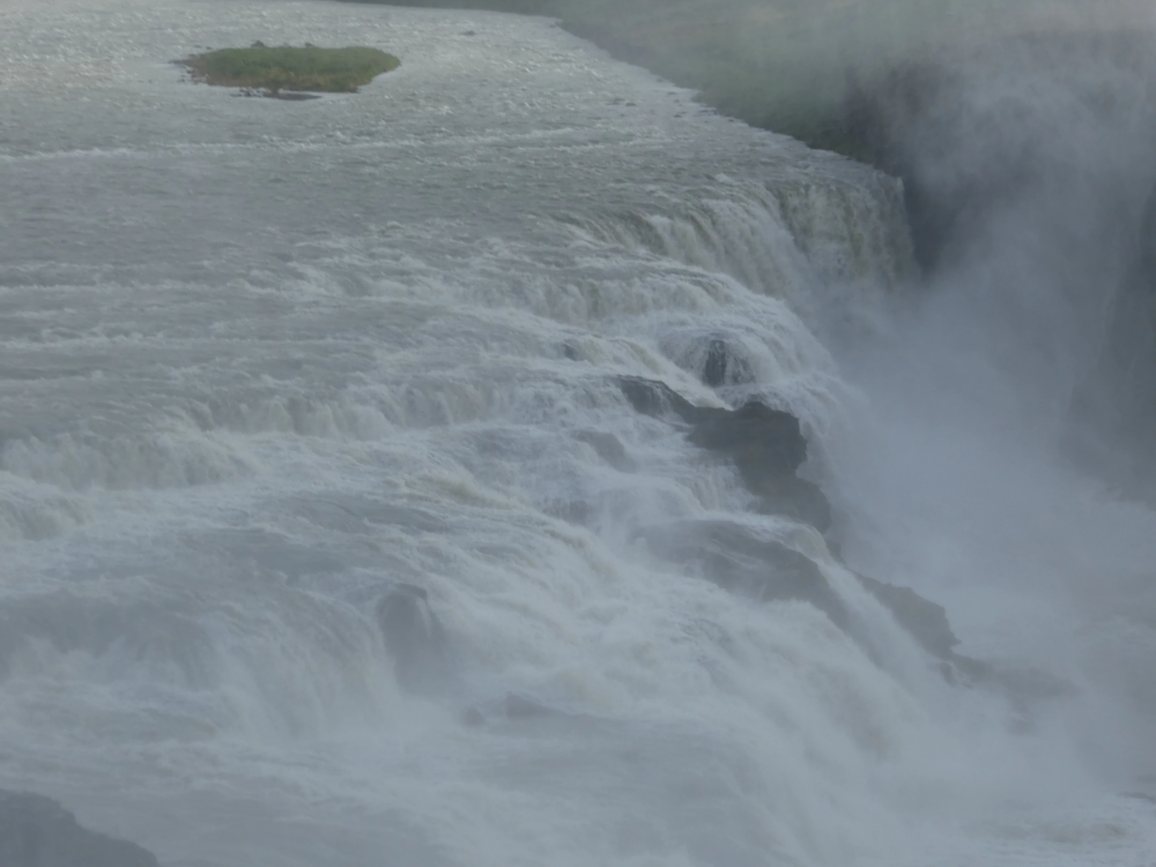
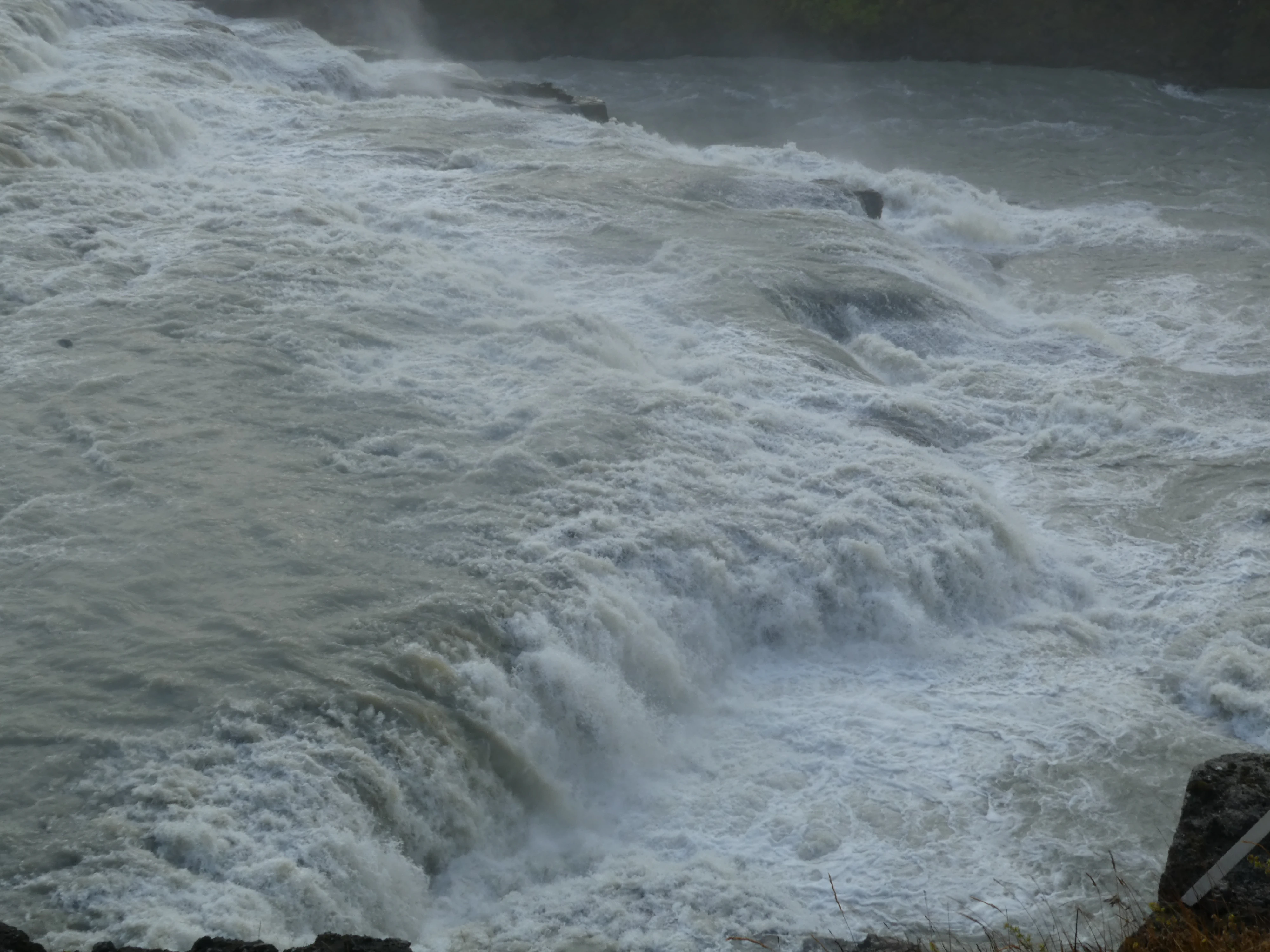
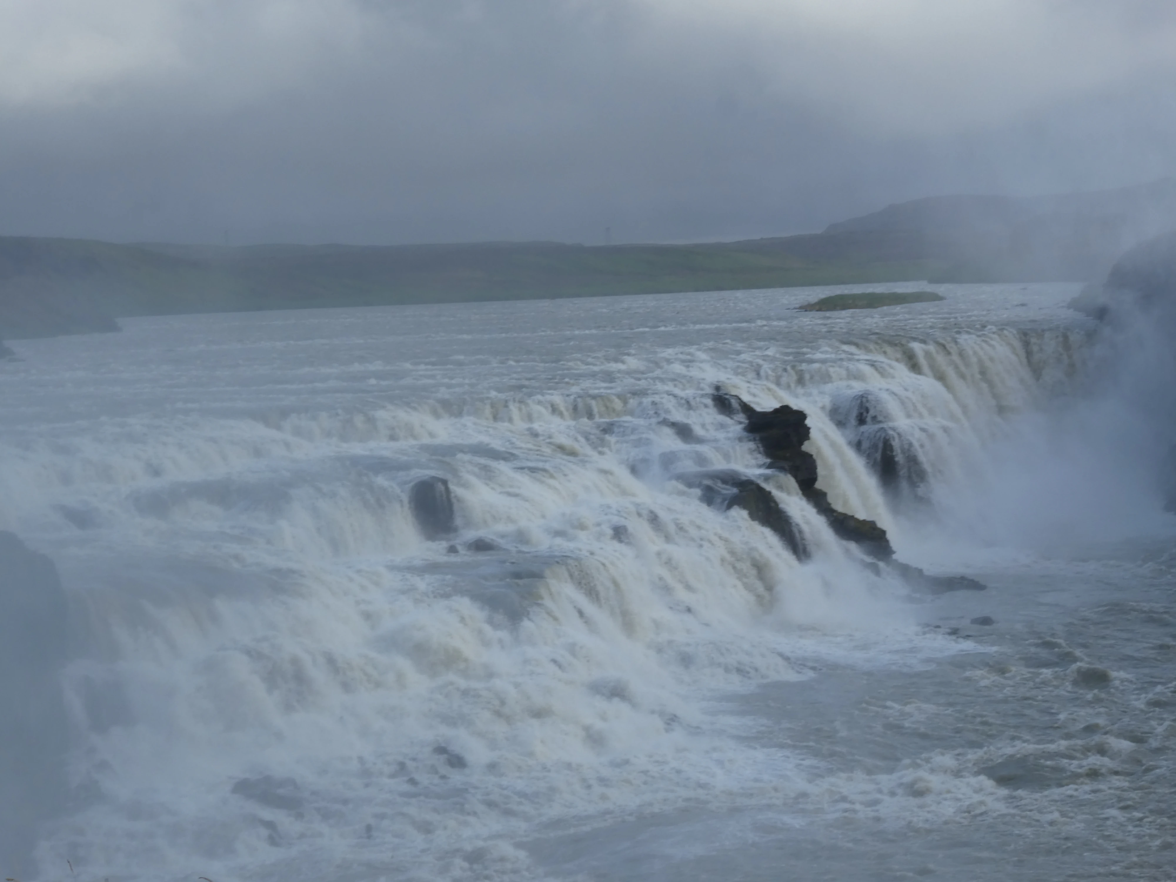
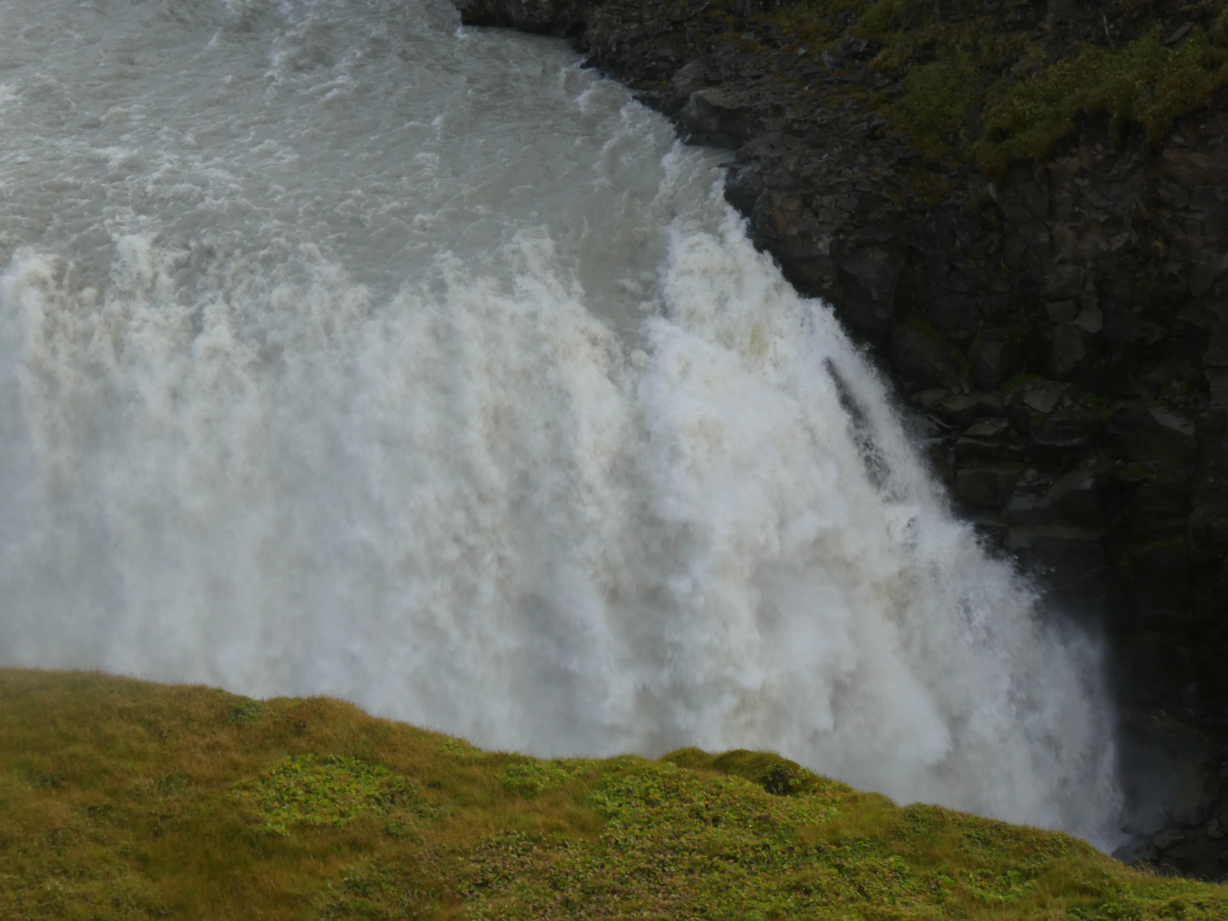
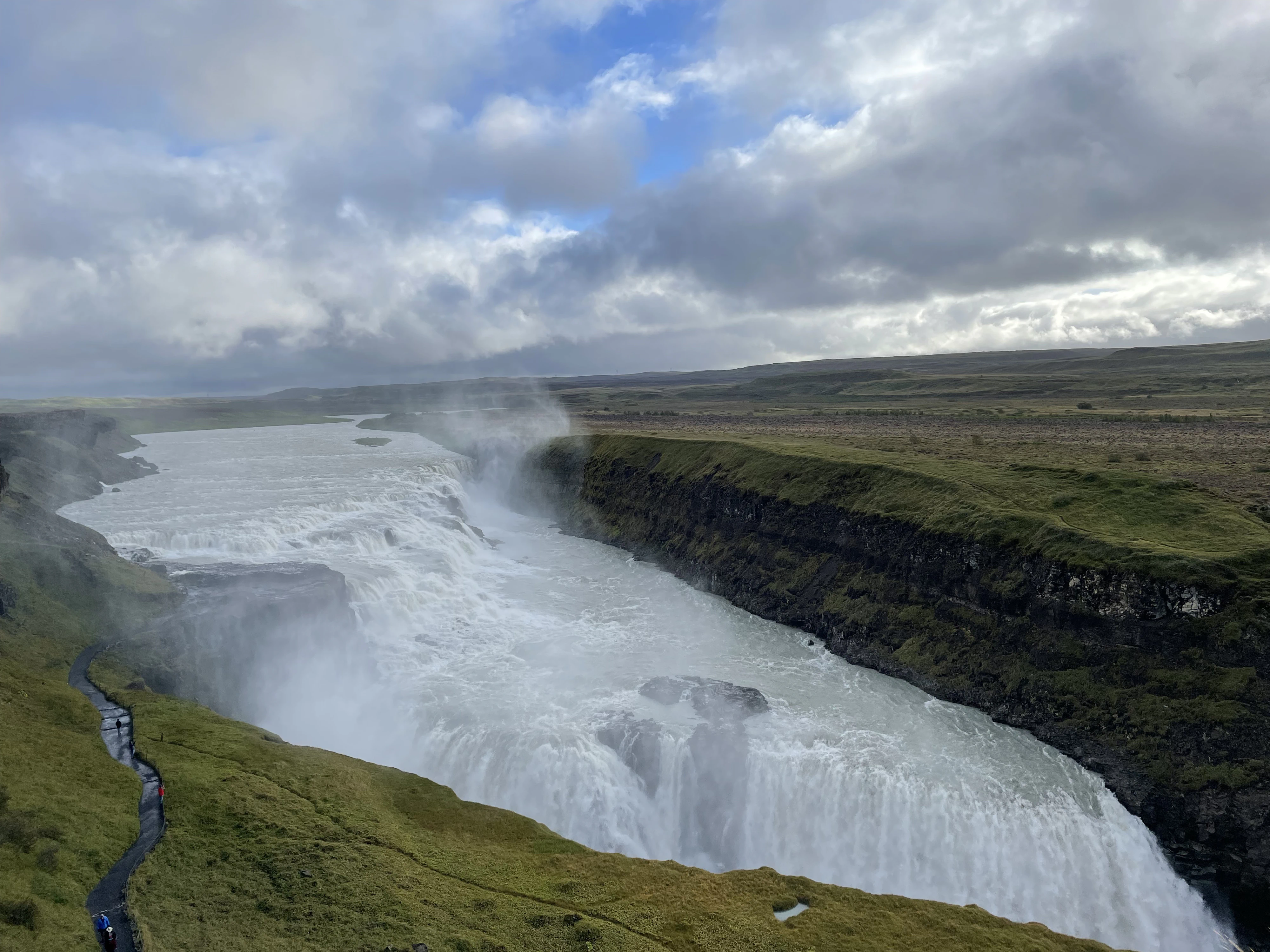
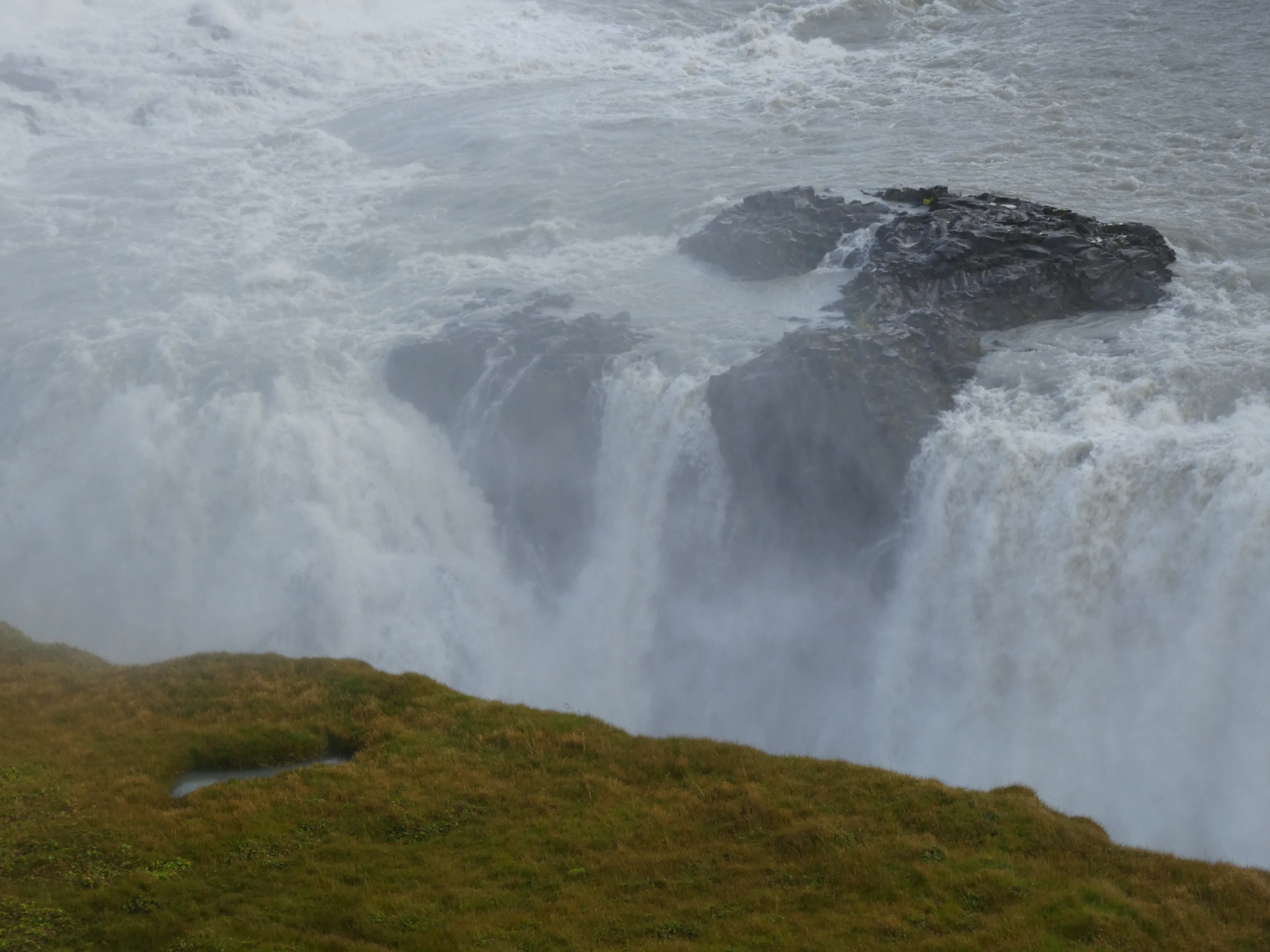
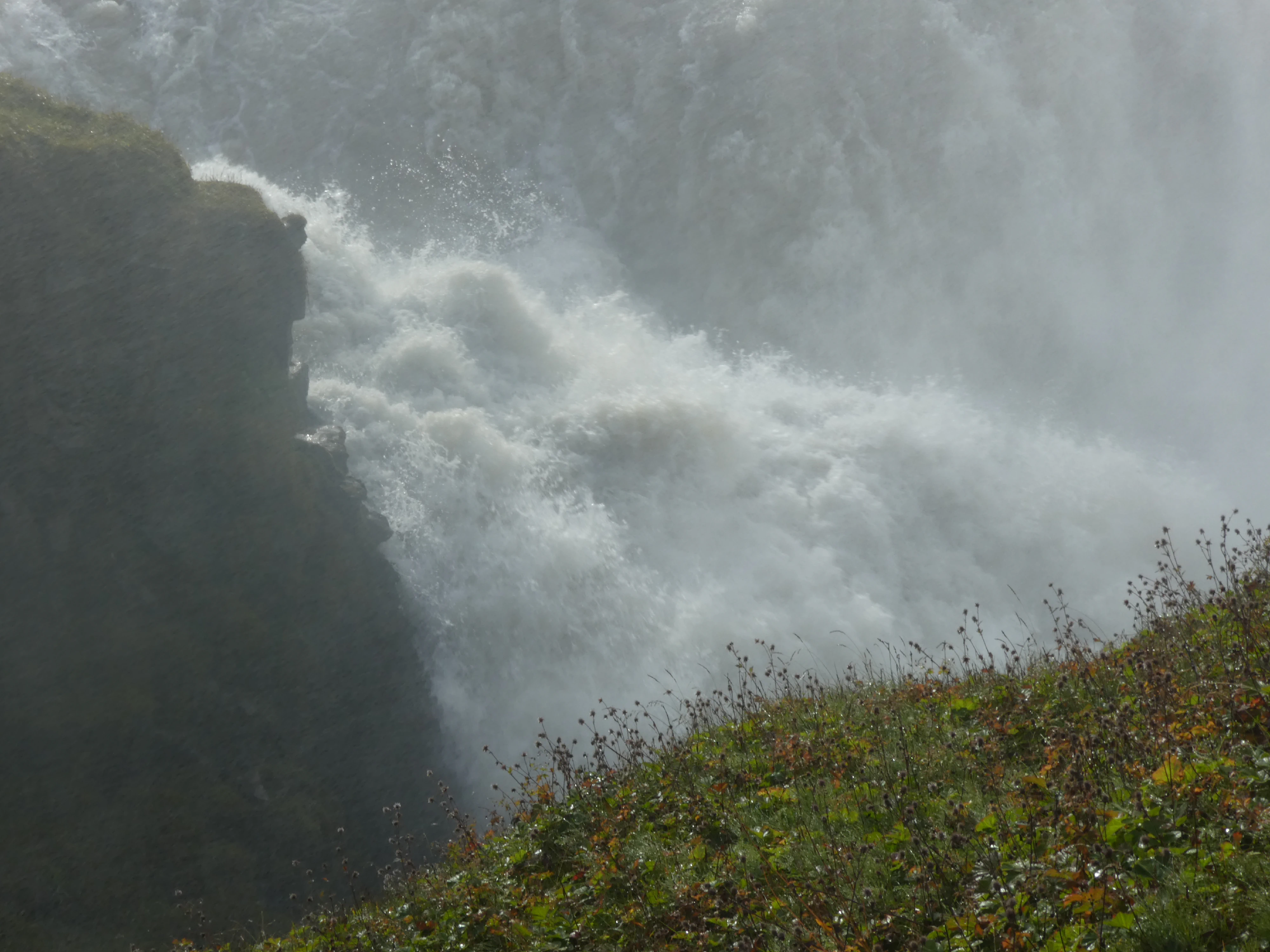
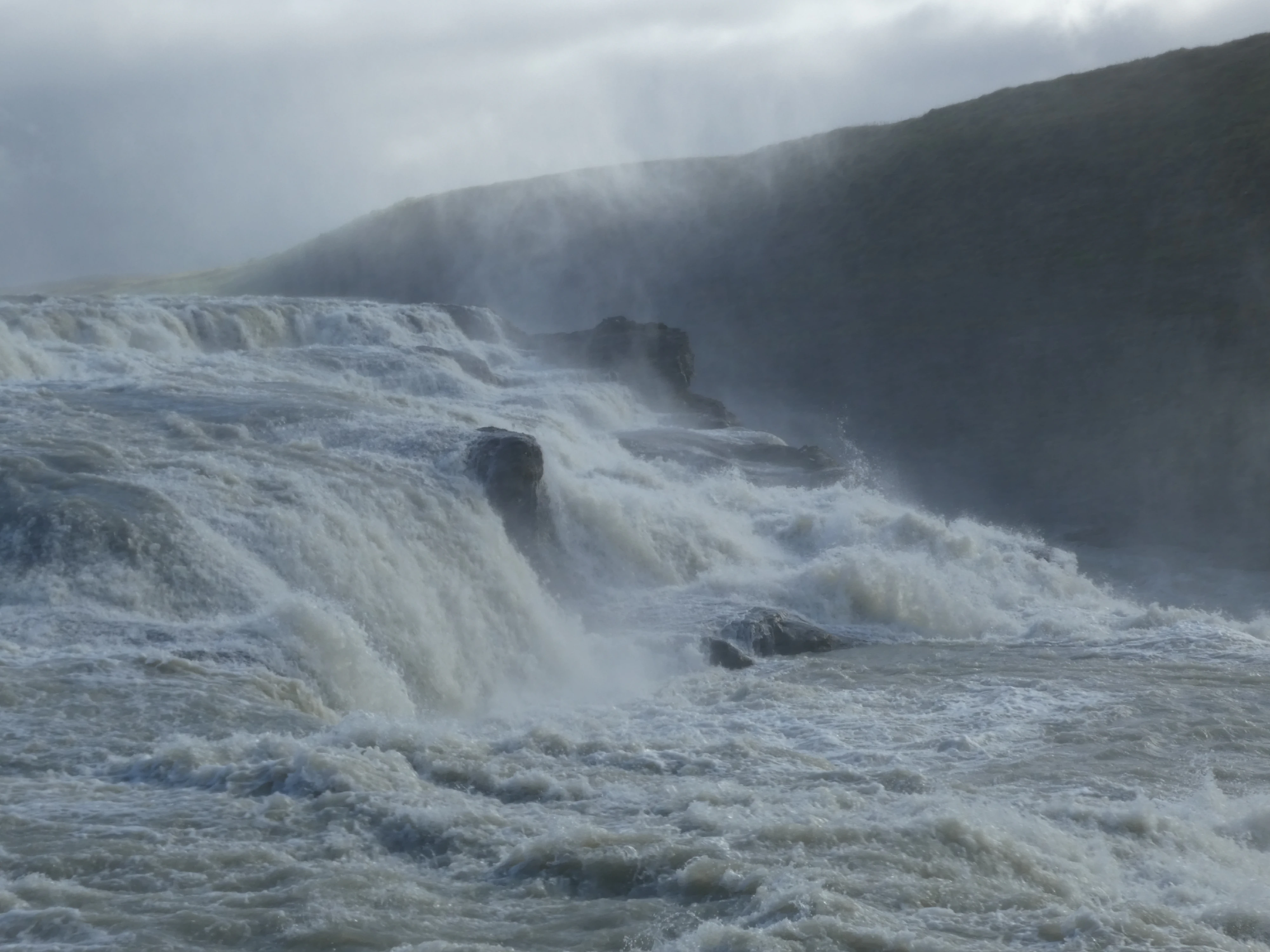
Gullfoss, or the “Golden Falls”, was the most impressive waterfall we saw. The pedestrian infrastructure let us get real close to the action. Some tourists opted to wear rain ponchos, but, being from Seattle, I saw this as an affront to everything good in this world. I came to regret it later when I was in wet pants and socks for the remainder of the day.
Gullfoss
Shot on the Panasonic Lumix DMC-ZS60. Credit: Keenan Schott
Misty
Shot on the Panasonic Lumix DMC-ZS60. Credit: Keenan Schott
The Descent
Shot on the Panasonic Lumix DMC-ZS60. Credit: Keenan Schott
The Next Level
Shot on the Panasonic Lumix DMC-ZS60. Credit: Keenan Schott
At Eye Level
Shot on the Panasonic Lumix DMC-ZS60. Credit: Keenan Schott
The Crevice
Shot on the Panasonic Lumix DMC-ZS60. Credit: Keenan Schott
In Summary
Shot on the iPhone 12. Credit: Keenan Schott
Over the Edge
Shot on the Panasonic Lumix DMC-ZS60. Credit: Keenan Schott
The Moment of Impact
Shot on the Panasonic Lumix DMC-ZS60. Credit: Keenan Schott

Rushing
Shot on the Panasonic Lumix DMC-ZS60. Credit: Keenan Schott
On the Way
Shot on the Panasonic Lumix DMC-ZS60. Credit: Keenan Schott
Kerið is a volcanic crater lake that is fairly shallow but, due to minerals from the soil, is an opaque and strikingly vivid aquamarine. This was also one of the few times we saw Iceland’s flag flying from a flagpole.
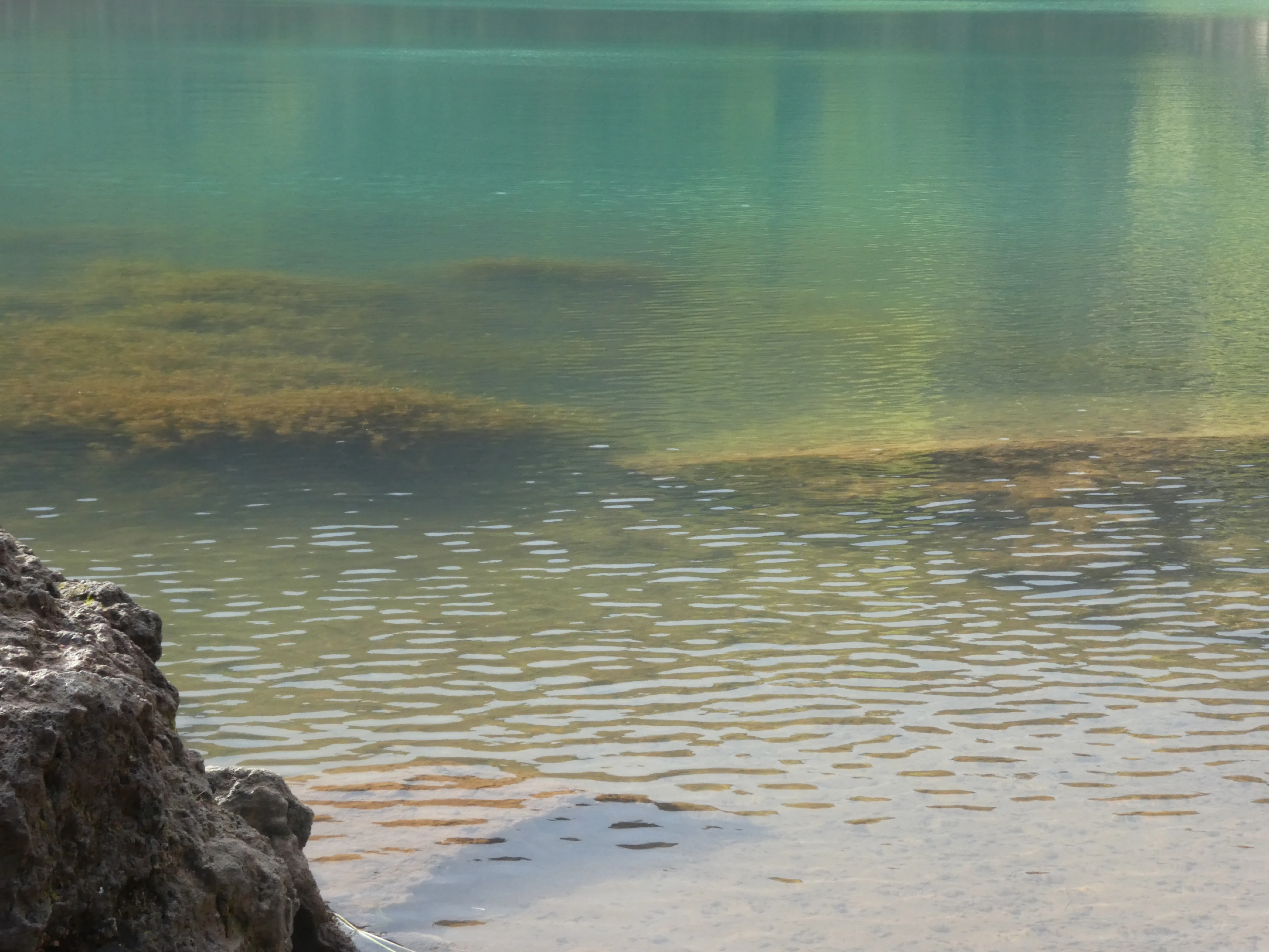
A Striking Color
Shot on the Panasonic Lumix DMC-ZS60. Credit: Keenan Schott
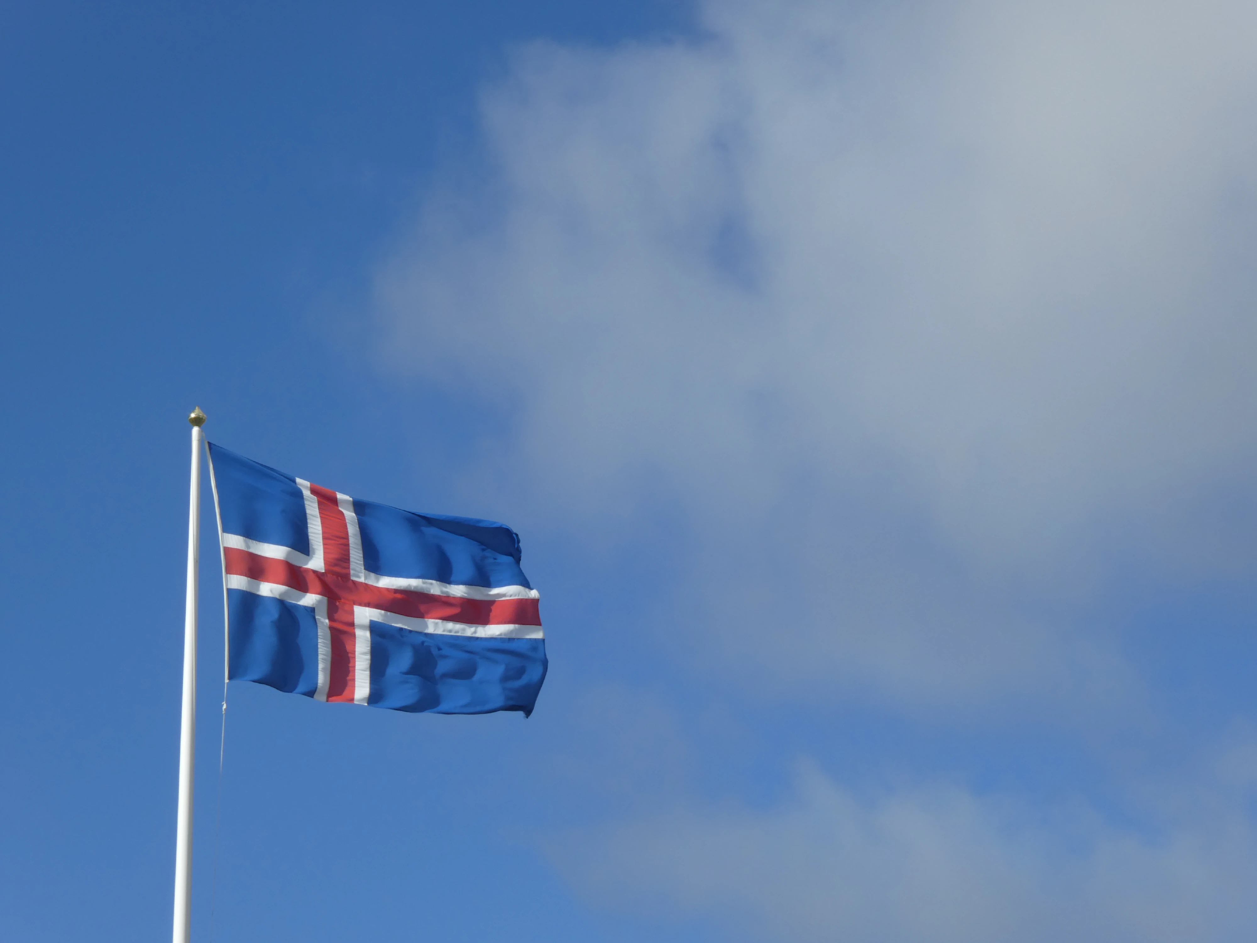
The Flag of Iceland
Shot on the Panasonic Lumix DMC-ZS60. Credit: Keenan Schott
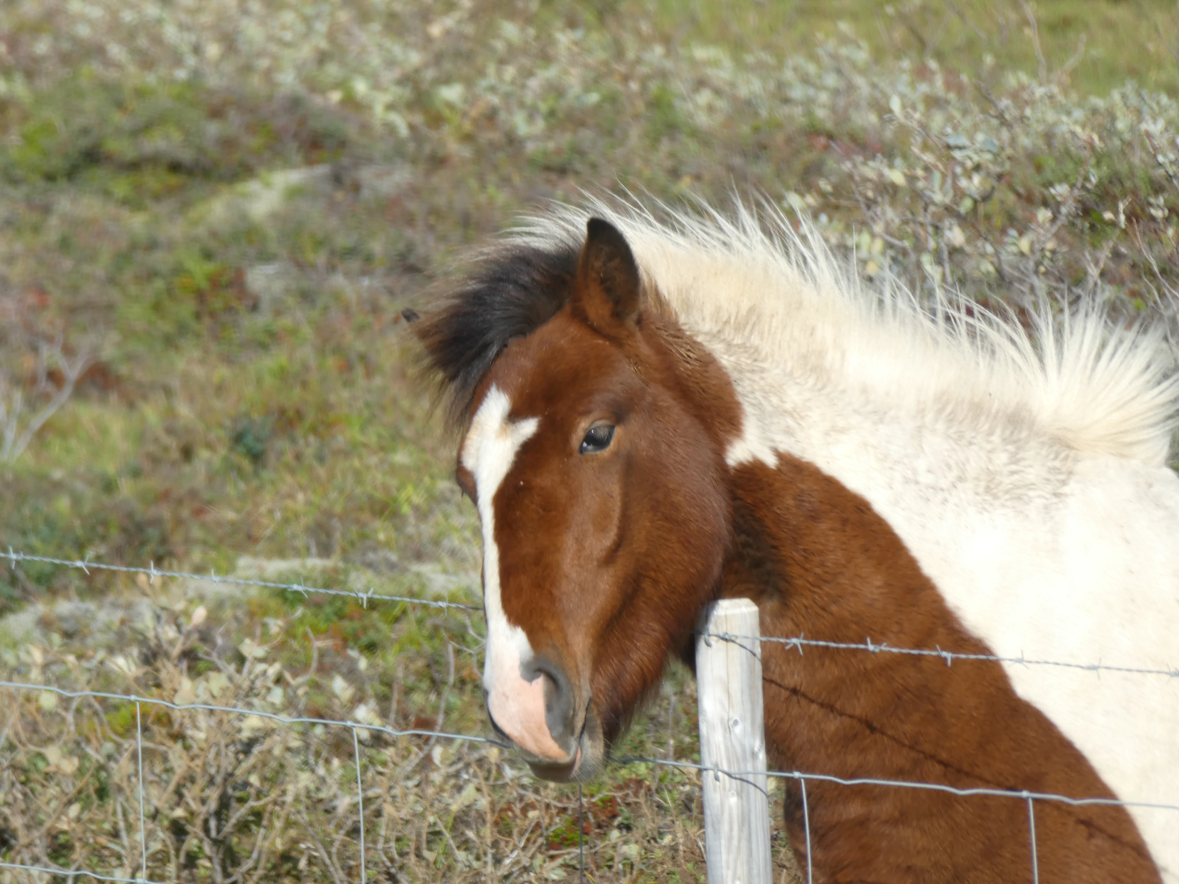
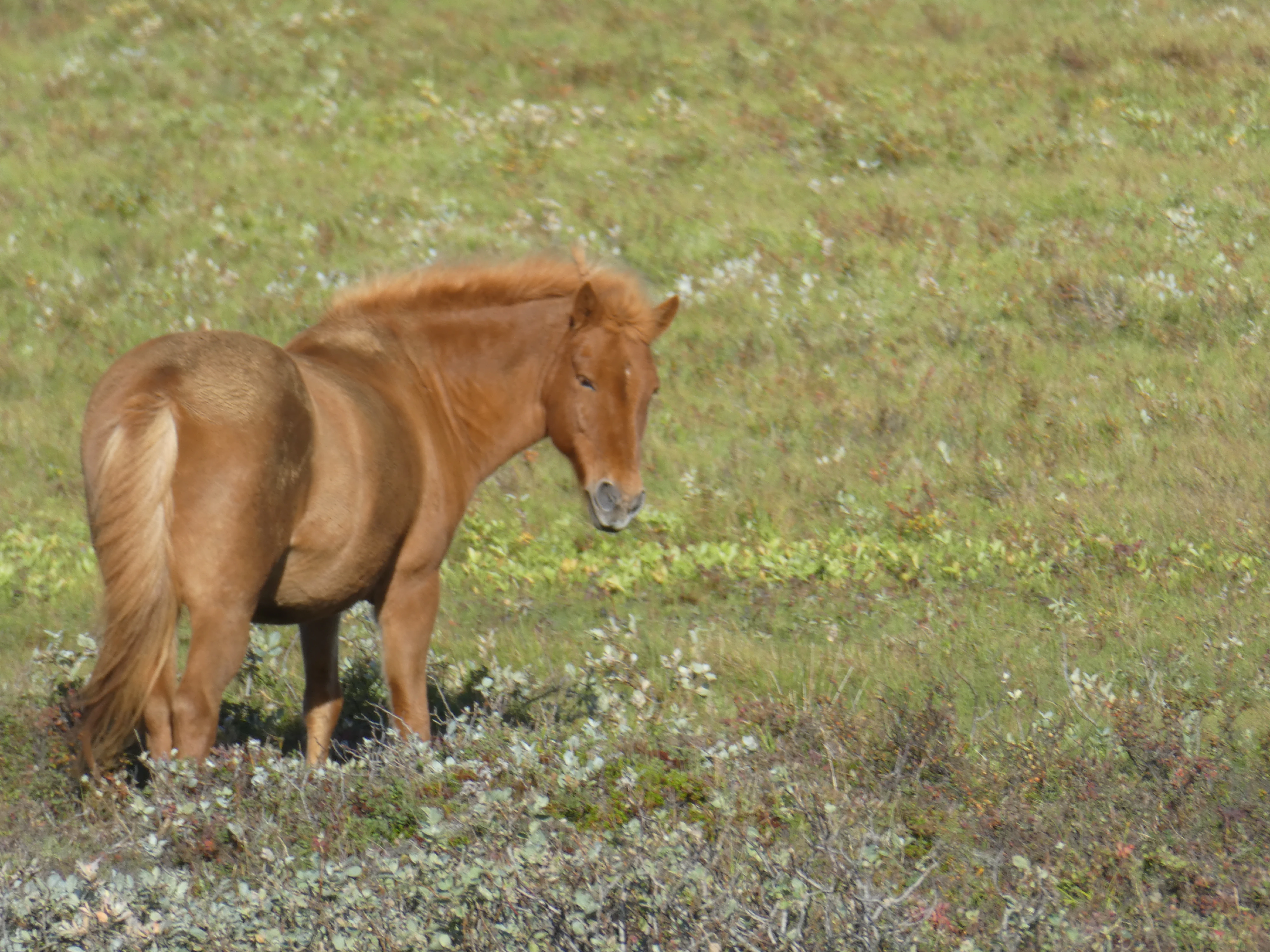
On our way south, we again saw many Icelandic horses.
Friends
Shot on the Panasonic Lumix DMC-ZS60. Credit: Keenan Schott
Grazin'
Shot on the Panasonic Lumix DMC-ZS60. Credit: Keenan Schott
Scratchin'
Shot on the Panasonic Lumix DMC-ZS60. Credit: Keenan Schott
Wanderin'
Shot on the Panasonic Lumix DMC-ZS60. Credit: Keenan Schott
The South
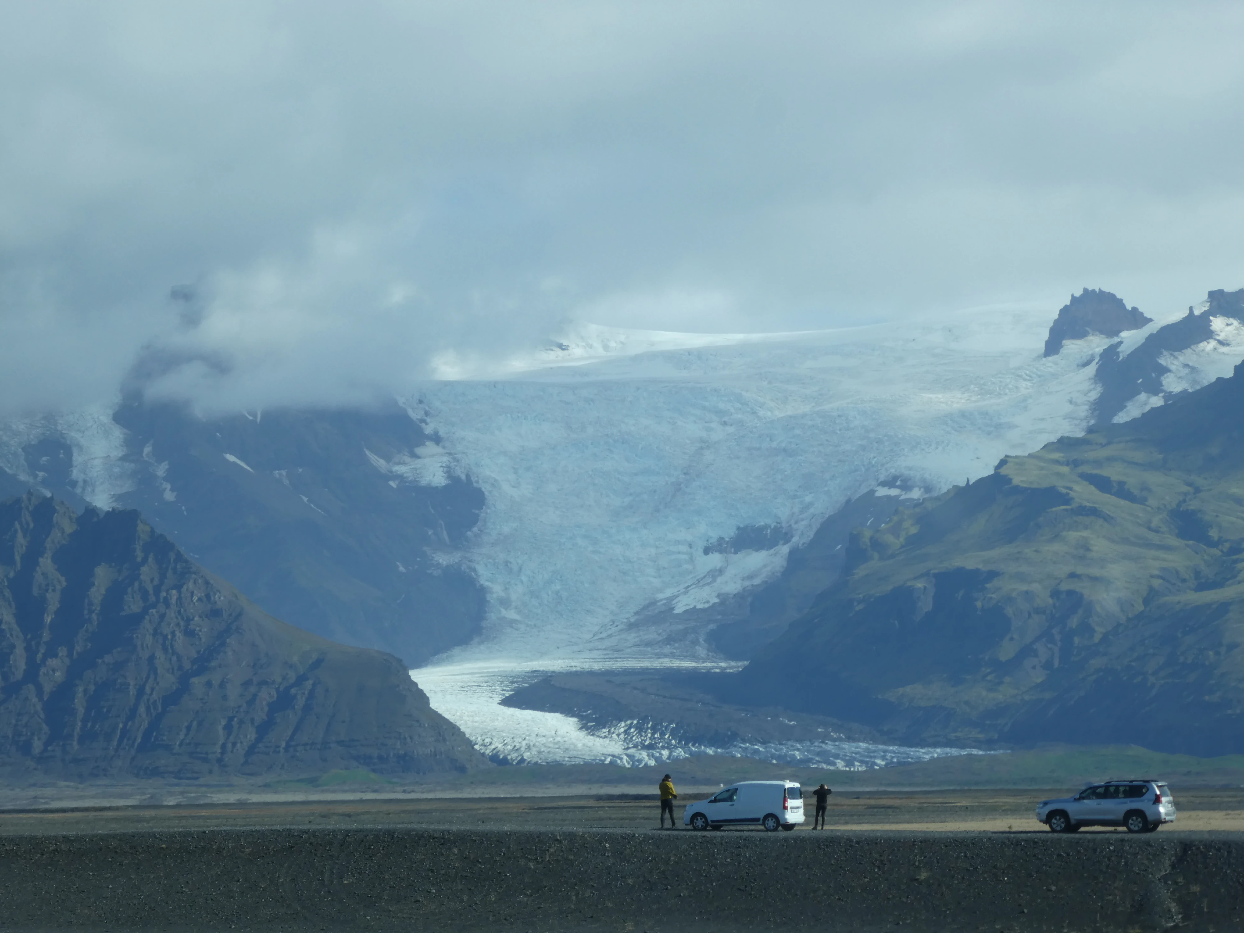
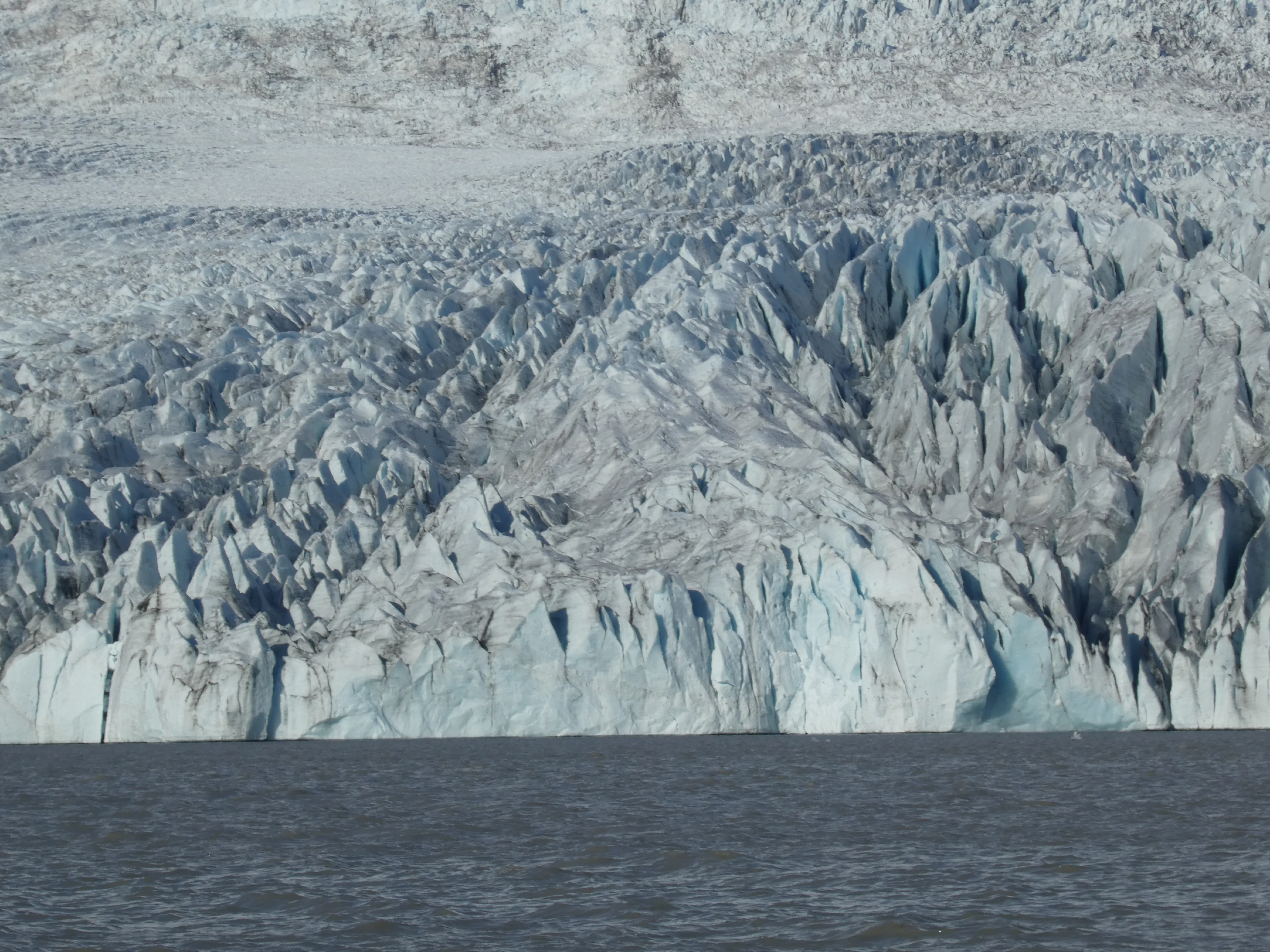
Vatnajökull is the largest and most voluminous ice cap in Iceland and covers around ten percent of the country. Our brief guided hike of the ice cap, which required crampons and careful footing, allowed us to explore the giant hunk of ice and all its nooks and crannies. Given that we were visiting in early September, we were witnessing the end of the cap’s recession, meaning the ice was covered almost entirely in volcanic ash, which would soon be buried as the ice grew once more in the winter. It was a strange sensation to be walking on almost perfectly black ice.
From the Road
Shot on the Panasonic Lumix DMC-ZS60. Credit: Keenan Schott
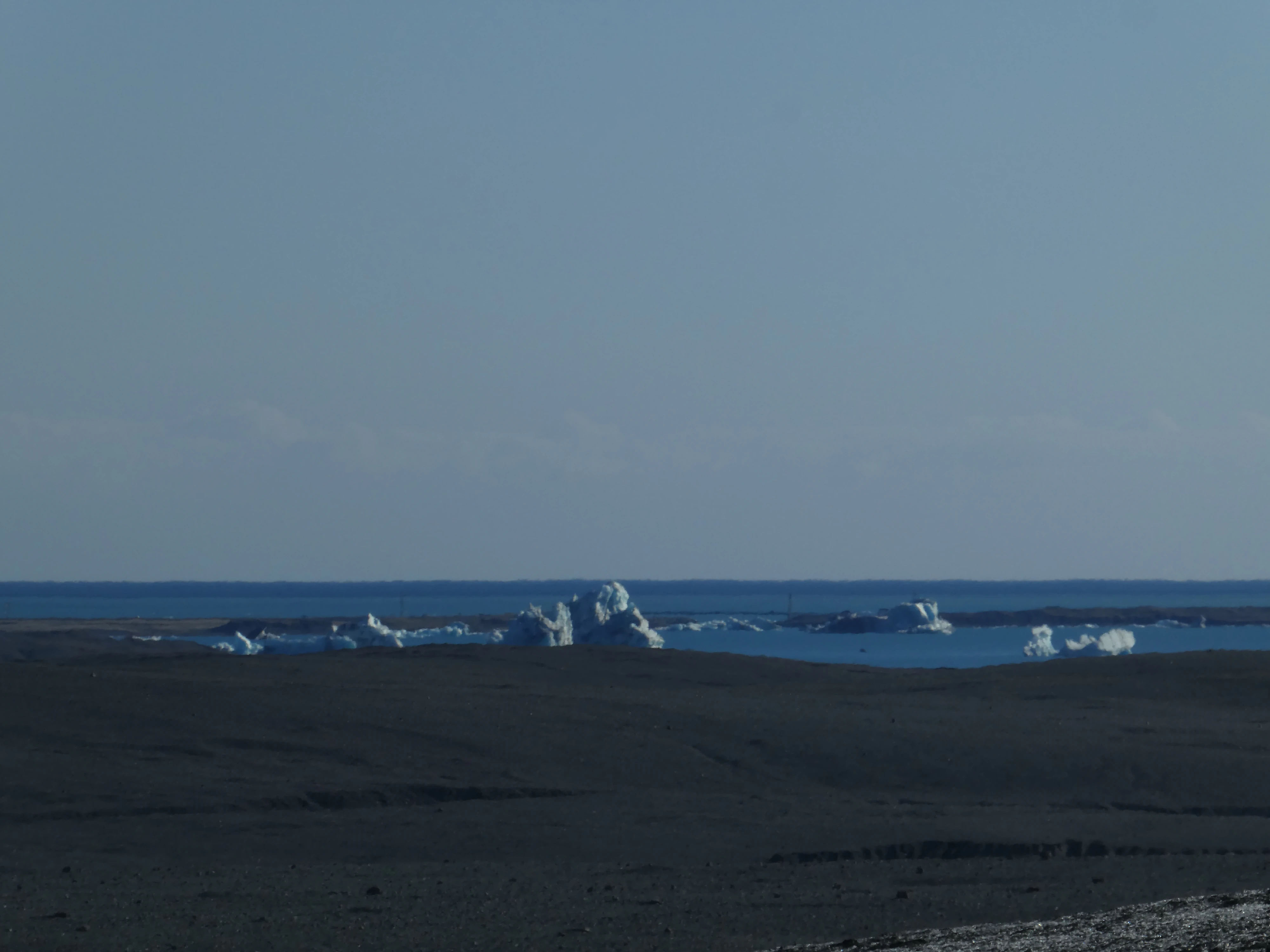
Icebergs in the Distance
Shot on the Panasonic Lumix DMC-ZS60. Credit: Keenan Schott
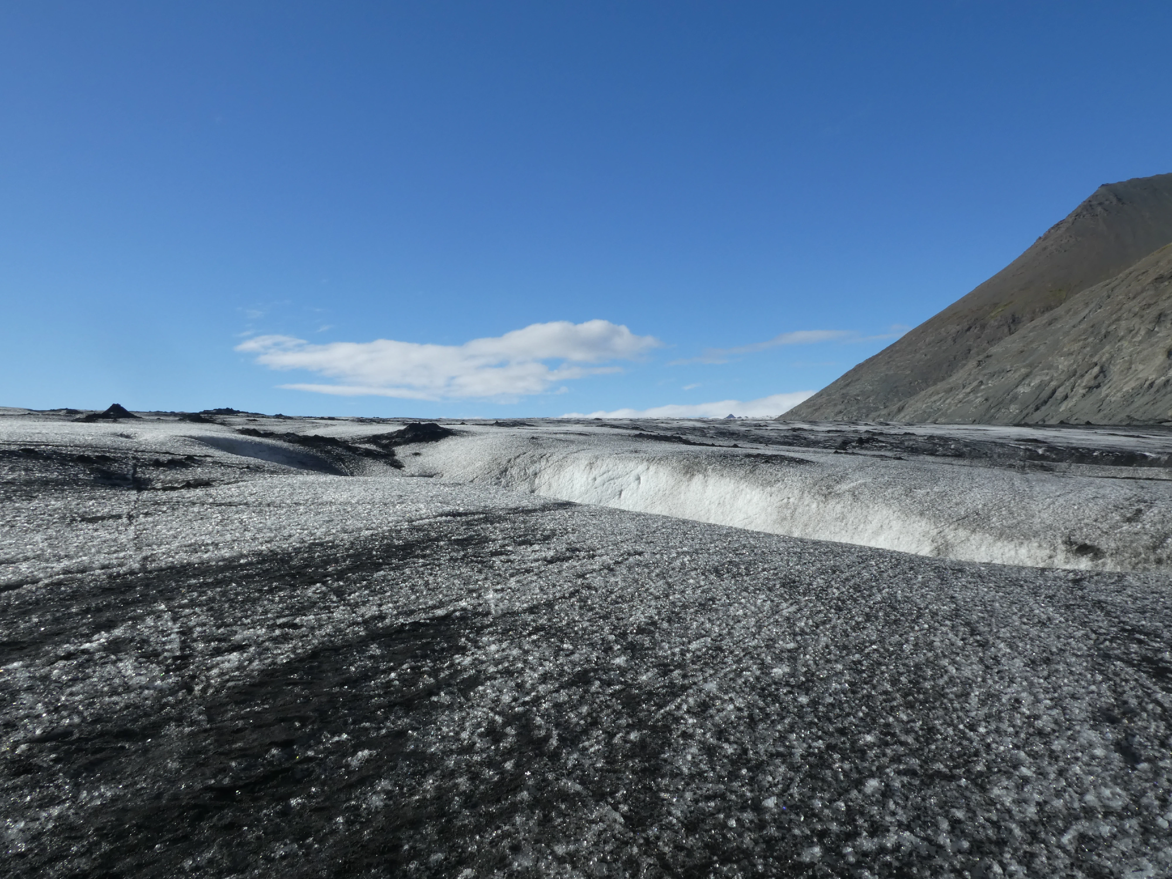
Vatnajökull
Shot on the Panasonic Lumix DMC-ZS60. Credit: Keenan Schott
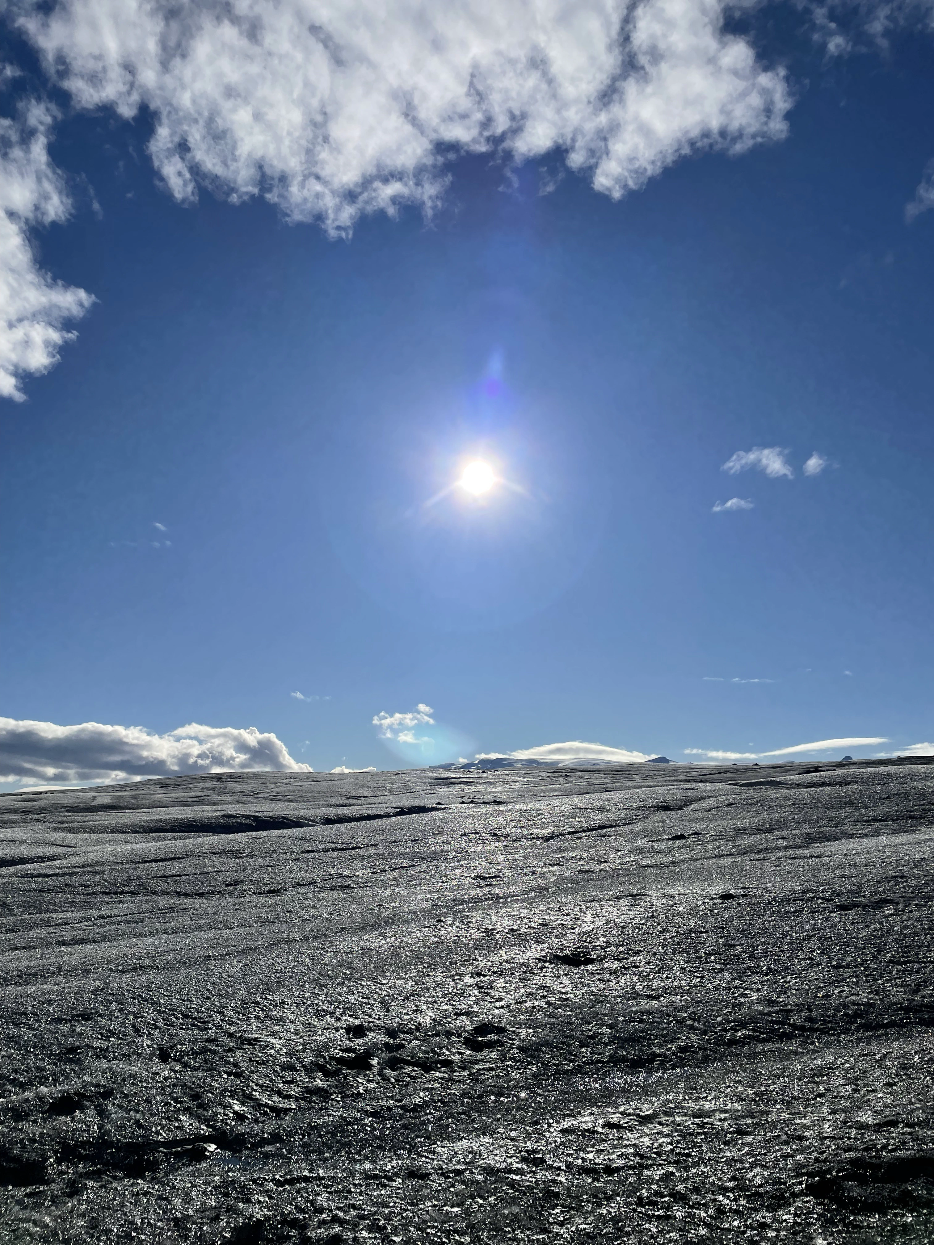
The Blistering Sun
Shot on the iPhone 12. Credit: Keenan Schott
The tour continued on the water where we had the opportunity to get up close and personal with some icebergs. It’s hard to fathom just how far each one extends underwater given how large they appear above the water.
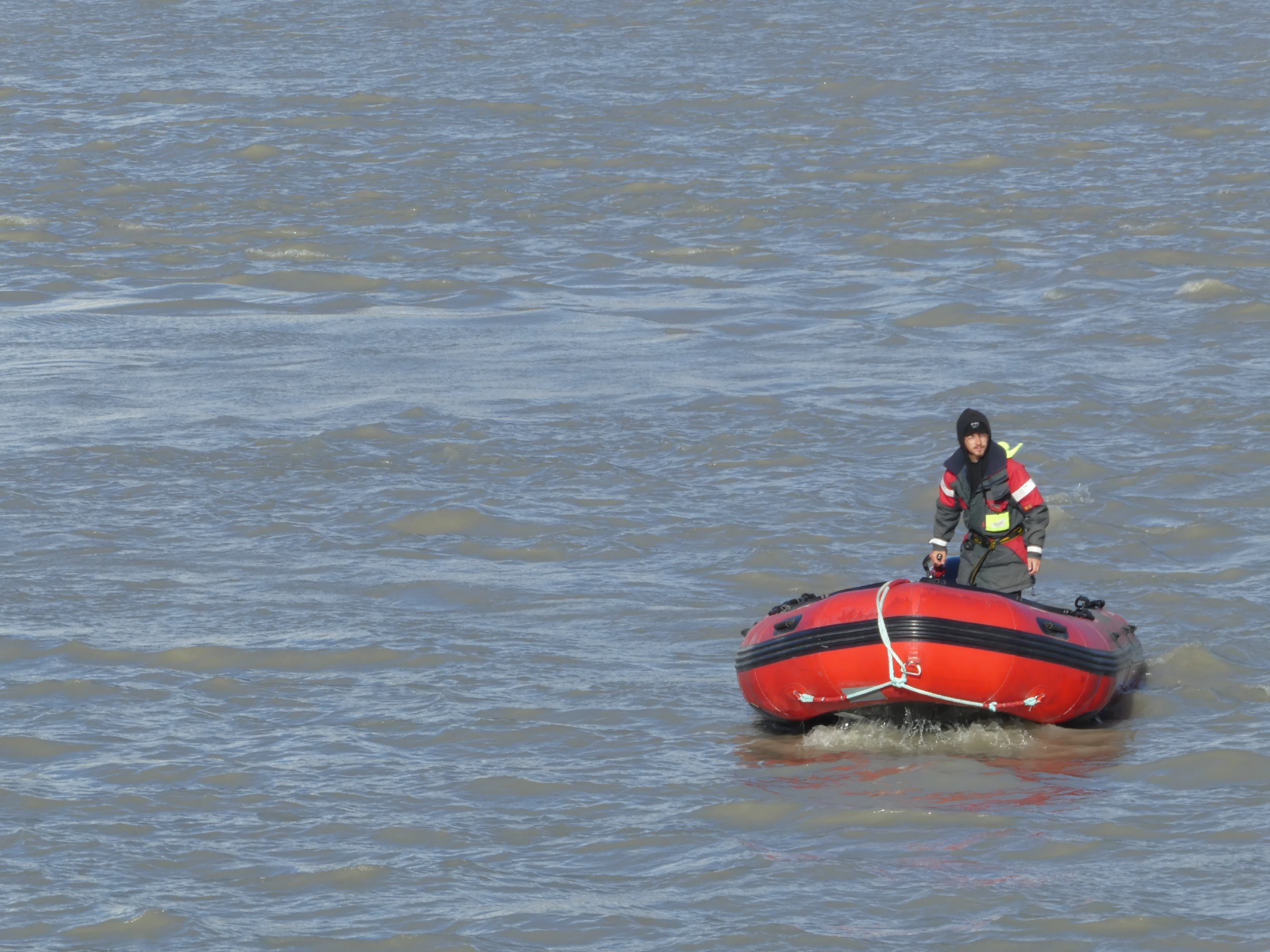
Our Guide
Shot on the Panasonic Lumix DMC-ZS60. Credit: Keenan Schott
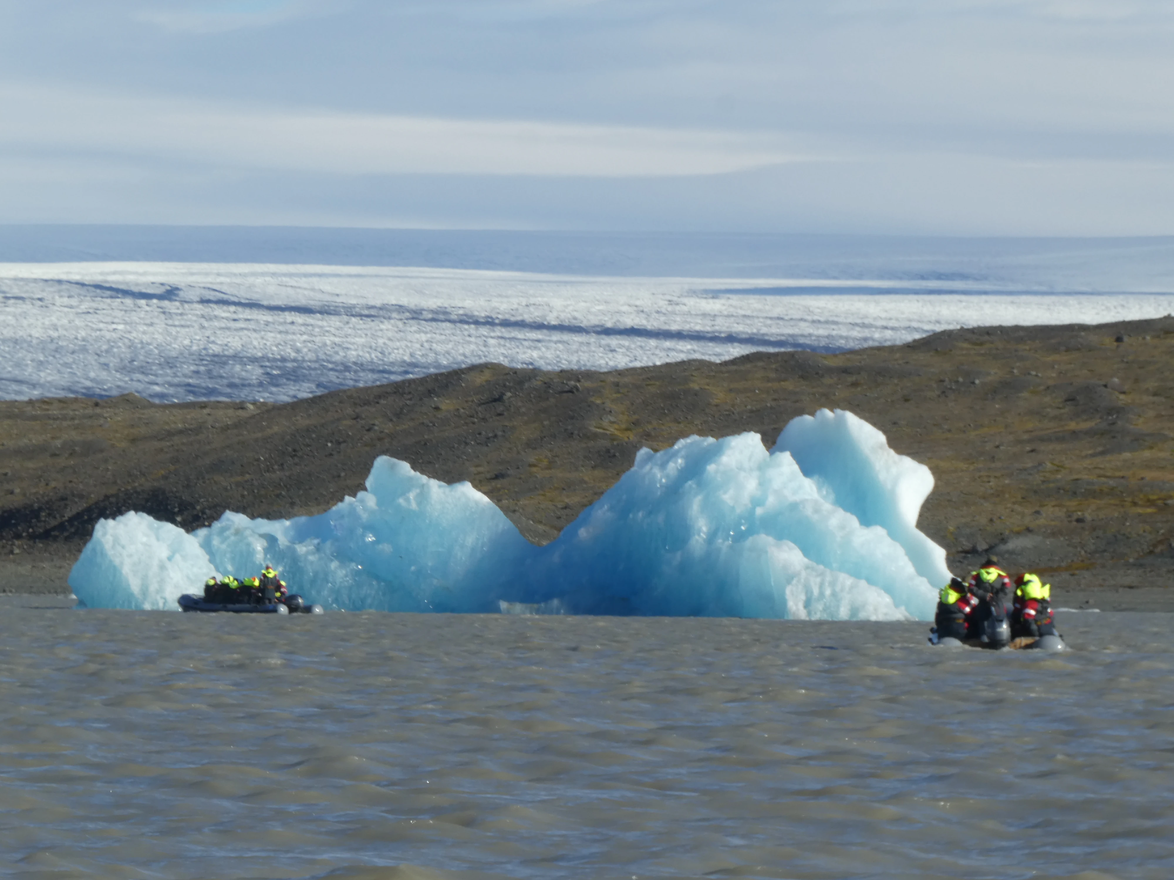
A Sizeable Iceberg
Shot on the Panasonic Lumix DMC-ZS60. Credit: Keenan Schott
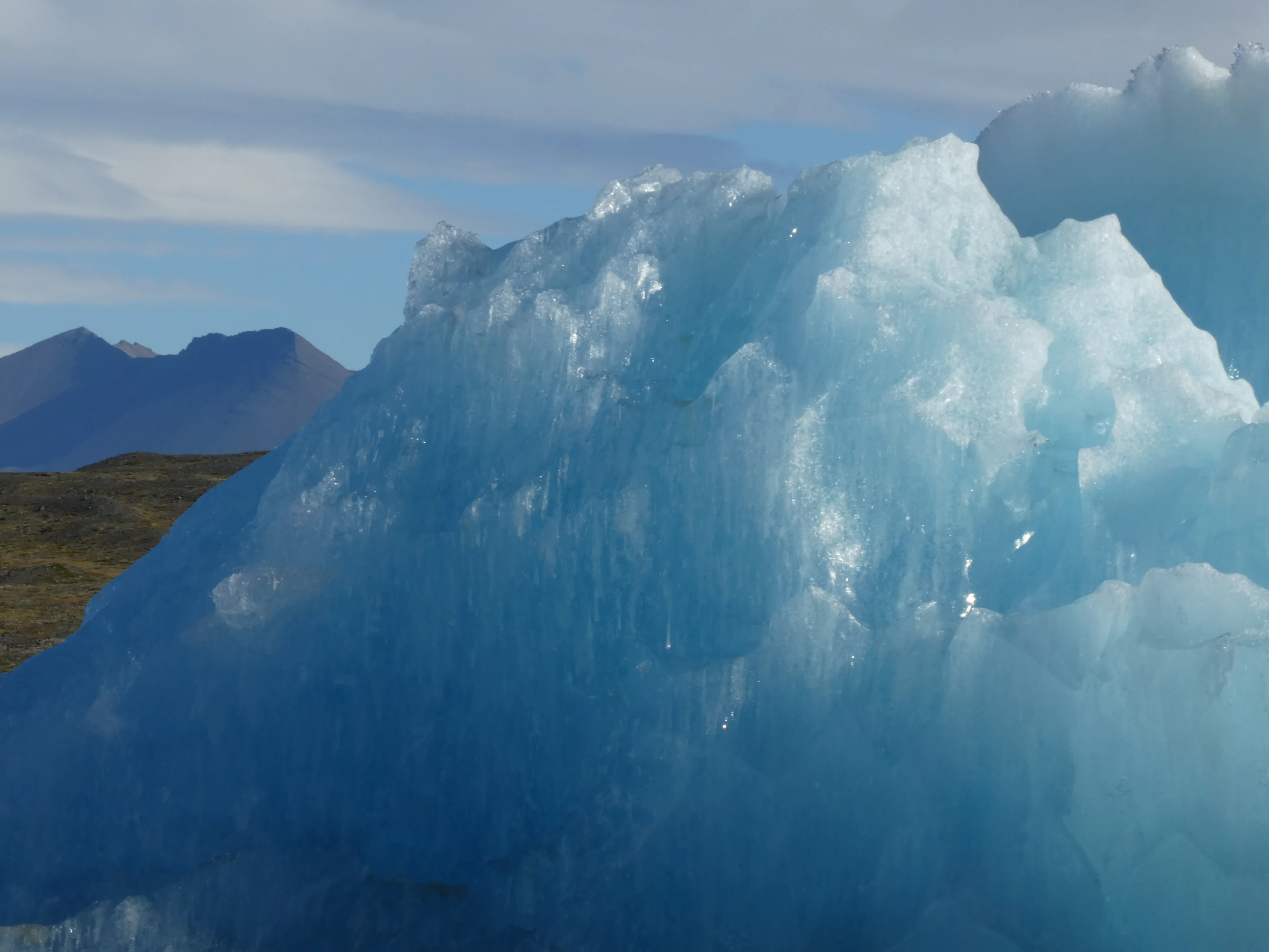
The Blue Hue
Shot on the Panasonic Lumix DMC-ZS60. Credit: Keenan Schott
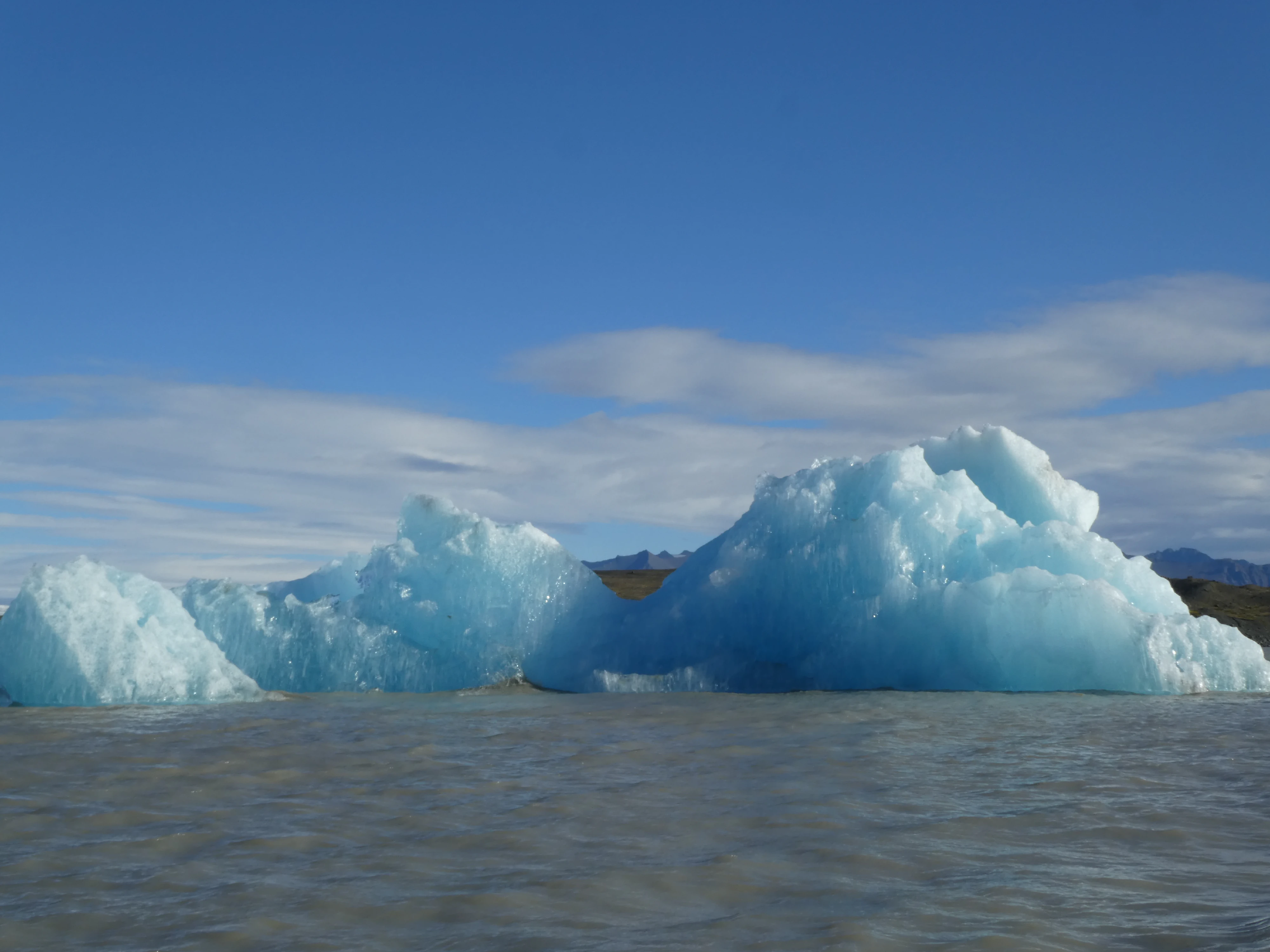
A Floater
Shot on the Panasonic Lumix DMC-ZS60. Credit: Keenan Schott
The Ice Shelf
Shot on the Panasonic Lumix DMC-ZS60. Credit: Keenan Schott
Reynisfjara is a world-famous black-sand beach found on the southern coast of Iceland, which features basalt columns and the Reynisdrangar sea stacks. The hexagonal rock formations were formed by cooling lava, making for good photos and easy climbing. Legend has it that the sea stacks originated when two trolls dragged a three-masted ship to land unsuccessfully and when daylight broke they became needles of rock.
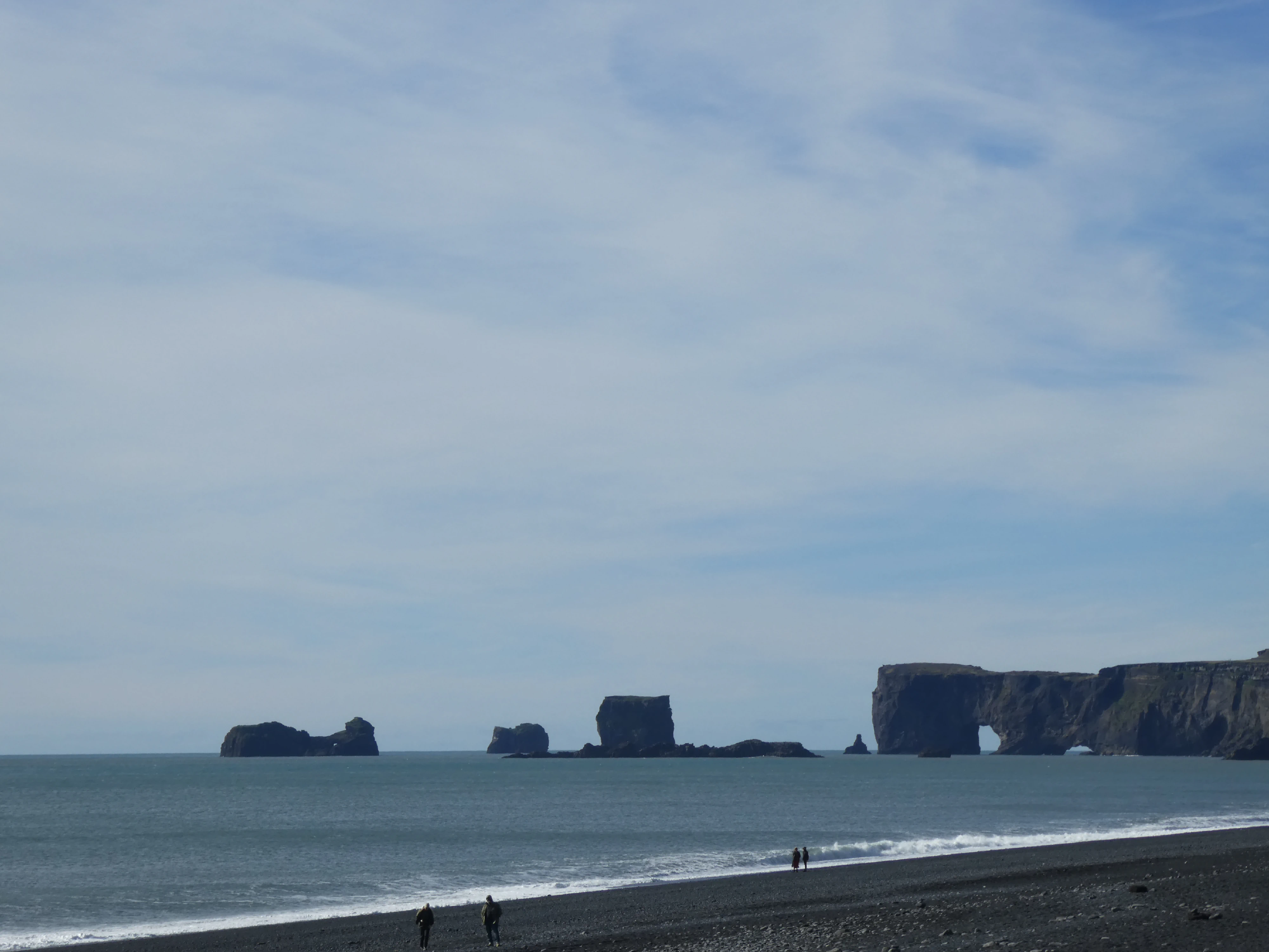
The Sea Stacks
Shot on the Panasonic Lumix DMC-ZS60. Credit: Keenan Schott
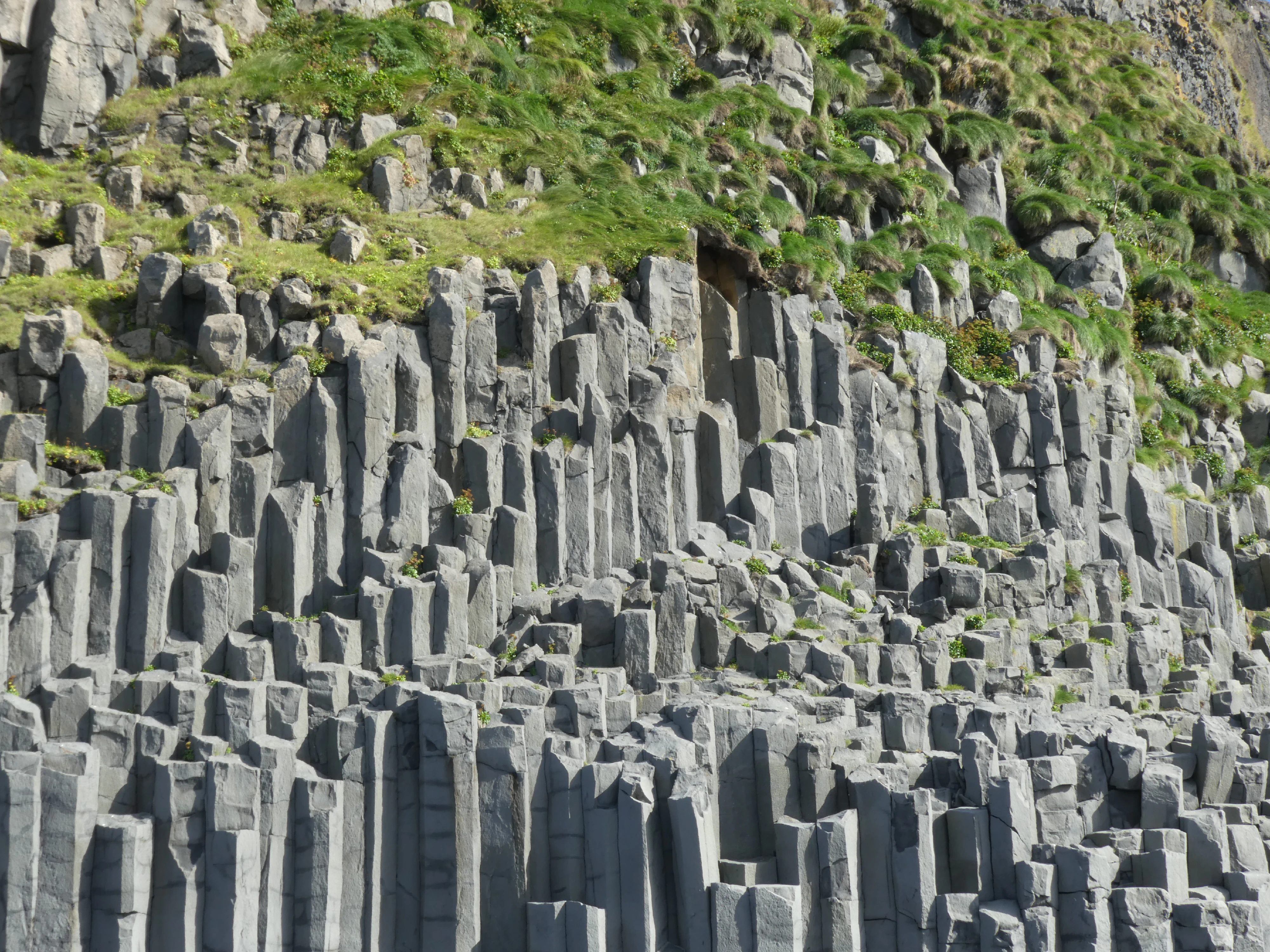
The Columns
Shot on the Panasonic Lumix DMC-ZS60. Credit: Keenan Schott
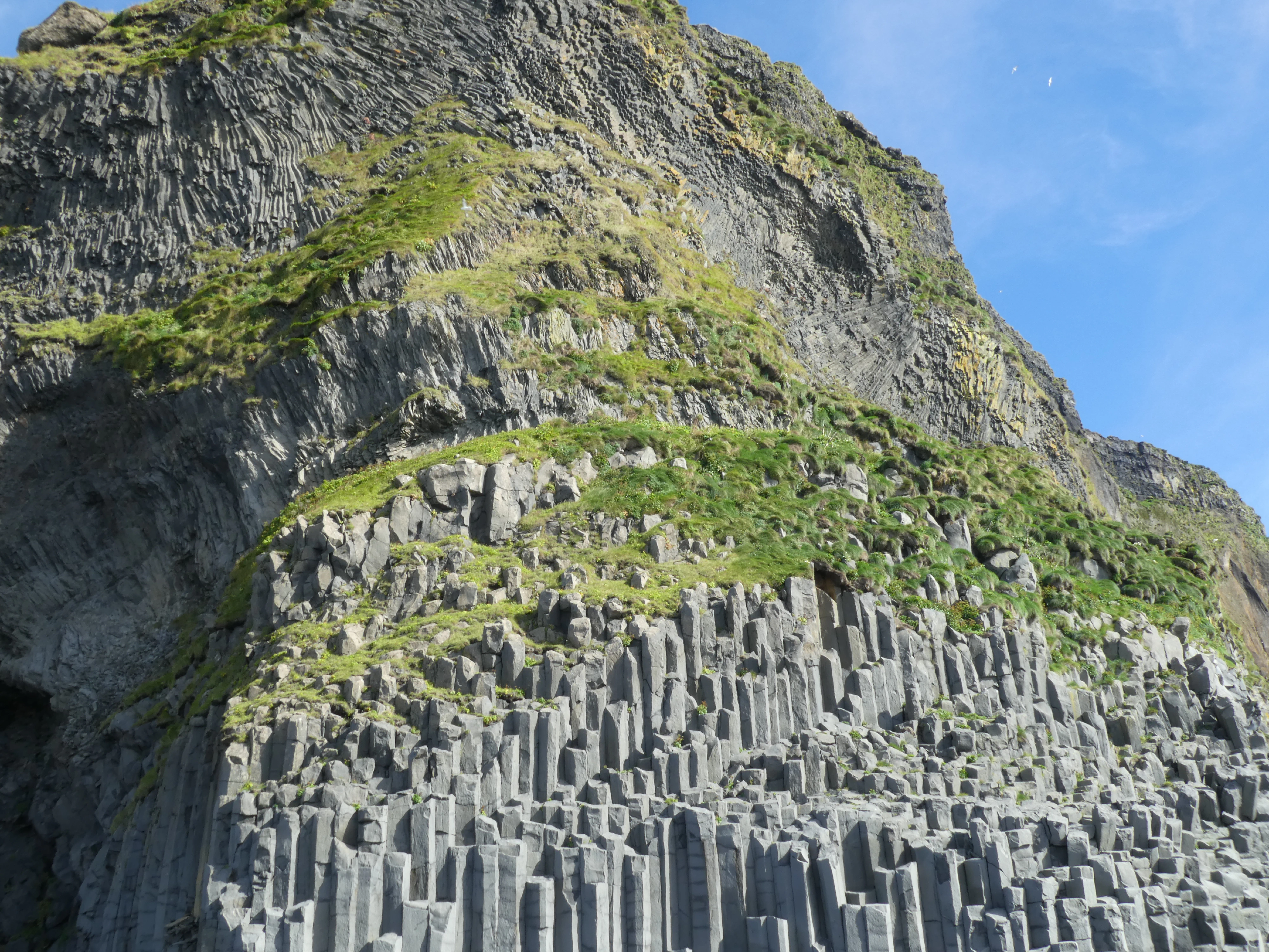
The Hillside
Shot on the Panasonic Lumix DMC-ZS60. Credit: Keenan Schott
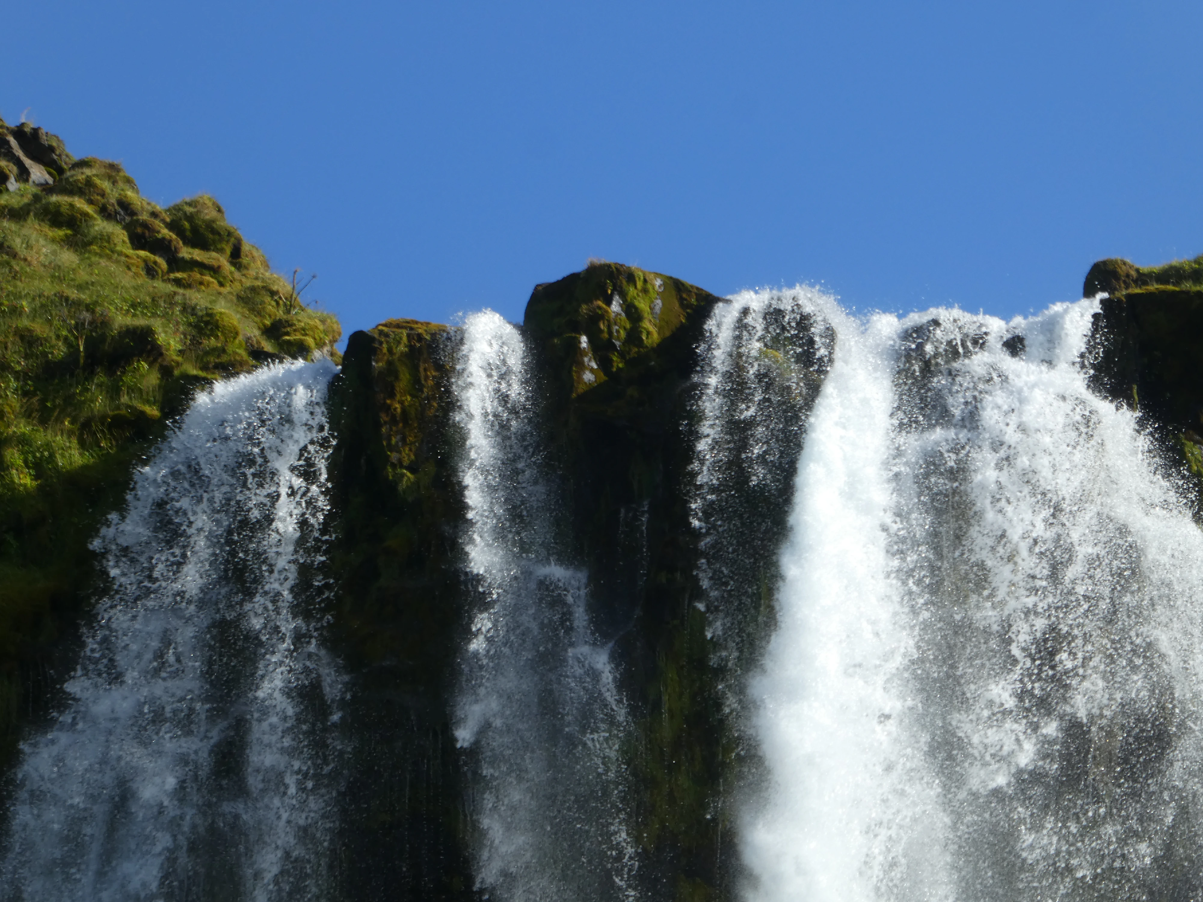
Seljalandsfoss was the last waterfall of our trip. Visitors can walk behind the falls into a small cave; however, unlike Gullfoss, Seljalandsfoss offers those who dare more of a shower rather than a light mist.
Atop the Falls
Shot on the Panasonic Lumix DMC-ZS60. Credit: Keenan Schott
Reykjavík, Again
We hit Reykjavík once again on the way back to the airport to grab some food and maybe catch what we missed the first time around. The first photo depicts a statue of Ingólfr Arnarson, the first permanent Norse settler of Iceland in 874. Only the Irish monks had been in the country before the Norsemen, but left due to not wanting to live with pagans. Next up is Christian IX, the King of Denmark in the late 1860s. The statue depicts him handing over Iceland’s first constitution in 1874. With Iceland under the rule of the Kingdom of Denmark at the time, this act was the first step in what would eventually lead to Iceland’s independence.

Ingólfr Arnarson
Shot on the Panasonic Lumix DMC-ZS60. Credit: Keenan Schott
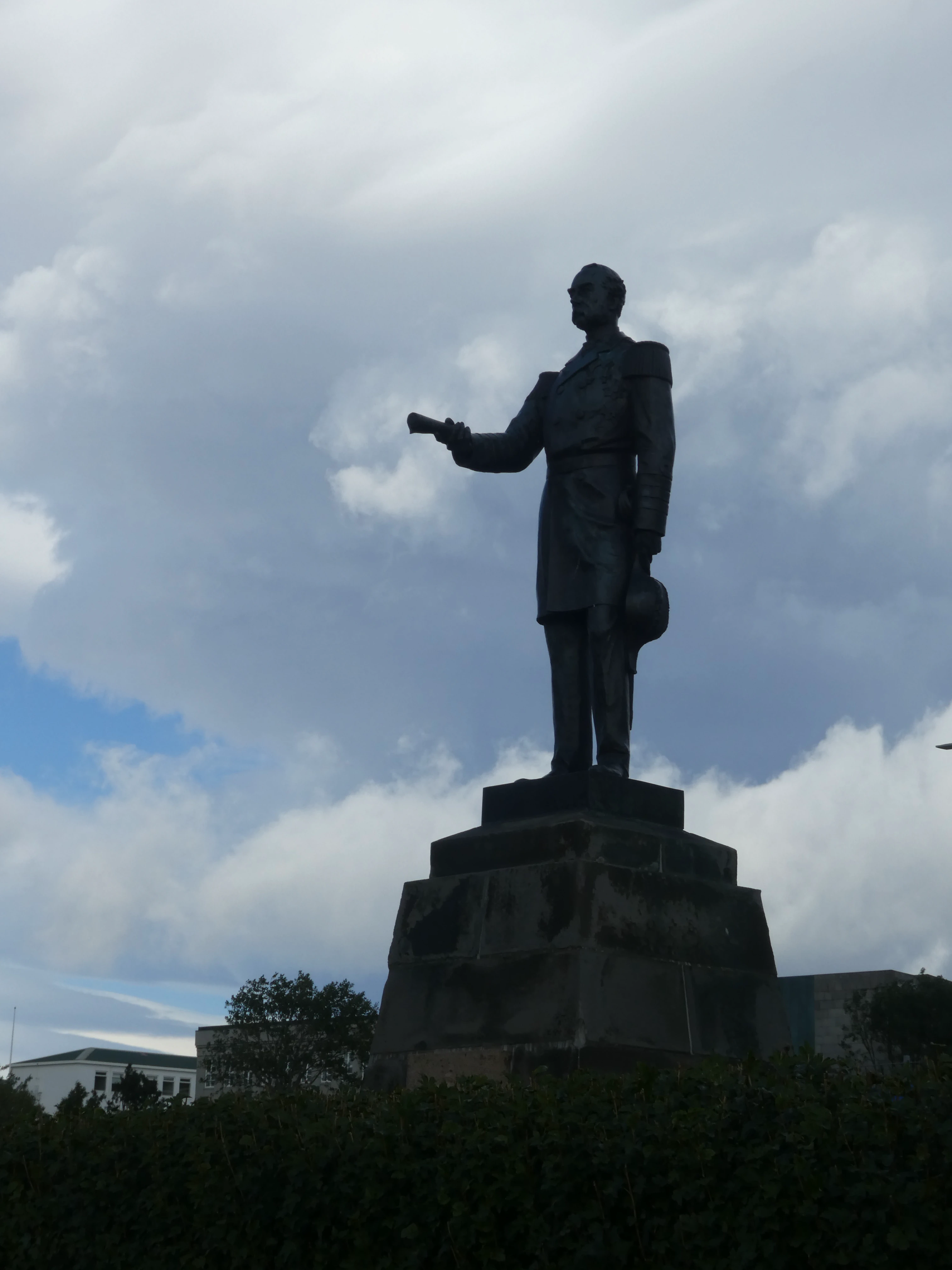
Christian IX of Denmark
Shot on the Panasonic Lumix DMC-ZS60. Credit: Keenan Schott
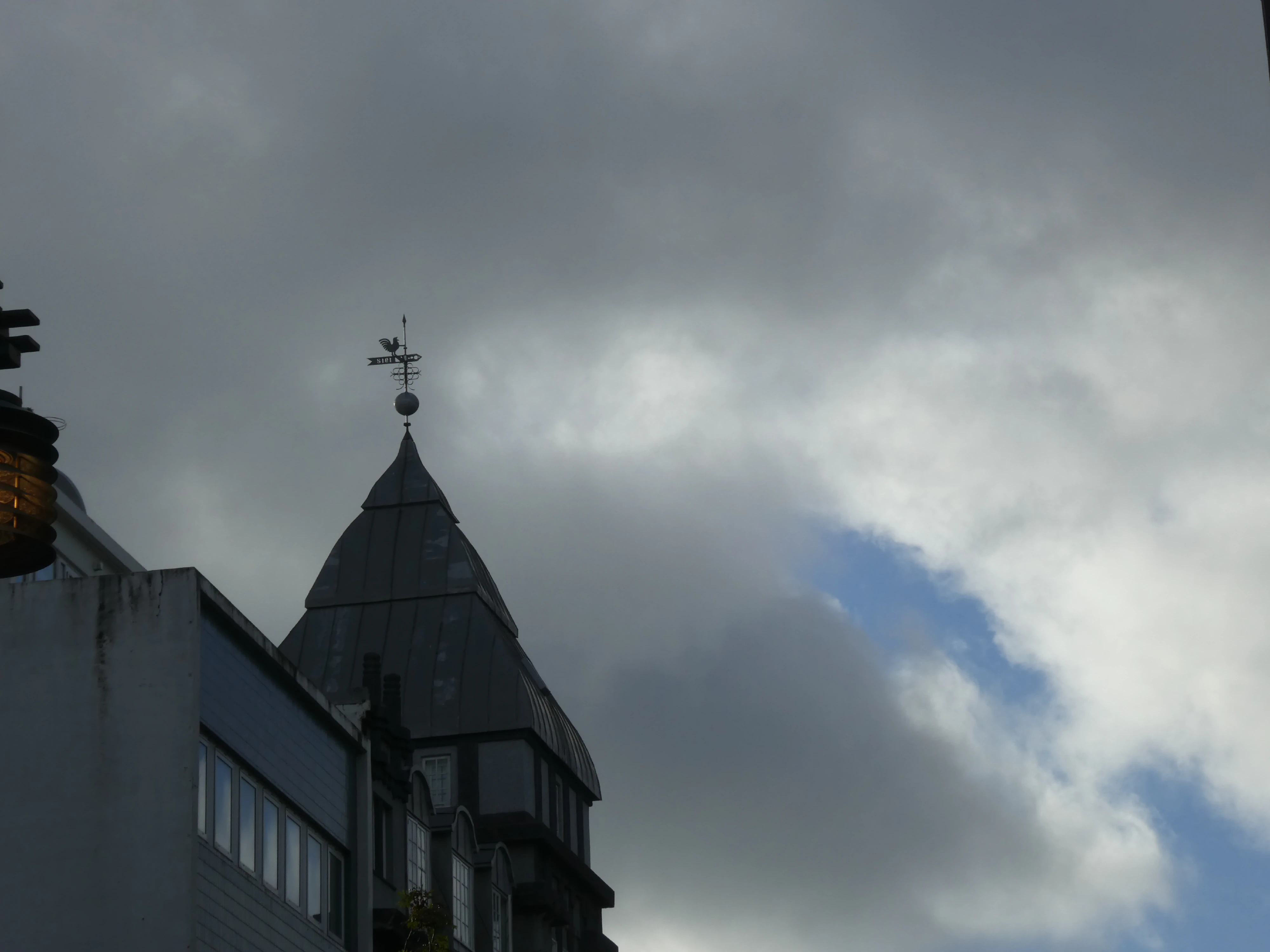
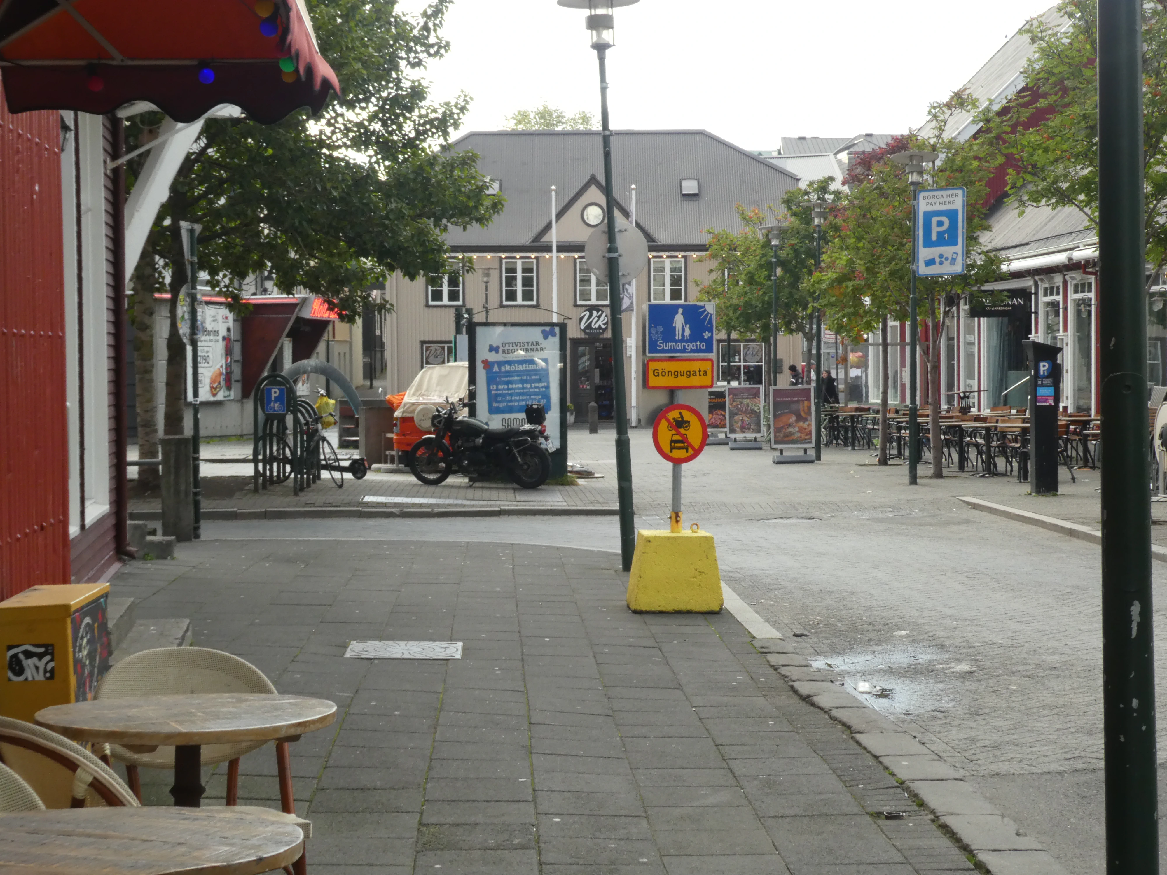
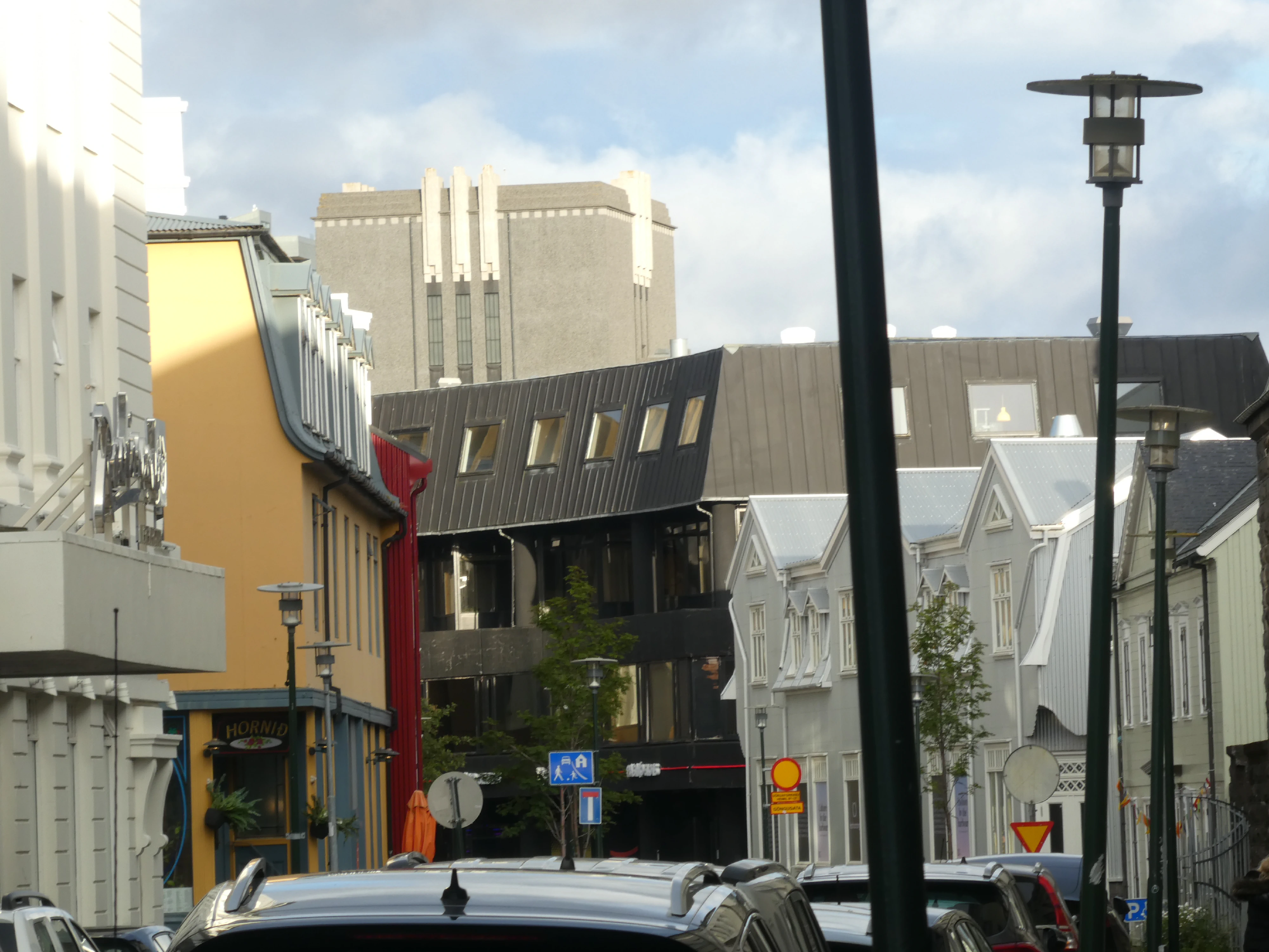
I also took a few moments to photograph the streets of Reykjavík. As most cities are, it was occasionally dirty and grimy, but it had its charms. There are no Starbucks or McDonalds, and the city doesn’t have that manufactured, corporate, or plastic feel that plagues some American cities. It felt like people lived in the city and gave it value.
Pointed
Shot on the Panasonic Lumix DMC-ZS60. Credit: Keenan Schott
A Reykjavík Street
Shot on the Panasonic Lumix DMC-ZS60. Credit: Keenan Schott
Down the Alley
Shot on the Panasonic Lumix DMC-ZS60. Credit: Keenan Schott
Outtakes
Throughout our travels, crackers, bread, cheese, and butter, or “smjör”, was the snack of choice. Interestingly enough, the word “smear” comes from the Old English word “smeoru”, which shares it origins with “smjör”. No wonder it felt so natural to be smearing smjör.
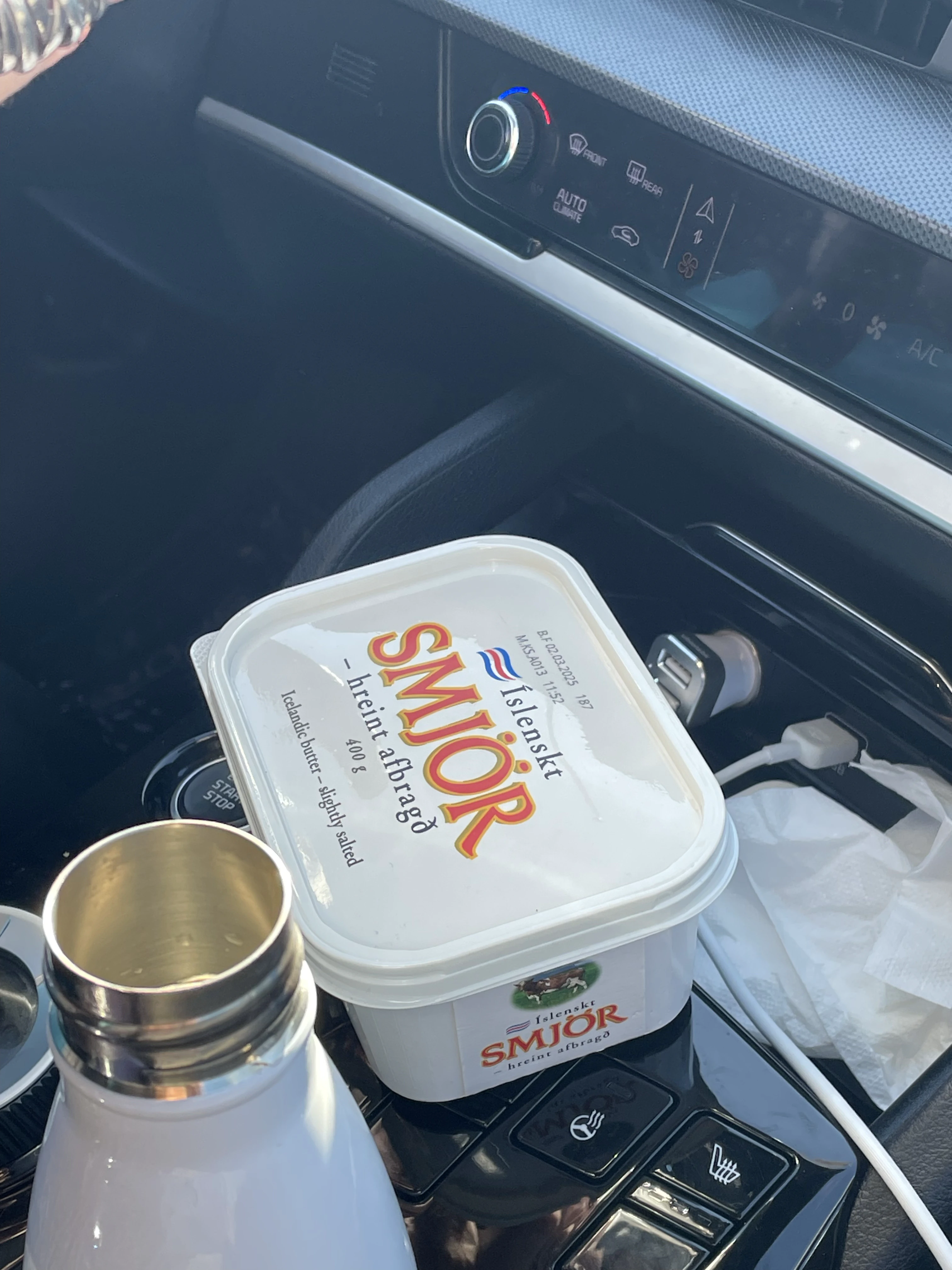
Smjör
Shot on the iPhone 12. Credit: Keenan Schott
No matter where you go in the world, there will always be a 12th man.
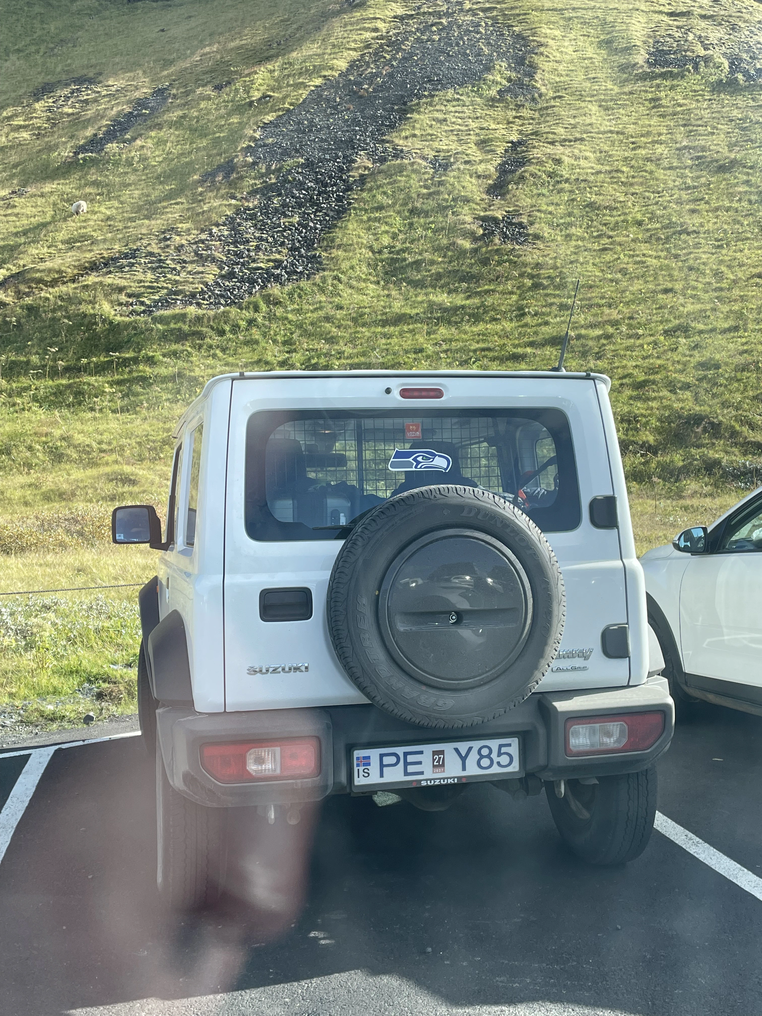
Go Hawks
Shot on the iPhone 12. Credit: Keenan Schott
The final sunset - taken on our way back to the airport on the Reykjanes Peninsula.
The Reykjanes Peninsula
Shot on the Panasonic Lumix DMC-ZS60. Credit: Keenan Schott
Final Thoughts
At some point, I’m confident I’ll return to Iceland, though it will be in a different phase of life. Regardless, I’m grateful that I got to do this trip now with my mother. I’m grateful that she made it happen. I’m grateful that she’s encouraging my brother and I to see the world. In the big picture, what I consider to be “the world” is only a small corner of the globe. I hope to keep expanding on this perspective as time passes, preferably when I’m young and not as a stubborn old man. This trip reminded me that my youth is something to be enjoyed, and it’ll pass me by if I’m not careful. I hope that the next time I go, I’ll either be enjoying it or savoring whatever comes next.